Trail Creek
- 6.4 mi
- round trip
- 2,343 ft
- climb
- 6,782 ft
- high point
- Out and back
- route
Is Trail Creek open right now?
Alert in the area
The Forest Service lists 5 alerts for Flathead National Forest.
Camp Creek Fire Updated Trail Closure
Agency alert covering Flathead National Forest · Order 01-10- · USFS · Flathead National Forest
FK&L Area Closed to Public Access Starting July 22, 2026
Agency alert covering Flathead National Forest · Order 01-10- · USFS · Flathead National Forest
Trail 800 Tally-Ashely Closure
Agency alert covering Flathead National Forest · Order 01-10- · USFS · Flathead National Forest
Ryan Creek Occupancy and Use Order
Agency alert covering Flathead National Forest · Order 1-10- · USFS · Flathead National Forest
Logan Creek Hoke Creek Closure
Agency alert covering Flathead National Forest · Order 01-10- · USFS · Flathead National Forest
As of · Source: USFS · Flathead National Forest. Agencies don't list every closure — check before you go.
Trail Creek is a moderate hike in Montana's Flathead National Forest, within the Spotted Bear Ranger District. The trail is an out-and-back route of about 6.4 miles, with an elevation gain of 2,343 feet, and the climb carries you from a low point of about 4,300 feet to a high point of about 6,800 feet. The Forest Service manages the land, and the trailhead is named Trail Creek Trailhead. The trail is open year-round. Horses are allowed, and the trail surface is natural. Bikes are not, and it is not an accessible route. The Trail Creek Connector starts just 0.1 mile away. Sergeant - Corporal Creek and Green Mountain Lookout are both within about 2.3 miles. Beaver Creek Campground, about 2.4 miles off, is the closest place to camp.
Local outfitters
- North American RV Park & Yurt Village45 mi away
- Rocky Mountain Outfitter45 mi away
Not on Roamze yet. Their page has how to reach them.
Keep exploring — more trails worth the drive
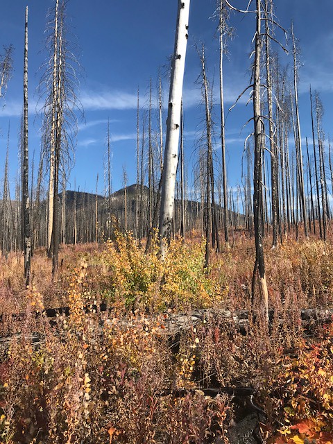 Photo: Forest Service - Northern Region, Public Domain Mark (via Flickr)
Webb Lake
~5 min drive
3.34-mile out-and-back trail to Webb Lake in Montana
 Photo: Forest Service - Northern Region, Public Domain Mark (via Flickr)
Lower Twin
~13 min drive
17.24-mile out-and-back trail in Montana with 2,172 ft elevation gain.
HIKE
Red Creek
~9 min drive
2.13-mile out-and-back trail in Montana with 290 ft elevation gain.
Photo: Forest Service - Northern Region, Public Domain Mark (via Flickr)Crossover Mtn.
~13 min drive
3.92-mile out-and-back trail in Montana with 1,641 ft of elevation gain.
Photo: Forest Service - Northern Region, Public Domain Mark (via Flickr)Soldier Creek
~14 min drive
12.69-mile out-and-back trail in Montana with 1,128 ft gain.
HIKE
Dean Creek
~10 min drive
0.43-mile out-and-back trail at Dean Creek in Montana.
HIKE
Green Mountain Lookout
~4 min drive
3.04-mile out-and-back trail to Green Mountain Lookout in Montana, 805 ft elevation gain.
HIKE
Sergeant - Corporal Creek
~4 min drive
19-mile out-and-back trail in Montana with 1,107 ft gain.
HIKE
Meadow Creek Gorge
~13 min drive
1.22-mile out-and-back trail in Meadow Creek Gorge, Montana.
HIKE
South Creek
~5 min drive
5.10-mile out-and-back trail in Montana with 92 ft of elevation gain.

