The Loop Trail
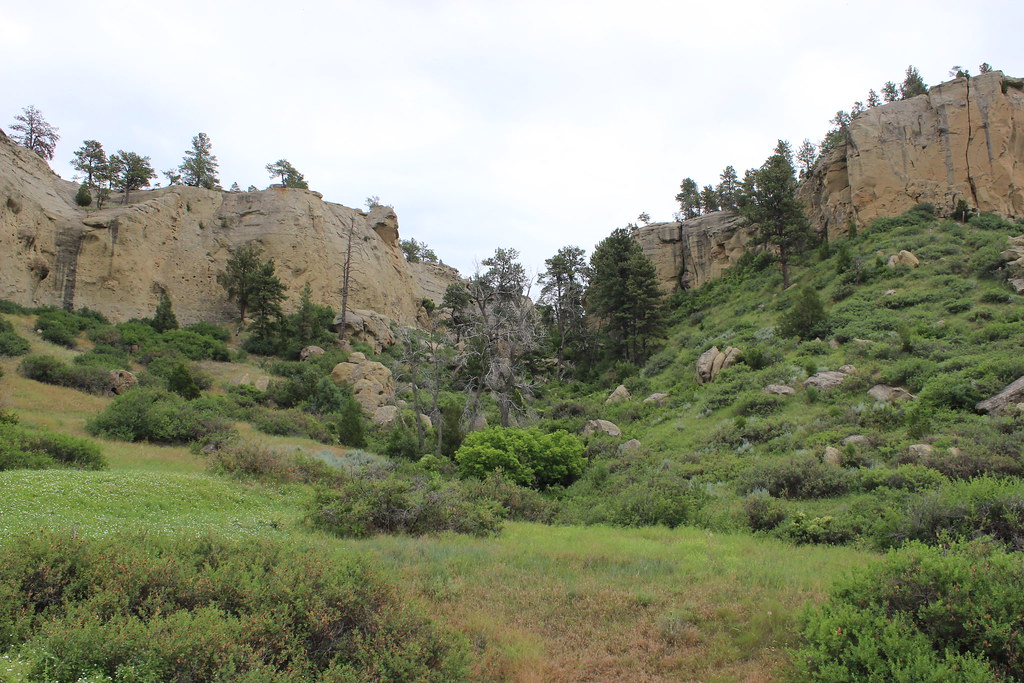 Photo: AllAroundTheWest, CC BY-SA 2.0 (via Flickr)
- 0.4 mi
- loop
- 161 ft
- climb
- 3,522 ft
- high point
- Loop
- route
- Apr–Jun, Aug–Oct
- best months
Clear at last check
Weather is good · OpenWeather · checked 23 h ago
The Loop Trail is a short loop inside Pictograph Cave State Park in Montana, managed by State Fish and Wildlife. It is a 0.42-mile trail that starts and ends at about 3,383 feet, rising to a high point of 3,522 feet. The climb is gentle and balanced, with a total gain and loss of 161 feet, and the steepest stretch comes about a fifth of the way in, where the grade reaches 16%. For timing, late spring and early fall are the most comfortable. Typical averages from a nearby weather station show May highs around 68°F and September highs around 75°F, with July the warmest month at about 86°F. That station sits about 425 feet lower than the trail, so temperatures on the loop run a little cooler. The trail takes about half an hour to complete. The Freight Trail is about 2.6 miles away, and the Walking path at John H Dover Park is about 7.5 miles out. Climbers can head to Gregory, about 8.8 miles away, or the Billings Rimrocks, about 8.9 miles away.
- Freight TrailHiking2.6 mi
- Walking path at John H Dover ParkHiking7.5 mi
- Rims Mountain Bike PathMountain biking7.6 mi
- GregoryRock climbing8.8 mi
- Billings RimrocksRock climbing8.9 mi
- Shiloh Conservation TrailHiking9.1 mi
- Rockwood CircleRock climbing9.2 mi
Source: Roamze catalog (indexable pages within 10 miles, PostGIS distance)
 Bighorn Head Gate TrailHiking · ~1h 4m drivePhoto: Matt Lavin, CC BY-SA 2.0 (via Flickr)
 Lower Layout CreekHiking · ~1h 21m drivePhoto: Greg_Hanson, CC BY 2.0 (via Flickr)
- Big PryorHiking · ~1h 5m drive
- Crater Ice CaveHiking · ~1h 8m drive
- nullHiking · ~1h 17m drive
- Beaver Pond Nature TrailHiking · ~1h 6m drivePhoto: Matt Lavin, CC BY-SA 2.0 (via Flickr)
 Sullivans KnobHiking · ~1h 24m drivePhoto: Mobilus In Mobili, CC BY-SA 2.0 (via Flickr)
- Shriver Peak RoadHiking · ~1h 8m drive
- South PastureHiking · ~1h 17m drive
- Barry’s Island TrailHiking · ~1h 18m drive
Best time to visit The Loop Trail
Best months: April–June and August–October. Best months have typical highs of 55–85 °F, lows of 30 °F or warmer (32 °F where the station doesn't record snow), at most one snowy day and no more than 12 wet days.
Jan
37° / 14°
5 wet · 4 snow
Feb
41° / 17°
5 wet · 3 snow
Mar
51° / 25°
6 wet · 2 snow
Apr
59° / 33°
8 wet · 1 snow
May
68° / 42°
11 wet
Jun
77° / 50°
10 wet
Jul
86° / 56°
7 wet
Aug
85° / 54°
5 wet
Sep
75° / 45°
6 wet
Oct
60° / 34°
7 wet · 1 snow
Nov
47° / 24°
5 wet · 2 snow
Dec
37° / 16°
5 wet · 4 snow
Typical high / low (°F) and days with rain or snow, 1991–2020. Measured at Billings Wtp, MT, 3.4 mi away at 3,097 ft. Source: NOAA NCEI U.S. Climate Normals 1991–2020.
Map and trail data © OpenStreetMap contributors
