Silvertip Creek
- 11.3 mi
- loop
- 1,523 ft
- climb
- 7,604 ft
- high point
- Loop
- route
Is Silvertip Creek open right now?
Alert in the area
The Forest Service lists 6 alerts for Flathead National Forest.
Ashley Lake North Campground Closure
Agency alert covering Flathead National Forest · Order 01-10- · USFS · Flathead National Forest
Camp Creek Fire Updated Trail Closure
Agency alert covering Flathead National Forest · Order 01-10- · USFS · Flathead National Forest
FK&L Area Closed to Public Access Starting July 22, 2026
Agency alert covering Flathead National Forest · Order 01-10- · USFS · Flathead National Forest
Trail 800 Tally-Ashely Closure
Agency alert covering Flathead National Forest · Order 01-10- · USFS · Flathead National Forest
Ryan Creek Occupancy and Use Order
Agency alert covering Flathead National Forest · Order 1-10- · USFS · Flathead National Forest
As of · Source: USFS · Flathead National Forest. Agencies don't list every closure — check before you go.
Silvertip Creek is a 11.3-mile loop hike in the Bob Marshall Wilderness, part of the Spotted Bear Ranger District of Flathead National Forest in northwest Montana. The trail climbs from about 4,259 feet to 7,604 feet, with a total elevation gain of 1,523 feet, and it is rated hard. The Forest Service manages the land, and the route is natural-surface, not accessible, and allows horses but not bikes. The trip is open year-round, and the estimated time is about 4.5 hours. Silvertip Cabin sits about a mile away, and Limestone Peak and Gunsight Peak are both within about a mile and a half. Beaver Creek Campground is roughly 4 miles off.
- Limestone PeakHiking0.5 mi
- Silvertip CabinCamping1.1 mi
- Gunsight PeakHiking1.4 mi
- Dean CreekHiking2.4 mi
- Elk Ridge WestHiking3 mi
- Spotted Bear RiverHiking3.1 mi
- Beaver Creek CampgroundCamping3.9 mi
 South Fork Flathead RiverCanoeingPhoto: Public domain (via Wikimedia Commons)7.9 mi
Source: Roamze catalog (indexable pages within 10 miles, PostGIS distance)
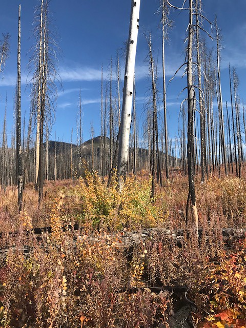 Webb LakeHiking · ~15 min drivePhoto: Forest Service - Northern Region, Public Domain Mark (via Flickr)
- Limestone PeakHiking · Next door
- Dean CreekHiking · ~7 min drive
- Elk Ridge WestHiking · ~5 min drive
- Gunsight PeakHiking · ~2 min drive
- TRAIL CREEK CONNECTORHiking · ~11 min drive
- Trail CreekHiking · ~11 min drive
- Dean CreekHiking · ~4 min drive
- Meadow Creek GorgeHiking · ~14 min drive
- CHAIR MTN. CUTOFFHiking · ~13 min drive
