Limestone Peak
- 6.3 mi
- round trip
- 2,007 ft
- climb
- 7,219 ft
- high point
- Out and back
- route
Is Limestone Peak open right now?
Alert in the area
The Forest Service lists 5 alerts for Flathead National Forest.
Camp Creek Fire Updated Trail Closure
Agency alert covering Flathead National Forest · Order 01-10- · USFS · Flathead National Forest
FK&L Area Closed to Public Access Starting July 22, 2026
Agency alert covering Flathead National Forest · Order 01-10- · USFS · Flathead National Forest
Trail 800 Tally-Ashely Closure
Agency alert covering Flathead National Forest · Order 01-10- · USFS · Flathead National Forest
Ryan Creek Occupancy and Use Order
Agency alert covering Flathead National Forest · Order 1-10- · USFS · Flathead National Forest
Logan Creek Hoke Creek Closure
Agency alert covering Flathead National Forest · Order 01-10- · USFS · Flathead National Forest
As of · Source: USFS · Flathead National Forest. Agencies don't list every closure — check before you go.
Limestone Peak is a hard hike in the Bob Marshall Wilderness, part of the Spotted Bear Ranger District of Flathead National Forest in northwest Montana. The route is an out-and-back that climbs from about 5,210 feet to the summit at 7,219 feet, with a total elevation gain of 2,007 feet over a distance of about 6.3 miles. The Forest Service manages the land, and the trail is natural-surfaced and not accessible. Horses are allowed, but bikes are not. The trip is open year-round, so plan for conditions that can change with the season. The peak sits in the heart of the Bob Marshall Wilderness, and the surrounding area offers several other destinations. Silvertip Creek is about half a mile away, and Silvertip Cabin is about 1.5 miles off. Gunsight Peak and Dean Creek are both within about 2 miles.
Keep exploring — more trails worth the drive
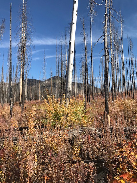 Photo: Forest Service - Northern Region, Public Domain Mark (via Flickr)
Webb Lake
~16 min drive
3.34-mile out-and-back trail to Webb Lake in Montana
HIKE
Silvertip Creek
Next door
11.29-mile loop trail in Montana with 1,523 ft elevation gain.
HIKE
Dean Creek
~7 min drive
0.43-mile out-and-back trail at Dean Creek in Montana.
HIKE
Elk Ridge West
~5 min drive
3.82-mile out-and-back trail in Montana with 2,600 ft elevation gain.
HIKE
Gunsight Peak
~3 min drive
15.91-mile out-and-back trail to Gunsight Peak in Montana with 998 ft gain.
HIKE
Elk Ridge
~9 min drive
1.17-mile out-and-back trail in Montana with 72 ft of elevation gain.
HIKE
Green Mountain Lookout
~10 min drive
3.04-mile out-and-back trail to Green Mountain Lookout in Montana, 805 ft elevation gain.
HIKE
Dean Creek
~3 min drive
19.43-mile out-and-back trail in Montana with 1,099 ft elevation gain.
HIKE
TRAIL CREEK CONNECTOR
~11 min drive
2.06-mile out-and-back trail with 655 ft elevation gain and loss in Montana
HIKE
Trail Creek
~11 min drive
6.44-mile out-and-back trail in Montana with 2,343 ft elevation gain.

