Meadow Mtn.
- 3.3 mi
- distance
- 2,990 ft
- climb
Is Meadow Mtn. open right now?
Alert in the area
The Forest Service lists 5 alerts for Flathead National Forest.
Camp Creek Fire Updated Trail Closure
Agency alert covering Flathead National Forest · Order 01-10- · USFS · Flathead National Forest
FK&L Area Closed to Public Access Starting July 22, 2026
Agency alert covering Flathead National Forest · Order 01-10- · USFS · Flathead National Forest
Trail 800 Tally-Ashely Closure
Agency alert covering Flathead National Forest · Order 01-10- · USFS · Flathead National Forest
Ryan Creek Occupancy and Use Order
Agency alert covering Flathead National Forest · Order 1-10- · USFS · Flathead National Forest
Logan Creek Hoke Creek Closure
Agency alert covering Flathead National Forest · Order 01-10- · USFS · Flathead National Forest
As of · Source: USFS · Flathead National Forest. Agencies don't list every closure — check before you go.
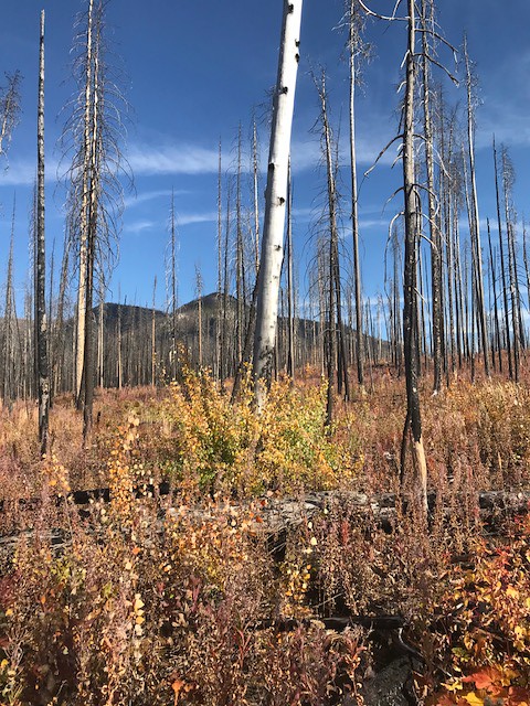
Meadow Mtn. is a mountain biking route in the Bob Marshall Wilderness, part of the Spotted Bear Ranger District of Flathead National Forest in northwest Montana. The Forest Service manages the land, and the route lies within designated wilderness. The climb starts at about 4,525 feet and reaches 7,040 feet, with a total gain of 2,990 feet over 3.3 miles. The steepest stretch comes at about 1.9 miles in, where the grade reaches 52%. The route also has a total loss of 804 feet, so it's not a straightforward ascent. For a longer outing, Lost Jack Creek is about a mile away, and Harrison Creek and Main South Fork are both within 2 miles. Paddlers can head to the South Fork Flathead River, about 2.4 miles off.
Local outfitters
- Montana Basecamp48 mi away
Not on Roamze yet. Their page has how to reach them.
Keep exploring — more rides worth the drive
 Photo: Kirk Olson from Jacksonville, FL, USA, CC BY 2.0 (via Wikimedia Commons)
Cabin Creek
~44 min drive
Cabin Creek is a 6.09-mile trail at Elk Hill, Montana with 398 ft of elevation gain.
RIDE
Lost Jack Creek
~3 min drive
1.56-mile trail at Meadow Creek Trail Head with 778 ft elevation gain.
RIDE
Cliff By-Pass
~3 min drive
0.24-mile by-pass trail near cliffs in Montana's Meadow Creek Trail Head system.
RIDE
Meadow Cr Airstrip Shortcut
~4 min drive
0.16-mile trail at Meadow Creek Trail Head with 10 ft elevation gain
RIDE
Meadow Creek Gorge
~4 min drive
0.44-mile trail in Montana with 115 ft elevation gain
RIDE
Wagon Trail AT Meadow
~4 min drive
0.25-mile trail at Meadow Creek Trail Head with 98 ft elevation gain
RIDE
Mid Creek Take-Out
~5 min drive
0.05-mile trail in Meadow Creek Trail Head, Montana
RIDE
Main South Fork
~16 min drive
22.89-mile trail at Meadow Creek Trail Head with 2,357 ft of elevation gain
RIDE
Gildart Flats
~39 min drive
Gildart Flats is a 4.2-mile mountain bike trail in Montana.
RIDE
Fatty Piper
~43 min drive
Fatty Piper is a 5.1-mile mountain bike trail in Montana.

Map and trail data © OpenStreetMap contributors
