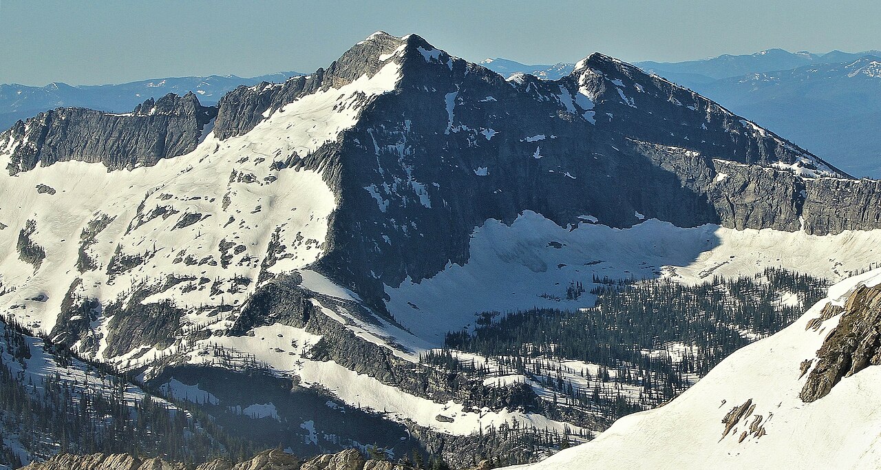
Engle
- 7.4 mi
- round trip
- 2,521 ft
- climb
- 6,321 ft
- high point
- Out and back
- route
Is Engle open right now?
Closure in the area
There's a closure order in Kootenai National Forest. It doesn't name Engle, so check the source for the area it covers.
Kootenai Flood Event & Inaccessible Areas
Agency closure covering Kootenai National Forest · USFS · Kootenai National Forest
Updated Skillet Fire Area, Road, Trail Closure
Agency alert covering Kootenai National Forest · Order 01-10- · USFS · Kootenai National Forest
As of · Source: USFS · Kootenai National Forest. Agencies don't list every closure — check before you go.
Engle is a hard hike in the Cabinet Ranger District of Montana's Kootenai National Forest, about 5.4 miles from the town of Tuscor. The route is an out-and-back that climbs from a low point of about 3,020 feet to a high of about 6,321 feet, with a total elevation gain of about 2,521 feet over roughly 7.4 miles. The trail is natural-surfaced and allows horses, according to the Forest Service's trail records. That makes it a viable option for riders as well as hikers. Several other destinations sit within a few miles. Bear Paw and Engle Lake are both hikes about 2.4 miles away, and Engle Peak is about 2.5 miles off. For an overnight stay, Marten Creek Campground is about 7.8 miles away.
Local outfitters
- Kootenai River Campground38 mi away
- CDA River RV43 mi away
Not on Roamze yet. Their page has how to reach them.
Keep exploring — more trails worth the drive
HIKE
Bear Paw
~4 min drive
2.06-mile out-and-back trail in Montana with 849 ft of elevation gain.
HIKE
Engle Lake
~4 min drive
7-mile out-and-back hike to Engle Lake in Montana with 1,162 ft of elevation gain.
HIKE
Engle Peak
~4 min drive
0.95-mile loop with 863 ft gain at Engle Peak, Montana
HIKE
20 Odd Peak Trail
~14 min drive
11.38-mile out-and-back trail in Montana with 6,240 ft elevation gain/loss.
HIKE
Swamp Creek Trail
~8 min drive
7.08-mile out-and-back trail in Montana with 1,723 ft elevation gain.
HIKE
Goat Ridge
~5 min drive
13.94-mile out-and-back trail in Montana with 5,650 ft elevation gain.
HIKE
Buck Lake
~8 min drive
0.63-mile out-and-back trail to Buck Lake in Montana with 166 ft gain.
HIKE
20 ODD PEAK
~14 min drive
8.58-mile out-and-back hike in Montana with 4,729 ft elevation gain.
HIKE
Cabinet Divide South Trail
~9 min drive
10.55-mile out-and-back hike in Montana with 1,555 ft gain
HIKE
Wanless Lake
~6 min drive
14.52-mile out-and-back trail in Montana with 5,212 ft elevation gain.