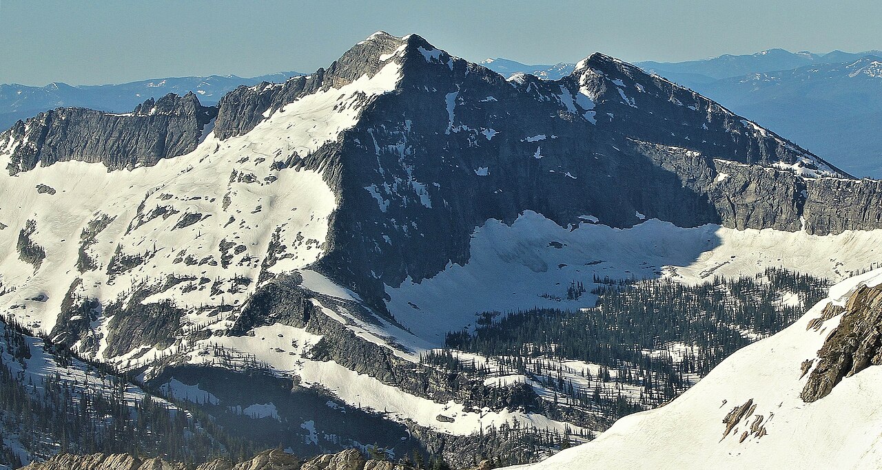
Wanless Lake
- 14.5 mi
- round trip
- 5,212 ft
- climb
- 6,445 ft
- high point
- Out and back
- route
Is Wanless Lake open right now?
Closure in the area
There's a closure order in Kootenai National Forest. It doesn't name Wanless Lake, so check the source for the area it covers.
Kootenai Flood Event & Inaccessible Areas
Agency closure covering Kootenai National Forest · USFS · Kootenai National Forest
Updated Skillet Fire Area, Road, Trail Closure
Agency alert covering Kootenai National Forest · Order 01-10- · USFS · Kootenai National Forest
As of · Source: USFS · Kootenai National Forest. Agencies don't list every closure — check before you go.
Wanless Lake is a hard hike in the Cabinet Ranger District of Montana's Kootenai National Forest, a route that rises from about 3,077 feet to roughly 6,445 feet in a 14.5-mile out-and-back. It is a long, steep climb, and the trail is not an accessible route. The Forest Service manages the land. The trail is natural-surface and not open to bikes. It stays open year-round. The route lies in the high country of the Cabinet Ranger District, and the surrounding area offers several other options. Swamp Creek and Swamp Creek Trail are both about 1.5 miles away. Ojibway Peak, a climbing area, is about 5 miles off, and Lake Creek Campground is about 5.8 miles away.
Local outfitters
- Kootenai River Campground38 mi away
- CDA River RV46 mi away
Not on Roamze yet. Their page has how to reach them.
Keep exploring — more trails worth the drive
HIKE
Swamp Creek
~2 min drive
17.65-mile out-and-back trail in Montana with 687 ft elevation gain.
HIKE
Swamp Creek Trail
~3 min drive
7.08-mile out-and-back trail in Montana with 1,723 ft elevation gain.
HIKE
Engle Peak
~3 min drive
0.95-mile loop with 863 ft gain at Engle Peak, Montana
HIKE
20 ODD PEAK
~14 min drive
8.58-mile out-and-back hike in Montana with 4,729 ft elevation gain.
HIKE
Goat Ridge
~5 min drive
13.94-mile out-and-back trail in Montana with 5,650 ft elevation gain.
HIKE
Cabinet Divide South Trail
~4 min drive
10.55-mile out-and-back hike in Montana with 1,555 ft gain
HIKE
Upper Geiger Lake
~5 min drive
0.40-mile out-and-back trail to Upper Geiger Lake in Montana.
HIKE
Divide Cutoff Trail
~5 min drive
6.32-mile out-and-back trail in Montana with 3,299 ft elevation gain and loss.
HIKE
Bear Paw
~4 min drive
2.06-mile out-and-back trail in Montana with 849 ft of elevation gain.
HIKE
Baree Lake
~6 min drive
0.61-mile out-and-back trail to Baree Lake in Montana.