Burnt Lake Ds
Campground
Campground · < 0.1 mi from the trail
Closure in the area
There's a closure order in Kootenai National Forest. It doesn't name Burnt Lake, so check the source for the area it covers.
Kootenai Flood Event & Inaccessible Areas
Agency closure covering Kootenai National Forest · USFS · Kootenai National Forest
Updated Skillet Fire Area, Road, Trail Closure
Agency alert covering Kootenai National Forest · Order 01-10- · USFS · Kootenai National Forest
As of · Source: USFS · Kootenai National Forest. Agencies don't list every closure — check before you go.
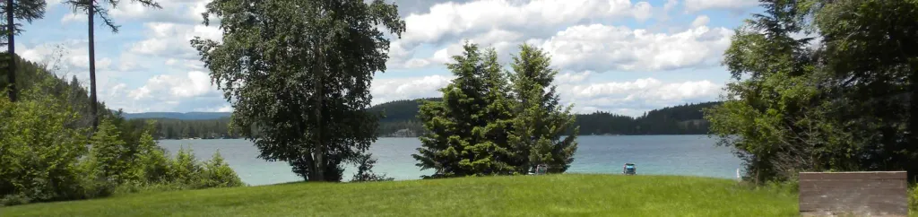
Burnt Lake is a short, easy hike in the Fortine Ranger District of Montana's Kootenai National Forest, about a quarter mile long and rising about 50 feet from a low point of 3,659 feet to a high of 3,723 feet. The trail is an out-and-back, and the Forest Service manages the land. The route is natural-surfaced and open to both horses and bikes, so it works for riders and pack animals as well as hikers. The trailhead is Burnt Lake TH 102, and the hike is open from June 1 through October 31. Summer is the most comfortable time to go. Typical averages from the nearby Olney weather station, which sits about 550 feet lower, show July and August highs around 80°F with lows in the low 40s, while winter highs stay in the 20s. Fire Lakes is just 0.2 miles away, and Smokey Lake is about half a mile off. Climbers can head to Mouse House, roughly 1.8 miles away, and Stillwater Lake Campground is about 3 miles away.
Burnt Lake Ds
Campground
Stillwater bar
Pub
Places © OpenStreetMap contributors
More in WhitefishNot on Roamze yet. Their page has how to reach them.
 Stillwater RiverCanoeingPhoto: Joe Mabel (on Flickr as Joe Mabel from Seattle, US), CC BY-SA 3.0 (via Wikimedia Commons)4.4 mi
 South Dickey LakeCampingPhoto: Recreation.gov (RIDB) / public domain7.4 mi
Source: Roamze catalog (indexable pages within 10 miles, PostGIS distance)
 Chain LakeHiking · ~23 min drivePhoto: Forest Service Northern Region from Missoula, MT, USA, Public domain (via Wikimedia Commons)
 Link LakeHiking · ~20 min drivePhoto: Forest Service Northern Region from Missoula, MT, USA, Public domain (via Wikimedia Commons)Nasukoin Mtn.Hiking · ~20 min drivePhoto: Forest Service Northern Region from Missoula, MT, USA, Public domain (via Wikimedia Commons)
Also worth it near here
Best months: May–September. Best months have typical highs of 55–85 °F, lows of 30 °F or warmer (32 °F where the station doesn't record snow), at most one snowy day and no more than 12 wet days.
Jan
28° / 12°
10 wet
Feb
34° / 12°
8 wet
Mar
43° / 19°
8 wet
Apr
53° / 26°
8 wet
May
63° / 34°
11 wet
Jun
69° / 41°
12 wet
Jul
80° / 43°
7 wet
Aug
80° / 41°
6 wet
Sep
69° / 33°
7 wet
Oct
52° / 25°
9 wet
Nov
36° / 19°
10 wet
Dec
27° / 13°
10 wet
Typical high / low (°F) and days with rain or snow, 1991–2020. Measured at Olney, MT, 8.2 mi away at 3,165 ft. The station sits about 600 ft lower than this place, so expect it a little cooler here. This station doesn't record snowfall. Source: NOAA NCEI U.S. Climate Normals 1991–2020.
