Stryker Basin Trail
- 3.9 mi
- round trip
- 3,343 ft
- climb
- 7,249 ft
- high point
- Out and back
- route
Stryker Basin Trail is a hard hike in Stillwater State Forest in Montana, managed by the State Department of Natural Resources. The trail is an out-and-back route of about 7.7 miles, with a one-way climb of 580 feet and a total round-trip gain of 3,343 feet. The steepest stretch comes early, at about 0.13 miles from the start, where the grade reaches 30 percent. The trail begins at an elevation of about 7,124 feet and reaches a high point of 7,249 feet. That makes it a significant climb, and the back-loaded profile means the hardest work is on the way up. The Stillwater River, about 1.5 miles away, offers canoeing. Stryker Basin, a hike about 2.1 miles off, and Point of Rocks, a climbing area about 2.6 miles away, round out the nearby options. For an overnight stay, Stillwater Lake Campground is about 5.9 miles away.
Local outfitters
- Indian Springs Montana23 mi away
- North American RV Park & Yurt Village34 mi away
Not on Roamze yet. Their page has how to reach them.
Conditions and forecast on Stryker Peak
Daily highs and lows, wind and the chance of precipitation at the summit and route start for the next 7 days, from the Open-Meteo model.
 Stillwater RiverCanoeingPhoto: Joe Mabel (on Flickr as Joe Mabel from Seattle, US), CC BY-SA 3.0 (via Wikimedia Commons)1.5 mi
- Stryker BasinHiking2.1 mi
- Point of RocksRock climbing2.6 mi
- Mouse HouseRock climbing3 mi
- Old Fort Steele TrailHiking3.5 mi
- Patrick RidgeHiking4.1 mi
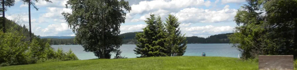 South Dickey LakeCampingPhoto: Recreation.gov (RIDB) / public domain5.7 mi
- Stillwater Lake CampgroundCamping5.9 mi
Source: Roamze catalog (indexable pages within 10 miles, PostGIS distance)
 Link LakeHiking · ~12 min drivePhoto: Forest Service Northern Region from Missoula, MT, USA, Public domain (via Wikimedia Commons)
 Chain LakeHiking · ~16 min drivePhoto: Forest Service Northern Region from Missoula, MT, USA, Public domain (via Wikimedia Commons)
- Laughing WaterHiking · ~14 min drive
- Smokey LakeHiking · ~8 min drive
- Nasukoin Mtn.Hiking · ~13 min drivePhoto: Forest Service Northern Region from Missoula, MT, USA, Public domain (via Wikimedia Commons)
- Huntsberger LakeHiking · ~17 min drive
- Fire LakesHiking · ~8 min drive
- Stryker BasinHiking · ~4 min drive
- KrinklehornHiking · ~18 min drive
- Sunday FallsHiking · ~8 min drive
Also worth it near here
- Stillwater RiverCanoeing · ~3 min drivePhoto: Joe Mabel (on Flickr as Joe Mabel from Seattle, US), CC BY-SA 3.0 (via Wikimedia Commons)
- Fish LakeLake fishing · ~3 min drive
- Point of RocksRock climbing · ~5 min drive
- South Dickey LakeCamping · ~10 min drive
- Red Meadow SmCross-country skiing · ~11 min drive
Route details
- Distance
- 3.9 mi round trip
- Climbing
- About 3,343 ft
- Summit
- 7,339 ft
- Difficulty
- Hard
- Time
- About 1.5 hours
Questions about this route
How long is the Stryker Basin Trail on Stryker Peak?
About 3.9 mi round trip.
How much elevation gain is on the Stryker Basin Trail?
About 3,343 ft of climbing round trip.
How hard is the Stryker Basin Trail?
It is rated hard.
How long does the Stryker Basin Trail take?
About 1.5 hours round trip.
Map and trail data © OpenStreetMap contributors
