Asnebumskit Ridge Trail
- 2.0 mi
- round trip
- 720 ft
- climb
- 1,344 ft
- high point
- Out and back
- route
- Jun–Oct
- best months
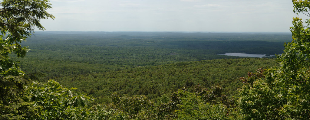
Asnebumskit Ridge Trail is a 2-mile hike in central Massachusetts, about 1.6 miles from the town of Paxton. It is an out-and-back route that starts and ends at the high point of 1,344 feet, with the low point at 942 feet. The total climb is 720 feet, and the steepest stretch comes at about 1.4 miles in, where the grade reaches 12 percent. The most comfortable months for a visit are late spring through early fall. Typical averages from a nearby weather station in Worcester run from highs around 67°F in May to about 71°F in September, with July peaking near 80°F. That station sits roughly 344 feet lower than the trail's high point, so temperatures on the ridge run a little cooler. The trip takes about 1.5 hours. The East-West Trail lies about 1.9 miles away, and the Tatnuck Boulder climbing area is about 2.2 miles off. Paddlers can reach Kettle Brook at about 4.5 miles and the Quinapoxet River at about 5.5 miles.
- East-West TrailHiking1.9 mi
- Tatnuck BoulderRock climbing2.2 mi
- Talus Cliff BandRock climbing3.7 mi
- God’s Acre, WorcesterRock climbing3.8 mi
- Secondary 56Hiking4 mi
- Indian Lake Pathway to Nick's Woods Trail ConnectionHiking4.1 mi
- Kettle BrookCanoeing4.5 mi
 Quinapoxet RiverCanoeingPhoto: en:User:LymanSchool (Richard B. Johnson), CC BY-SA 3.0 (via Wikimedia Commons)5.5 mi
Source: Roamze catalog (indexable pages within 10 miles, PostGIS distance)
 Corridor 71Hiking · ~13 min drivePhoto: WhitA, CC BY 2.0 (via Flickr)
 Hitchcock Mountain TrailHiking · ~22 min drivePhoto: Bobby17543, CC BY-SA 3.0 (via Wikimedia Commons)
 Carlstrom II TrailHiking · ~20 min drivePhoto: Gudlyf, CC BY 2.0 (via Flickr)
- White Oak TrailHiking · ~12 min drive
 Mountain House TrailHiking · ~21 min drivePhoto: xxv, CC BY-SA 2.0 (via Flickr)
- North Brookfield Rail TrailHiking · ~17 min drive
 Cook's Canyon TrailHiking · ~22 min drivePhoto: Paul J. Morris, CC BY-SA 2.0 (via Flickr)
- Edmund Hill TrailHiking · ~24 min drive
 John Malley TrailHiking · ~23 min drivePhoto: Eriky8 (Kevin Johnson), CC BY-SA 3.0 (via Wikimedia Commons)
- South TrailHiking · ~24 min drivePhoto: Bobby17543, CC BY-SA 3.0 (via Wikimedia Commons)
Best time to visit Asnebumskit Ridge Trail
Best months: June–October. Best months have typical highs of 55–85 °F, lows of 30 °F or warmer (32 °F where the station doesn't record snow), at most one snowy day and no more than 12 wet days.
Jan
32° / 17°
12 wet · 7 snow
Feb
35° / 19°
11 wet · 7 snow
Mar
43° / 26°
12 wet · 5 snow
Apr
56° / 36°
13 wet · 1 snow
May
67° / 47°
13 wet
Jun
75° / 56°
12 wet
Jul
80° / 62°
11 wet
Aug
78° / 61°
10 wet
Sep
71° / 53°
10 wet
Oct
59° / 42°
11 wet
Nov
48° / 32°
11 wet · 2 snow
Dec
38° / 23°
12 wet · 5 snow
Typical high / low (°F) and days with rain or snow, 1991–2020. Measured at Worcester Rgnl Ap, MA, 2.7 mi away at 1,000 ft. Source: NOAA NCEI U.S. Climate Normals 1991–2020.
Map and trail data © OpenStreetMap contributors
