Indian Lake Pathway to Nick's Woods Trail Connection
- 0.7 mi
- one way
- 83 ft
- climb
- 638 ft
- high point
- Point to point
- route
- Jun–Oct
- best months
Indian Lake Pathway to Nick's Woods Trail Connection is a short, easy hike in Massachusetts, about 0.6 miles from the town of Westchester. The route is 0.72 miles long, with a total elevation gain of 83 feet, and it is rated easy. The trail is a point-to-point connection, and the climb is gentle. The steepest part comes at about 0.5 miles in, with a grade of 7 percent. The start sits at about 556 feet, and the high point is around 638 feet. Summer and early fall are the most comfortable times to go. Typical averages from a nearby weather station in Worcester show July highs around 80°F and September highs near 71°F, with lows in the low 50s. That station sits about 360 feet higher than the trail, so temperatures on the route run a little warmer. Nearby, Tatnuck Boulder offers climbing about 2.7 miles away, and the East-West Trail is about 2.8 miles off. The Asnebumskit Ridge Trail is about 4.1 miles away, and paddlers can head to the Quinapoxet River, roughly 5.4 miles from the trail.
- Tatnuck BoulderRock climbing2.7 mi
- East-West TrailHiking2.8 mi
- Talus Cliff BandRock climbing3.9 mi
- God’s Acre, WorcesterRock climbing3.9 mi
- Asnebumskit Ridge TrailHiking4.1 mi
- Kettle BrookCanoeing5.1 mi
 Quinapoxet RiverCanoeingPhoto: en:User:LymanSchool (Richard B. Johnson), CC BY-SA 3.0 (via Wikimedia Commons)5.4 mi
- White Dot TrailHiking6.1 mi
Source: Roamze catalog (indexable pages within 10 miles, PostGIS distance)
 Carlstrom II TrailHiking · ~13 min drivePhoto: Gudlyf, CC BY 2.0 (via Flickr)
- White Oak TrailHiking · ~12 min drive
 John Malley TrailHiking · ~16 min drivePhoto: Eriky8 (Kevin Johnson), CC BY-SA 3.0 (via Wikimedia Commons)
- Edmund Hill TrailHiking · ~17 min drive
 Little Chauncy TrailHiking · ~18 min drivePhoto: Jakob Roedler (1808-1862), Public domain (via Wikimedia Commons)
- Whitehall Yellow TrailHiking · ~23 min drive
 Corridor 71Hiking · ~19 min drivePhoto: WhitA, CC BY 2.0 (via Flickr)
- North Brookfield Rail TrailHiking · ~23 min drive
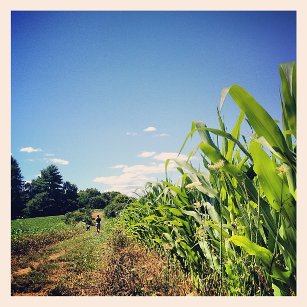 Cedar Hill TrailHiking · ~19 min drivePhoto: dee & tula monstah, CC BY 2.0 (via Flickr)
- Crane Swamp TrailHiking · ~20 min drivePhoto: Jakob Roedler (1808-1862), Public domain (via Wikimedia Commons)
Best time to visit Indian Lake Pathway to Nick's Woods Trail Connection
Best months: June–October. Best months have typical highs of 55–85 °F, lows of 30 °F or warmer (32 °F where the station doesn't record snow), at most one snowy day and no more than 12 wet days.
Jan
32° / 17°
12 wet · 7 snow
Feb
35° / 19°
11 wet · 7 snow
Mar
43° / 26°
12 wet · 5 snow
Apr
56° / 36°
13 wet · 1 snow
May
67° / 47°
13 wet
Jun
75° / 56°
12 wet
Jul
80° / 62°
11 wet
Aug
78° / 61°
10 wet
Sep
71° / 53°
10 wet
Oct
59° / 42°
11 wet
Nov
48° / 32°
11 wet · 2 snow
Dec
38° / 23°
12 wet · 5 snow
Typical high / low (°F) and days with rain or snow, 1991–2020. Measured at Worcester Rgnl Ap, MA, 3.7 mi away at 1,000 ft. Source: NOAA NCEI U.S. Climate Normals 1991–2020.
Map and trail data © OpenStreetMap contributors
