Lichen Trail
- 0.6 mi
- round trip
- 178 ft
- climb
- 1,148 ft
- high point
- Out and back
- route
- May–Sep
- best months
Is Lichen Trail open right now?
Alert in the area
The National Park Service lists 2 alerts for Katahdin Woods and Waters National Monument.
Hunting Season Begins
Park alert covering Katahdin Woods and Waters National Monument · NPS · Katahdin Woods and Waters National Monument
Increased Logging Traffic Along Swift Brook Road
Park alert covering Katahdin Woods and Waters National Monument · NPS · Katahdin Woods and Waters National Monument
As of · Source: NPS · Katahdin Woods and Waters National Monument. Agencies don't list every closure — check before you go.
Lichen Trail is a short, easy out-and-back hike in Katahdin Woods and Waters National Monument in Maine, managed by the National Park Service. The trail is about 0.6 miles long, with a total elevation gain of 178 feet, and it takes roughly half an hour to complete. The route is front-loaded, with the steepest stretch coming early on, around 0.14 miles from the start. The trail reaches a high point of 1,148 feet and returns to a low of 958 feet, with the start at 972 feet. There is no fee to hike it. Summer is the most comfortable time to go. Typical averages from a nearby weather station in Patten put July highs around 76°F with lows near 55°F, while winter highs stay in the 20s. Rocky Pond Trail lies about 1.2 miles away, and Katahdin Lake Trail and Deasey Pond Trail are each roughly 4 miles off. Climbers can find Katahdin about 6 miles away.
- Rocky Pond TrailHiking1.2 mi
- Katahdin Lake TrailHiking3.8 mi
- Deasey Pond TrailHiking3.9 mi
- Esker Pond TrailHiking3.9 mi
- j. The Maine Highlands (inc. BSP / Katahdin )Rock climbing6 mi
- KatahdinRock climbing6.1 mi
- Millinocket StreamCanoeing8.1 mi
- Chimney Pond ("South") Basin - Summer Rock RoutesRock climbing8.6 mi
Source: Roamze catalog (indexable pages within 10 miles, PostGIS distance)
 Logan Pond TrailHiking · ~11 min drivePhoto: daveynin, CC BY 2.0 (via Flickr)
 Dudley TrailHiking · ~15 min drivePhoto: davidwilson1949, CC BY 2.0 (via Flickr)
- International Appalachian Trail New-BrunswickHiking · ~10 min drive
- Helon Taylor TrailHiking · ~12 min drive
 Cranberry Pond TrailHiking · ~12 min drivePhoto: daveynin, CC BY 2.0 (via Flickr)
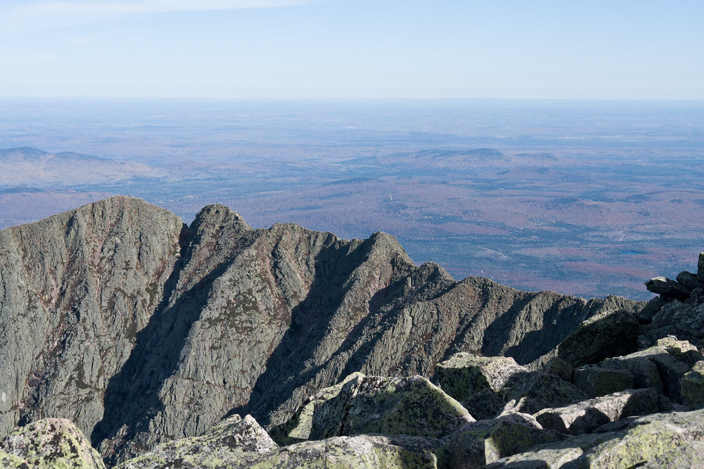 Chimney Pond TrailHiking · ~15 min drivePhoto: Pat Spinney, CC BY 2.0 (via Flickr)
- South Turner Mountain TrailHiking · ~12 min drive
- Kettle Pond TrailHiking · ~13 min drivePhoto: daveynin, CC BY 2.0 (via Flickr)
 North Basin TrailHiking · ~15 min drivePhoto: davidwilson1949, CC BY 2.0 (via Flickr)
- Telos Tote TrailHiking · ~13 min drive
Best time to visit Lichen Trail
Best months: May–September. Best months have typical highs of 55–85 °F, lows of 30 °F or warmer (32 °F where the station doesn't record snow), at most one snowy day and no more than 12 wet days.
Jan
22° / 3°
Feb
25° / 6°
Mar
34° / 16°
Apr
48° / 29°
May
62° / 40°
Jun
72° / 49°
Jul
76° / 55°
Aug
75° / 54°
Sep
67° / 45°
Oct
53° / 35°
Nov
41° / 25°
Dec
29° / 13°
Typical high / low (°F) and days with rain or snow, 1991–2020. Measured at Patten 2, ME, 17.4 mi away at 820 ft. This station doesn't record snowfall. Source: NOAA NCEI U.S. Climate Normals 1991–2020.
Map and trail data © OpenStreetMap contributors
