Barnard Mountain Trail
- 0.7 mi
- round trip
- 571 ft
- climb
- 1,623 ft
- high point
- Out and back
- route
- May–Sep
- best months
Is Barnard Mountain Trail open right now?
Alert in the area
The National Park Service lists 2 alerts for Katahdin Woods and Waters National Monument.
Hunting Season Begins
Park alert covering Katahdin Woods and Waters National Monument · NPS · Katahdin Woods and Waters National Monument
Increased Logging Traffic Along Swift Brook Road
Park alert covering Katahdin Woods and Waters National Monument · NPS · Katahdin Woods and Waters National Monument
As of · Source: NPS · Katahdin Woods and Waters National Monument. Agencies don't list every closure — check before you go.
Barnard Mountain Trail is a 1.4-mile out-and-back hike in Katahdin Woods and Waters National Monument in Maine. It starts at about 1,086 feet and climbs to 1,623 feet, with a total gain of 571 feet, making it a moderate route. The trail's steepest section comes near the beginning, where the grade reaches about 20 percent. Summer is the most comfortable time to go. Typical averages from a nearby weather station in Patten run from highs around 72°F in June to 76°F in July, and temperatures on the mountain run cooler than that station's figures. Winter is harsh, with January highs near 22°F. The International Appalachian Trail New-Brunswick passes about 0.1 mile from the start. Katahdin Lake Trail and Martin Ponds Trail are within about 2.3 miles. Climbers can find j. The Maine Highlands (inc. BSP / Katahdin) Campground) instead. The trail is a short distance from the road.
Conditions and forecast on Barnard Mountain
Daily highs and lows, wind and the chance of precipitation at the summit and route start for the next 7 days, from the Open-Meteo model.
- International Appalachian Trail New-BrunswickHiking0.1 mi
- Barnard Mtn TrailHiking0.5 mi
- Katahdin Lake TrailHiking2.1 mi
- j. The Maine Highlands (inc. BSP / Katahdin )Rock climbing2.1 mi
- Martin Ponds TrailHiking2.3 mi
 North BasinRock climbingPhoto: Famartin, CC BY-SA 4.0 (via Wikimedia Commons)7 mi
- KatahdinRock climbing7 mi
- Seboeis River Paddling TrailCanoeing9.2 mi
Source: Roamze catalog (indexable pages within 10 miles, PostGIS distance)
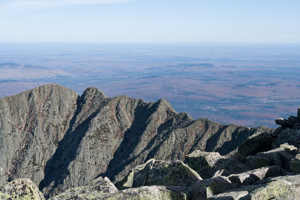 North Basin Cut-OffHiking · ~12 min drivePhoto: Pat Spinney, CC BY 2.0 (via Flickr)
 North Basin TrailHiking · ~12 min drivePhoto: davidwilson1949, CC BY 2.0 (via Flickr)
- South Turner Mountain TrailHiking · ~8 min drive
- Katahdin Lake TrailHiking · ~4 min drive
- Chimney Pond TrailHiking · ~13 min drivePhoto: Pat Spinney, CC BY 2.0 (via Flickr)
- Helon Taylor TrailHiking · ~8 min drive
- Martin Ponds TrailHiking · ~4 min drive
 Dudley TrailHiking · ~13 min drivePhoto: davidwilson1949, CC BY 2.0 (via Flickr)
- Telos Tote TrailHiking · ~10 min drive
- Katahdin Lake TrailHiking · ~4 min drive
Best time to visit Barnard Mountain Trail
Best months: May–September. Best months have typical highs of 55–85 °F, lows of 30 °F or warmer (32 °F where the station doesn't record snow), at most one snowy day and no more than 12 wet days.
Jan
22° / 3°
Feb
25° / 6°
Mar
34° / 16°
Apr
48° / 29°
May
62° / 40°
Jun
72° / 49°
Jul
76° / 55°
Aug
75° / 54°
Sep
67° / 45°
Oct
53° / 35°
Nov
41° / 25°
Dec
29° / 13°
Typical high / low (°F) and days with rain or snow, 1991–2020. Measured at Patten 2, ME, 14.2 mi away at 820 ft. The station sits about 800 ft lower than this place, so expect it a little cooler here. This station doesn't record snowfall. Source: NOAA NCEI U.S. Climate Normals 1991–2020.
Route details
- Distance
- 0.7 mi round trip
- Climbing
- About 571 ft
- Summit
- 1,624 ft
- Difficulty
- Moderate
- Time
- About 0.5 hours
Other routes up Barnard Mountain
Questions about this route
How long is the Barnard Mountain Trail on Barnard Mountain?
About 0.7 mi round trip.
How much elevation gain is on the Barnard Mountain Trail?
About 571 ft of climbing round trip.
How hard is the Barnard Mountain Trail?
It is rated moderate.
How long does the Barnard Mountain Trail take?
About 0.5 hours round trip.
How many routes go up Barnard Mountain?
2: Barnard Mountain Trail and Barnard Mtn Trail.
Map and trail data © OpenStreetMap contributors
