Mount McCaleb
 Photo: BLMIdaho, CC BY 2.5 (via Wikimedia Commons)
- 11,672 ft
- summit
- Forest Service
- managed by
Is Mount McCaleb open right now?
Alert in the area
The Forest Service lists an alert for Salmon-Challis National Forest.
Stoddard Bridge Construction Closure
Agency alert covering Salmon-Challis National Forest · Order 0413-07-17 · USFS · Salmon-Challis National Forest
As of · Source: USFS · Salmon-Challis National Forest. Agencies don't list every closure — check before you go.
Mount McCaleb is a summit of about 11,672 feet in Custer County, Idaho, on the Lost River Ranger District of the Salmon-Challis National Forest. The nearest town is Mackay, about 6 miles away, and the Forest Service manages the surrounding land. Lower Cedar Creek is the closest nearby hike, about 2 miles away, and Shadow Lakes Trail is about 4 miles off. For camping, Joe T. Fallini Recreation Site sits about 5 miles away, and the Big Lost River Access Trail offers river fishing at a similar distance.
Conditions and forecast
Daily highs and lows, wind and the chance of precipitation at the summit for the next 7 days, from the Open-Meteo model.
- Summit elevation
- 11,672 ft
- Land manager
- Forest Service
Elevation from USGS 3D Elevation Program terrain data (about 10 m resolution).
We don't know of a mapped trail or route to the summit of Mount McCaleb. Plan the approach with local maps, a guidebook or a local guide, and check conditions before you go.
Questions about Mount McCaleb
How tall is Mount McCaleb?
11,672 ft (3,558 m).
Is there a trail to the top of Mount McCaleb?
We don't know of a mapped trail or route to the summit. Plan the approach with local maps, a guidebook or a local guide.
 Mount Breitenbach12,141 ft · Idaho1 route6.2 mi awayPhoto: G. Thomas Fredlyfish4, CC BY-SA 3.0 (via Wikimedia Commons)
- Leatherman Peak12,225 ft · Idaho1 route9.1 mi awayPhoto: G. Thomas Fredlyfish4, CC BY-SA 3.0 (via Wikimedia Commons)
 Borah Peak12,659 ft · Idaho2 routes13 mi awayPhoto: Leaflet, Public domain (via Wikimedia Commons)
- Foss Mountain9,187 ft · Idaho1 route25 mi away
- Iron Creek Point10,617 ft · Idaho1 route27 mi away
- Herd Peak9,858 ft · Idaho2 routes31 mi away
- Lower Cedar CreekHiking2.2 mi
- Shadow Lakes TrailHiking3.9 mi
- Joe T. Fallini Recreation SiteCamping4.6 mi
- The Right FlankRock climbing5.2 mi
- The Main WallRock climbing5.2 mi
- Big Lost River Access TrailRiver fishing5.8 mi
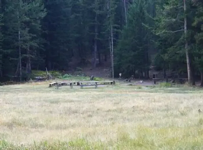 Loristica Group CampgroundCampingPhoto: Recreation.gov (RIDB) / public domain6.8 mi
 Big Lost RiverCanoeingPhoto: Matt Lavin from Bozeman, Montana, USA, CC BY-SA 2.0 (via Wikimedia Commons)7.8 mi
Source: Roamze catalog (indexable pages within 10 miles, PostGIS distance)
- Mount BreitenbachSummit · ~11 min drivePhoto: G. Thomas
Fredlyfish4, CC BY-SA 3.0 (via Wikimedia Commons)
- Donaldson PeakSummit · ~12 min drivePhoto: G. Thomas
Fredlyfish4, CC BY-SA 3.0 (via Wikimedia Commons)
- Leatherman PeakSummit · ~16 min drivePhoto: G. Thomas
Fredlyfish4, CC BY-SA 3.0 (via Wikimedia Commons)
- Borah PeakSummit · ~23 min drivePhoto: Leaflet, Public domain (via Wikimedia Commons)
 Bell MountainSummit · ~45 min drivePhoto: Forest Service Northern Region from Missoula, MT, USA, CC BY 2.0 (via Wikimedia Commons)
 Old Hyndman PeakSummit · ~54 min drivePhoto: Fredlyfish4, CC BY-SA 3.0 (via Wikimedia Commons)
 Hyndman PeakSummit · ~54 min drivePhoto: Fredlyfish4, CC BY-SA 3.0 (via Wikimedia Commons)
 Inferno ConeSummit · ~1h 5m drivePhoto: Clyde Charles Brown, CC BY-SA 4.0 (via Wikimedia Commons)
 Sheep MountainSummit · ~1h 6m drivePhoto: Fredlyfish4, CC BY-SA 4.0 (via Wikimedia Commons)
 Kent PeakSummit · ~1h 10m drivePhoto: Fredlyfish4, CC BY-SA 3.0 (via Wikimedia Commons)
