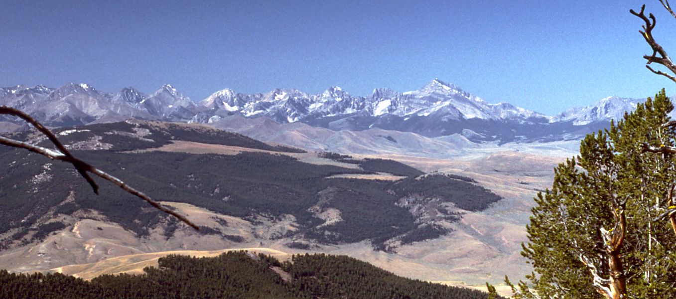
Bell Mountain
 Photo: Forest Service Northern Region from Missoula, MT, USA, CC BY 2.0 (via Wikimedia Commons)
- 11,609 ft
- summit
- Forest Service
- managed by
Is Bell Mountain open right now?
Alert in the area
The Forest Service lists an alert for Salmon-Challis National Forest.
Stoddard Bridge Construction Closure
Agency alert covering Salmon-Challis National Forest · Order 0413-07-17 · USFS · Salmon-Challis National Forest
As of · Source: USFS · Salmon-Challis National Forest. Agencies don't list every closure — check before you go.
Bell Mountain is a summit of about 11,609 feet in Lemhi County, Idaho, on the Lost River Ranger District of the Salmon-Challis National Forest. The nearest town is Clyde, about 7 miles away, and the Forest Service manages the surrounding land. Several trails lie within a few miles, including the Foss Mountain Trail and the Birch Basin Trail, each about 3 miles away, and South Fork Meadow at about 3.6 miles. Climbers can head to the Lemhi Range area, roughly 9 miles off.
Conditions and forecast
Daily highs and lows, wind and the chance of precipitation at the summit for the next 7 days, from the Open-Meteo model.
- Summit elevation
- 11,609 ft
- Land manager
- Forest Service
Elevation from USGS 3D Elevation Program terrain data (about 10 m resolution).
We don't know of a mapped trail or route to the summit of Bell Mountain. Plan the approach with local maps, a guidebook or a local guide, and check conditions before you go.
Questions about Bell Mountain
How tall is Bell Mountain?
11,609 ft (3,538 m).
Is there a trail to the top of Bell Mountain?
We don't know of a mapped trail or route to the summit. Plan the approach with local maps, a guidebook or a local guide.
- Foss Mountain9,187 ft · Idaho1 route2.8 mi away
- Iron Creek Point10,617 ft · Idaho1 route17 mi away
 Mount Breitenbach12,141 ft · Idaho1 route27 mi awayPhoto: G. Thomas Fredlyfish4, CC BY-SA 3.0 (via Wikimedia Commons)
- Leatherman Peak12,225 ft · Idaho1 route29 mi awayPhoto: G. Thomas Fredlyfish4, CC BY-SA 3.0 (via Wikimedia Commons)
 Borah Peak12,659 ft · Idaho2 routes30 mi awayPhoto: Leaflet, Public domain (via Wikimedia Commons)
- Herd Peak9,858 ft · Idaho2 routes54 mi away
- FOSS MOUNTAIN TRAILHiking3 mi
- BIRCH BASIN TRAILHiking3 mi
- South Fork MeadowHiking3.6 mi
- Meadow CanyonHiking3.6 mi
- CEDAR RUN TRAILHiking5.2 mi
- Sawmill CreekCanoeing8.5 mi
- Lemhi RangeRock climbing8.7 mi
- Summit CreekCanoeing9.2 mi
Source: Roamze catalog (indexable pages within 10 miles, PostGIS distance)
 Mount McCalebSummit · ~45 min drivePhoto: BLMIdaho, CC BY 2.5 (via Wikimedia Commons)
- Mount BreitenbachSummit · ~46 min drivePhoto: G. Thomas
Fredlyfish4, CC BY-SA 3.0 (via Wikimedia Commons)
- Donaldson PeakSummit · ~48 min drivePhoto: G. Thomas
Fredlyfish4, CC BY-SA 3.0 (via Wikimedia Commons)
- Leatherman PeakSummit · ~49 min drivePhoto: G. Thomas
Fredlyfish4, CC BY-SA 3.0 (via Wikimedia Commons)
- Borah PeakSummit · ~51 min drivePhoto: Leaflet, Public domain (via Wikimedia Commons)
 Diamond PeakSummit · ~15 min drivePhoto: Forest Service Northern Region from Missoula, MT, USA, CC BY 2.0 (via Wikimedia Commons)
 Smiley MountainSummit · ~1h 23m drivePhoto: Ben Christenson, CC BY 2.0 (via Wikimedia Commons)
- Foss MountainSummit · ~5 min drive
- Iron Creek PointSummit · ~30 min drive