Big Lost River
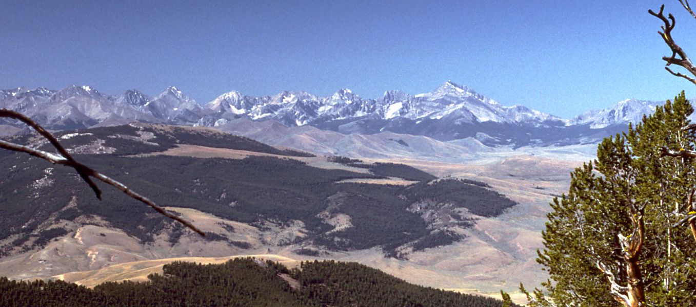
 Photo: Matt Lavin from Bozeman, Montana, USA, CC BY-SA 2.0 (via Wikimedia Commons)
- 39.3 mi
- distance
- 6,851 ft
- high point
- May–Sep
- best months
Big Lost River is a paddling destination in Idaho, just 0.3 miles from the town of Rothas. It is a canoeing route, and its setting close to town makes it an easy stop for anyone already in the area. Summer is the most comfortable time to paddle here. Typical averages from a nearby weather station at Mackay show July highs around 83°F with lows near 50°F, and June and September run only slightly cooler, with highs in the low to mid 70s. That station sits roughly 950 feet below the river, so temperatures on the water run a little cooler. Pass Creek, about 5 miles away, offers more paddling, and the Big Lost River Access Trail is a short drive for river fishing. For an overnight, Pass Creek Narrows Camping Area & Picnic Site is about 6 miles off. Hikers can also head to Bedy Canyon Trail, a little under 5 miles away.
- Pass CreekCanoeing5.1 mi
- BEDY CANYON TRAILHiking5.4 mi
- Big Lost River Access TrailRiver fishing5.5 mi
- Mackay Fishing AccessHiking5.6 mi
- Pass Creek Narrows Camping Area & Picnic SiteCamping6.1 mi
- Pass Creek CanyonRock climbing6.2 mi
- The Left SideRock climbing7 mi
- Joe T. Fallini Recreation SiteCamping8.8 mi
Source: Roamze catalog (indexable pages within 10 miles, PostGIS distance)
 Little Lost RiverCanoeing · ~33 min drivePhoto: G. Thomas at English Wikipedia, Public domain (via Wikimedia Commons)
- Rothwell Recreation SiteBoat launch · ~9 min drive
- Sawtooth National Recreation AreaFloat trip · ~1h 17m drive
- Pass CreekCanoeing · ~9 min drive
- Deadman Hole Boat RampBoat launch · ~1h 23m drive
- Antelope CreekCanoeing · ~21 min drive
- Wet CreekCanoeing · ~29 min drive
- Dry Fork CreekCanoeing · ~33 min drive
- East Fork Big Lost RiverCanoeing · ~36 min drive
- Summit CreekCanoeing · ~44 min drive
Best time to visit Big Lost River
Best months: May–September. Best months have typical highs of 55–85 °F, lows of 30 °F or warmer (32 °F where the station doesn't record snow), at most one snowy day and no more than 12 wet days.
Jan
30° / 8°
6 wet
Feb
34° / 12°
5 wet
Mar
44° / 22°
6 wet
Apr
54° / 29°
6 wet
May
65° / 37°
8 wet
Jun
73° / 43°
7 wet
Jul
83° / 50°
5 wet
Aug
82° / 48°
5 wet
Sep
72° / 40°
5 wet
Oct
58° / 31°
5 wet
Nov
41° / 19°
6 wet
Dec
29° / 10°
7 wet
Typical high / low (°F) and days with rain or snow, 1991–2020. Measured at Mackay Lost Rvr Rs, ID, 4.5 mi away at 5,897 ft. The station sits about 1,000 ft lower than this place, so expect it a little cooler here. This station doesn't record snowfall. Source: NOAA NCEI U.S. Climate Normals 1991–2020.

