Lookout Mountain
- 9,956 ft
- summit
- 1
- way up
Is Lookout Mountain open right now?
Alert in the area
The Forest Service lists 4 alerts for Sawtooth National Forest.
Paradise Prescribed Burn Restricted Access
Agency alert covering Sawtooth National Forest · USFS · Sawtooth National Forest
Grandjean Area, Road, and Trail Closure
Agency alert covering Sawtooth National Forest · Order 0414-04-165 · USFS · Sawtooth National Forest
Over-Snow Vehicle and Bicycle Prohibitions
Agency alert covering Sawtooth National Forest · Order 0414-00-028 · USFS · Sawtooth National Forest
Occupancy and Use - Food Storage
Agency alert covering Sawtooth National Forest · Order 0414-04-143 · USFS · Sawtooth National Forest
As of · Source: USFS · Sawtooth National Forest. Agencies don't list every closure — check before you go.
Lookout Mountain is a summit in the Cecil D. Andrus-White Clouds Wilderness, part of the Sawtooth National Recreation Area within Idaho's Sawtooth National Forest. The nearest town is Stanley, about 9 miles away. The closest trail is Lookout Mountain Cuttoff, about a mile away, and Garland Creek is roughly 2.4 miles off. Elk Creek Campground sits about 5 miles away, and paddlers can reach Warm Springs Creek within about 4 miles.
Conditions and forecast
Daily highs and lows, wind and the chance of precipitation at the summit and route start for the next 7 days, from the Open-Meteo model.
- Summit elevation
- 9,956 ft
Elevation from USGS 3D Elevation Program terrain data (about 10 m resolution).
Map © Mapbox © OpenStreetMap contributors Questions about Lookout Mountain
How tall is Lookout Mountain?
9,956 ft (3,035 m).
How many routes go to the summit of Lookout Mountain?
One: ROUGH CREEK-SKYLINE.
 Thompson Peak10,741 ft · Idaho1 route13 mi awayPhoto: Fredlyfish4, CC BY-SA 3.0 (via Wikimedia Commons)
- Horton Peak9,898 ft · Idaho1 route16 mi away
- Observation Peak9,150 ft · Idaho1 route17 mi away
- Mill Creek Summit8,802 ft · Idaho1 route23 mi away
- Ruffneck Peak9,418 ft · Idaho1 route28 mi away
- Herd Peak9,858 ft · Idaho2 routes30 mi away
- LOOKOUT MOUNTAIN CUTTOFFHiking1.2 mi
- Garland CreekHiking2.4 mi
- Warm Springs CreekCanoeing3.9 mi
 The towers at 202Rock climbingPhoto: tinosa, Public domain (via Wikimedia Commons)5.2 mi
- The dam buttressRock climbingPhoto: tinosa, Public domain (via Wikimedia Commons)5.3 mi
- Elk Creek CgCamping5.3 mi
- Stovepipe Springs Dispersed CampgroundCamping5.4 mi
- Salmon RiverRiver fishing8.6 mi
Source: Roamze catalog (indexable pages within 10 miles, PostGIS distance)
 Watson PeakSummit · ~10 min drivePhoto: Fredlyfish4, CC BY-SA 3.0 (via Wikimedia Commons)
 Lee PeakSummit · ~15 min drivePhoto: Leaflet, CC BY-SA 4.0 (via Wikimedia Commons)
 Blackmon PeakSummit · ~18 min drivePhoto: Leaflet, CC BY-SA 4.0 (via Wikimedia Commons)
 Alpine PeakSummit · ~25 min drivePhoto: Fredlyfish4, CC BY-SA 3.0 (via Wikimedia Commons)
 Decker PeakSummit · ~25 min drivePhoto: Fredlyfish4, CC BY-SA 4.0 (via Wikimedia Commons)
 Baron PeakSummit · ~26 min drivePhoto: Fredlyfish4, CC BY-SA 3.0 (via Wikimedia Commons)
 Mount ReganSummit · ~26 min drivePhoto: Fredlyfish4, CC BY-SA 4.0 (via Wikimedia Commons)
 Sevy PeakSummit · ~27 min drivePhoto: Fredlyfish4, CC BY-SA 3.0 (via Wikimedia Commons)
 McGowan PeakSummit · ~28 min drivePhoto: Fredlyfish4, CC BY-SA 4.0 (via Wikimedia Commons)
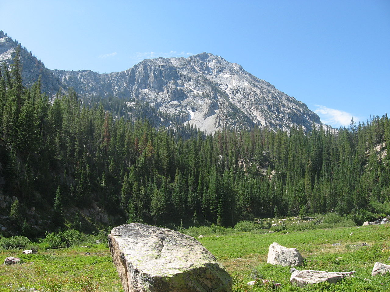 Parks PeakSummit · ~31 min drivePhoto: Fredlyfish4, CC BY-SA 3.0 (via Wikimedia Commons)
