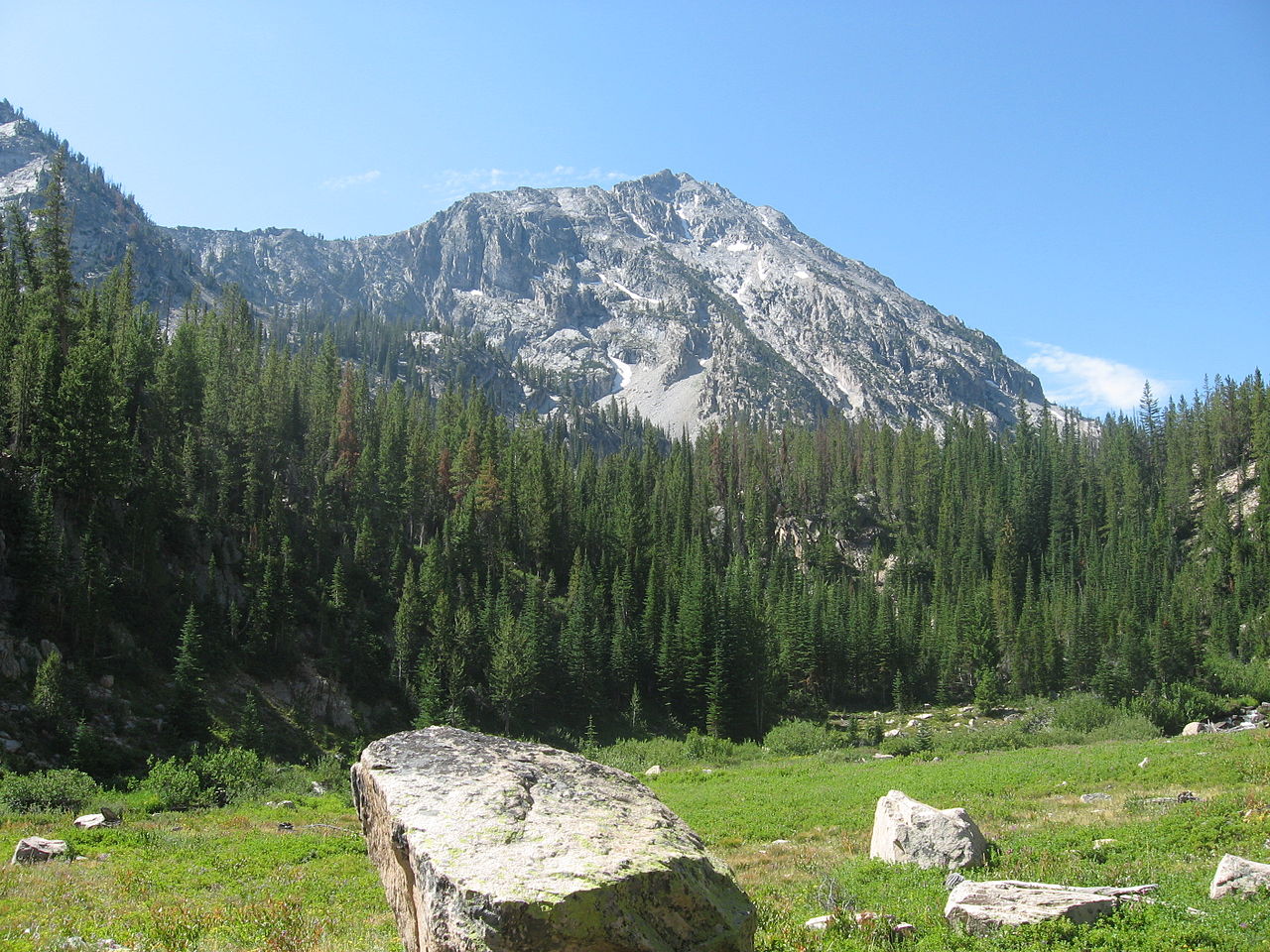
Grand Mogul
 Photo: Karthikc123, CC BY-SA 3.0 (via Wikimedia Commons)
- 9,725 ft
- summit
- Forest Service
- managed by
Is Grand Mogul open right now?
Alert in the area
The Forest Service lists 4 alerts for Sawtooth National Forest.
Paradise Prescribed Burn Restricted Access
Agency alert covering Sawtooth National Forest · USFS · Sawtooth National Forest
Grandjean Area, Road, and Trail Closure
Agency alert covering Sawtooth National Forest · Order 0414-04-165 · USFS · Sawtooth National Forest
Over-Snow Vehicle and Bicycle Prohibitions
Agency alert covering Sawtooth National Forest · Order 0414-00-028 · USFS · Sawtooth National Forest
Occupancy and Use - Food Storage
Agency alert covering Sawtooth National Forest · Order 0414-04-143 · USFS · Sawtooth National Forest
As of · Source: USFS · Sawtooth National Forest. Agencies don't list every closure — check before you go.
Grand Mogul is a summit of about 9,725 feet in Custer County, Idaho, inside the Sawtooth Wilderness. The Forest Service manages the land, and the nearest town is Stanley, about 9 miles away. The closest neighbors are the Saddleback Lakes West Trail and the Elephant's Perch climbing area, both about a mile away. Redfish Inlet Campground sits about 1.4 miles off, and Redfish Lake is about 3 miles away.
Conditions and forecast
Daily highs and lows, wind and the chance of precipitation at the summit for the next 7 days, from the Open-Meteo model.
- Summit elevation
- 9,725 ft
- Land manager
- Forest Service
Elevation from USGS 3D Elevation Program terrain data (about 10 m resolution).
We don't know of a mapped trail or route to the summit of Grand Mogul. Plan the approach with local maps, a guidebook or a local guide, and check conditions before you go.
Questions about Grand Mogul
How tall is Grand Mogul?
9,725 ft (2,964 m).
Is there a trail to the top of Grand Mogul?
We don't know of a mapped trail or route to the summit. Plan the approach with local maps, a guidebook or a local guide.
 Thompson Peak10,741 ft · Idaho1 route4.9 mi awayPhoto: Fredlyfish4, CC BY-SA 3.0 (via Wikimedia Commons)
- Observation Peak9,150 ft · Idaho1 route9.8 mi away
- Lookout Mountain9,956 ft · Idaho1 route13 mi away
- Horton Peak9,898 ft · Idaho1 route13 mi away
- Swanholm Peak8,727 ft · Idaho1 route22 mi away
- Red Mountain8,723 ft · Idaho1 route25 mi away
- The Elephant's PerchRock climbing1.1 mi
- Saddleback Lakes West TrailHiking1.1 mi
- Saddleback Lakes East TrailHiking1.1 mi
- Redfish Inlet CgCamping1.4 mi
- The Sawtooth RangeRock climbing2.1 mi
- Redfish LakeLake fishing3.1 mi
 Point CampgroundCampingPhoto: Recreation.gov (RIDB) / public domain4.1 mi
- Sawtooth WildernessLake fishing7.6 mi
Source: Roamze catalog (indexable pages within 10 miles, PostGIS distance)
 Decker PeakSummit · ~4 min drivePhoto: Fredlyfish4, CC BY-SA 4.0 (via Wikimedia Commons)
 Horstmann PeakSummit · ~5 min drivePhoto: Fredlyfish4, CC BY-SA 4.0 (via Wikimedia Commons)
 Sevy PeakSummit · ~7 min drivePhoto: Fredlyfish4, CC BY-SA 3.0 (via Wikimedia Commons)
 Monte VeritaSummit · ~7 min drivePhoto: Paul from Boise, USA, CC BY-SA 2.0 (via Wikimedia Commons)
 Baron PeakSummit · ~9 min drivePhoto: Fredlyfish4, CC BY-SA 3.0 (via Wikimedia Commons)
 Elk PeakSummit · ~9 min drivePhoto: Fredlyfish4, CC BY-SA 3.0 (via Wikimedia Commons)
- Payette PeakSummit · ~11 min drivePhoto: Fredlyfish4, CC BY-SA 3.0 (via Wikimedia Commons)
 Mount ReganSummit · ~13 min drivePhoto: Fredlyfish4, CC BY-SA 4.0 (via Wikimedia Commons)
 Alpine PeakSummit · ~13 min drivePhoto: Fredlyfish4, CC BY-SA 3.0 (via Wikimedia Commons)
 Parks PeakSummit · ~14 min drivePhoto: Fredlyfish4, CC BY-SA 3.0 (via Wikimedia Commons)
Also worth it near here
 Grand Mogul TrailHiking · ~2 min drivePhoto: WaterArchives.org from Sacramento, California, USA, CC BY-SA 2.0 (via Wikimedia Commons)
 Redfish Creek - Baron CreekMountain biking · ~3 min drivePhoto: Katja Schulz from Washington, D. C., USA, CC BY 2.0 (via Wikimedia Commons)
- Redfish LakeLake fishing · ~5 min drive
- Baron Creek FallsWaterfall · ~7 min drive
