Rainey Creek Bench
- 8.8 mi
- round trip
- 19 ft
- climb
- 6,331 ft
- high point
- Out and back
- route
- Jun–Sep
- best months
Is Rainey Creek Bench open right now?
No closures listed
The Forest Service lists no closures for Caribou-Targhee National Forest.
As of · Source: USFS · Caribou-Targhee National Forest. Agencies don't list every closure — check before you go.
Rainey Creek Bench is an easy out-and-back hike in Idaho's Caribou-Targhee National Forest, within the Palisades Ranger District. The trail is about 8.8 miles long, with a low point of 5,701 feet and a high of 6,331 feet, and it gains about 19 feet in elevation. The Forest Service manages the land, and the route is on natural surface, with horses and bikes both allowed. Summer is the most comfortable time to go. Typical averages from a nearby weather station in Swan Valley show July highs around 85°F with lows near 46°F, and September cools to highs around 75°F. That station sits roughly 900 feet lower than the trail's high point, so temperatures on the bench run cooler. The hike is open year-round. Falls Campground and the South Fork of the Snake River: Conant Boat Access are both about 4.5 miles away. Poison Creek and Fleming Canyon are a little farther, at about 4.2 and 4.5 miles.
Local outfitters
- Greys River Cove28 mi away
- The Virginian RV Park28 mi away
Not on Roamze yet. Their page has how to reach them.
Best time to go · Jun–Sep
Best time to visit Rainey Creek Bench
Best months: June–September. Best months have typical highs of 55–85 °F, lows of 30 °F or warmer (32 °F where the station doesn't record snow), at most one snowy day and no more than 12 wet days.
Jan
30° / 11°
10 wet
Feb
35° / 14°
9 wet
Mar
45° / 22°
10 wet
Apr
56° / 27°
12 wet
May
66° / 35°
13 wet
Jun
75° / 41°
10 wet
Jul
85° / 46°
8 wet
Aug
84° / 44°
8 wet
Sep
75° / 37°
8 wet
Oct
59° / 29°
8 wet
Nov
43° / 20°
9 wet
Dec
32° / 12°
9 wet
Typical high / low (°F) and days with rain or snow, 1991–2020. Measured at Swan Valley, ID, 4.9 mi away at 5,397 ft. The station sits about 900 ft lower than this place, so expect it a little cooler here. This station doesn't record snowfall. Source: NOAA NCEI U.S. Climate Normals 1991–2020.
Keep exploring — more trails worth the drive
 Photo: InSapphoWeTrust from Los Angeles, California, USA, CC BY-SA 2.0 (via Wikimedia Commons)
Poison Creek
~7 min drive
8.54-mile out-and-back trail in Idaho with 2,030 ft elevation gain.
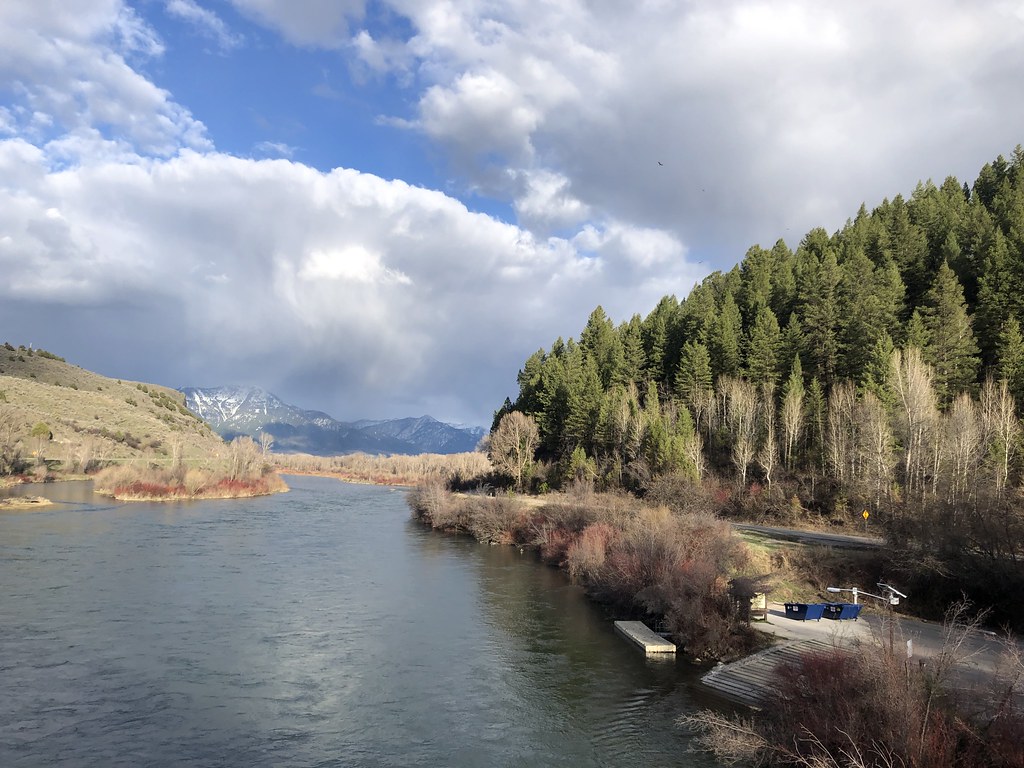 Photo: Rainhead, CC BY-SA 2.0 (via Flickr)
ECHO/INDIAN CREEK
~9 min drive
3.82-mile out-and-back trail in Idaho with 1,166 ft elevation gain
HIKE
RAINEY CREEK
~9 min drive
1.08-mile out-and-back trail at 5,795 ft elevation in Idaho.
HIKE
Chicken Springs
~14 min drive
5.93-mile out-and-back trail in Idaho with 323 ft gain and 2,623 ft loss.
HIKE
BURNT CANYON/DRY CANYON
~6 min drive
8.28-mile out-and-back trail in Idaho with 2,956 ft elevation gain.
Photo: InSapphoWeTrust from Los Angeles, California, USA, CC BY-SA 2.0 (via Wikimedia Commons)Tie Canyon
~10 min drive
5.88-mile out-and-back trail in Idaho with 784 ft elevation gain.
HIKE
MIKE SPENCER LOOP
~9 min drive
1.6-mile out-and-back out-and-back in Idaho with 732 ft elevation gain and loss.
HIKE
FLEMING CANYON
~8 min drive
11.18-mile out-and-back trail in Idaho with 4,424 ft elevation gain.
Photo: InSapphoWeTrust from Los Angeles, California, USA, CC BY-SA 2.0 (via Wikimedia Commons)Old Sheep
~12 min drive
Old Sheep is a 3.92-mile out-and-back trail in Idaho with 722 feet of elevation gain.
HIKE
CORRAL CANYON
~10 min drive
2.96-mile out-and-back trail in Idaho with 990 ft gain and 6,408 ft max elevation.
