Clear Creek RV Park
Campground
Campground · 1.3 mi from the trail
 Photo: Rick Kimpel from Spring, TX, USA, CC BY-SA 2.0 (via Wikimedia Commons)
South Table Mountain is a summit in Colorado, rising to 6,336 feet about 1.1 miles from the town of Golden. It sits close to town, making it an easy addition to a day spent exploring the area around Golden. Late spring and early fall are the most comfortable times to visit. Typical averages from a nearby weather station show May highs around 69°F and September highs around 76°F, with July the warmest month at about 87°F. That station sits a few hundred feet lower than the summit, so temperatures on top run a little cooler. Trails start right at the mountain. The Lubahn Trail and Olivine Trail are both about 0.3 miles away, and the Dome Flow Trail is under a mile off. Climbers can head to the Child Free Zone (aka Parkway Crags) at about 0.8 miles.
Clear Creek RV Park
Campground
 If it rainsClyde Charles Brown, CC BY-SA 4.0 · Wikimedia Commons
University museum, geology in CO, United States
Places © OpenStreetMap contributors, Places © Overture Maps Foundation · Photos: Clyde Charles Brown, CC BY-SA 4.0 (commons)
More in Idaho SpringsDaily highs and lows, wind and the chance of precipitation at the summit for the next 7 days, from the Open-Meteo model.
Elevation from USGS 3D Elevation Program terrain data (about 10 m resolution).
We don't know of a mapped trail or route to the summit of South Table Mountain. Plan the approach with local maps, a guidebook or a local guide, and check conditions before you go.
6,336 ft (1,931 m).
We don't know of a mapped trail or route to the summit. Plan the approach with local maps, a guidebook or a local guide.


 Child Free Zone (aka Parkway Crags)Rock climbingPhoto: ShanMcG213, CC BY-SA 2.0 (via Flickr)0.8 mi
 Overhang AreaRock climbingPhoto: ShanMcG213, CC BY-SA 2.0 (via Flickr)0.8 mi
 Clear Creek RV ParkCampingPhoto: cogdogblog, CC BY 2.0 (via Wikimedia Commons)1.3 mi
Source: Roamze catalog (indexable pages within 10 miles, PostGIS distance)
 North Table MountainSummit · ~3 min drivePhoto: Rick Kimpel from Spring, TX, USA, CC BY-SA 2.0 (via Wikimedia Commons)
 Mount ZionSummit · ~4 min drivePhoto: Ben Mason from Denver, CC BY 2.0 (via Wikimedia Commons)
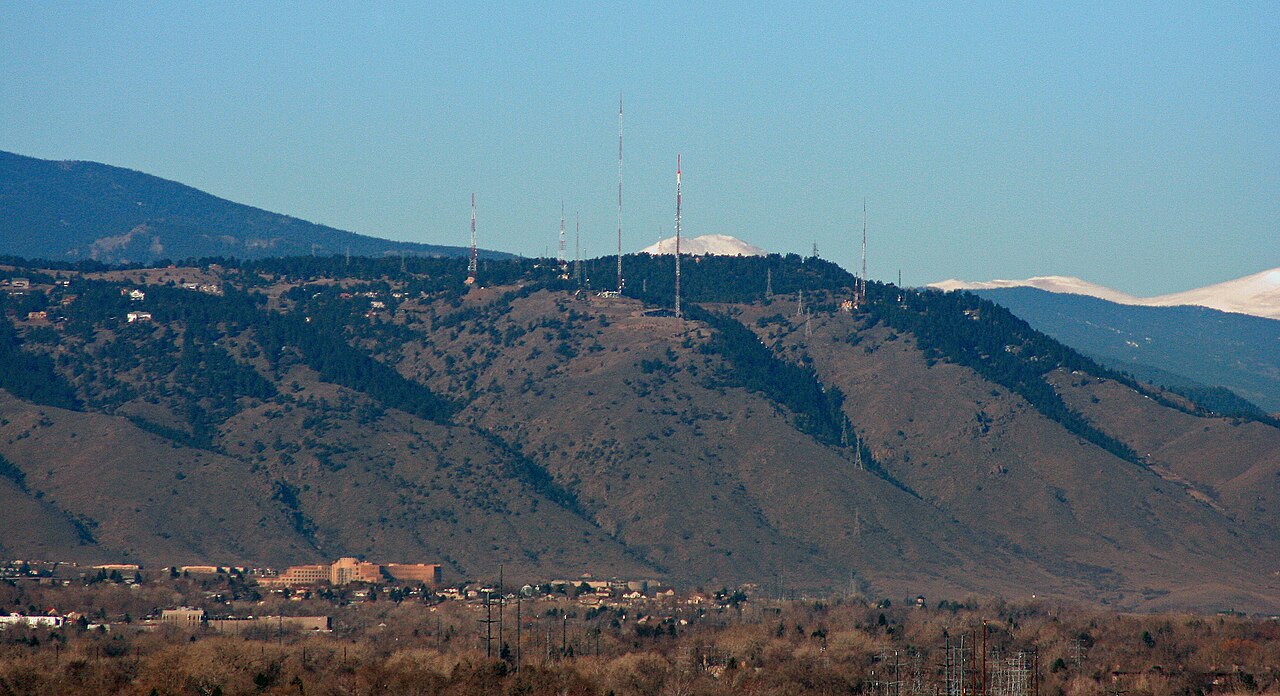 Lookout MountainSummit · ~4 min drivePhoto: Jeffrey Beall, CC BY 3.0 (via Wikimedia Commons)
 Green MountainSummit · ~7 min drivePhoto: Thomson200, CC0 (via Wikimedia Commons)Mount MorrisonSummit · ~11 min drivePhoto: Thomson200, CC0 (via Wikimedia Commons)
 Centennial ConeSummit · ~14 min drivePhoto: Jeffrey Beall, CC BY 4.0 (via Wikimedia Commons)
 Inspiration PointSummit · ~14 min drivePhoto: Jeffrey Beall, CC BY 3.0 (via Wikimedia Commons)Mount CarbonSummit · ~14 min drivePhoto: Xnatedawgx, CC BY-SA 3.0 (via Wikimedia Commons)
 Douglas MountainSummit · ~16 min drivePhoto: Jeffrey Beall, CC BY 4.0 (via Wikimedia Commons)
 Mount LindoSummit · ~18 min drivePhoto: Paradoxsociety, CC BY-SA 4.0 (via Wikimedia Commons)
Also worth it near here
Child Free Zone (aka Parkway Crags)Rock climbing · ~1 min drivePhoto: ShanMcG213, CC BY-SA 2.0 (via Flickr) Serpentine TrailHiking · ~2 min drivePhoto: Scott McLeod, CC BY 2.0 (via Flickr)Clear Creek RV ParkCamping · ~2 min drivePhoto: cogdogblog, CC BY 2.0 (via Wikimedia Commons)
Best months: April–June and August–October. Best months have typical highs of 55–85 °F, lows of 30 °F or warmer (32 °F where the station doesn't record snow), at most one snowy day and no more than 12 wet days.
Jan
45° / 23°
4 wet
Feb
46° / 22°
5 wet
Mar
54° / 29°
6 wet
Apr
60° / 35°
8 wet
May
69° / 45°
9 wet
Jun
81° / 55°
7 wet
Jul
87° / 61°
7 wet
Aug
84° / 59°
8 wet
Sep
76° / 51°
6 wet
Oct
64° / 39°
5 wet
Nov
53° / 30°
4 wet
Dec
45° / 23°
4 wet
Typical high / low (°F) and days with rain or snow, 1991–2020. Measured at Ralston Rsvr, CO, 5.2 mi away at 5,900 ft. This station doesn't record snowfall. Source: NOAA NCEI U.S. Climate Normals 1991–2020.
