Clear Creek RV Park
Campground
Campground · 0.8 mi from the trail
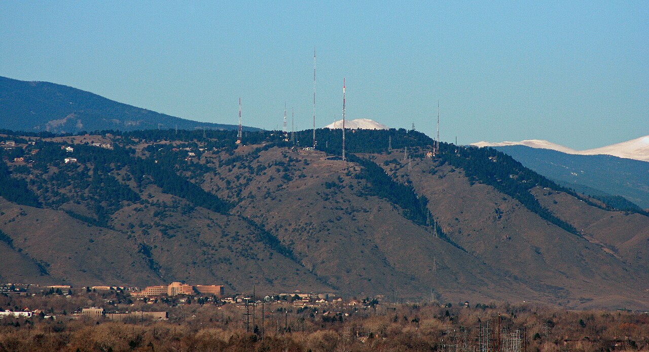
 Photo: Ben Mason from Denver, CC BY 2.0 (via Wikimedia Commons)
Mount Zion is a summit of 7,055 feet in Windy Saddle Park, a county park in Colorado, about 1.7 miles from the town of Golden. The land is managed by county authorities, and the peak sits within a cluster of climbing areas that make it a natural anchor for a day of rock and trail. Summer is the most comfortable time to visit. Typical averages from a nearby weather station in Evergreen, at a similar elevation, show July highs around 81°F with lows near 49°F, while winter highs sit in the mid-40s. The closest climbing areas are Recessed Slab, Middle and West Walls and Upper Tier, all about 0.1 mile away. The Clear Creek Trail and Welch Ditch Trail are each about 0.6 mile off, and Clear Creek RV Park is about 0.8 mile away for an overnight stay.
Clear Creek RV Park
Campground
 If it rainsClyde Charles Brown, CC BY-SA 4.0 · Wikimedia Commons
University museum, geology in CO, United States
Places © OpenStreetMap contributors, Places © Overture Maps Foundation · Photos: Clyde Charles Brown, CC BY-SA 4.0 (commons)
More in Idaho SpringsDaily highs and lows, wind and the chance of precipitation at the summit for the next 7 days, from the Open-Meteo model.
Elevation from USGS 3D Elevation Program terrain data (about 10 m resolution).
We don't know of a mapped trail or route to the summit of Mount Zion. Plan the approach with local maps, a guidebook or a local guide, and check conditions before you go.
7,055 ft (2,150 m).
We don't know of a mapped trail or route to the summit. Plan the approach with local maps, a guidebook or a local guide.


 Clear Creek TrailHikingPhoto: pingnews.com, CC BY-SA 2.0 (via Flickr)0.6 mi
 Welch Ditch TrailHikingPhoto: Ligoweth, CC BY-SA 2.0 (via Wikimedia Commons)0.6 mi
 Clear Creek RV ParkCampingPhoto: cogdogblog, CC BY 2.0 (via Wikimedia Commons)0.8 mi
 Bear CreekCanoeingPhoto: Footwarrior, CC BY-SA 3.0 (via Wikimedia Commons)8.8 mi
Source: Roamze catalog (indexable pages within 10 miles, PostGIS distance)
 Lookout MountainSummit · ~2 min drivePhoto: Jeffrey Beall, CC BY 3.0 (via Wikimedia Commons)
 South Table MountainSummit · ~4 min drivePhoto: Rick Kimpel from Spring, TX, USA, CC BY-SA 2.0 (via Wikimedia Commons)
 North Table MountainSummit · ~5 min drivePhoto: Rick Kimpel from Spring, TX, USA, CC BY-SA 2.0 (via Wikimedia Commons)
 Green MountainSummit · ~8 min drivePhoto: Thomson200, CC0 (via Wikimedia Commons)Mount MorrisonSummit · ~9 min drivePhoto: Thomson200, CC0 (via Wikimedia Commons)
 Centennial ConeSummit · ~11 min drivePhoto: Jeffrey Beall, CC BY 4.0 (via Wikimedia Commons)
 Douglas MountainSummit · ~13 min drivePhoto: Jeffrey Beall, CC BY 4.0 (via Wikimedia Commons)Mount CarbonSummit · ~15 min drivePhoto: Xnatedawgx, CC BY-SA 3.0 (via Wikimedia Commons)
 Mount LindoSummit · ~16 min drivePhoto: Paradoxsociety, CC BY-SA 4.0 (via Wikimedia Commons)
 Bergen PeakSummit · ~17 min drivePhoto: Xnatedawgx, CC BY-SA 3.0 (via Wikimedia Commons)
Also worth it near here
 The Sports WallRock climbing · Next doorPhoto: pingnews.com, CC BY-SA 2.0 (via Flickr)Clear Creek TrailHiking · Next doorPhoto: pingnews.com, CC BY-SA 2.0 (via Flickr)Clear Creek RV ParkCamping · ~1 min drivePhoto: cogdogblog, CC BY 2.0 (via Wikimedia Commons)
Best months: May–September. Best months have typical highs of 55–85 °F, lows of 30 °F or warmer (32 °F where the station doesn't record snow), at most one snowy day and no more than 12 wet days.
Jan
44° / 12°
5 wet
Feb
44° / 13°
6 wet
Mar
51° / 21°
7 wet
Apr
56° / 27°
8 wet
May
64° / 36°
10 wet
Jun
76° / 43°
10 wet
Jul
81° / 49°
12 wet
Aug
79° / 47°
12 wet
Sep
73° / 40°
8 wet
Oct
61° / 29°
6 wet
Nov
51° / 20°
5 wet
Dec
44° / 13°
5 wet
Typical high / low (°F) and days with rain or snow, 1991–2020. Measured at Evergreen, CO, 8.3 mi away at 6,985 ft. This station doesn't record snowfall. Source: NOAA NCEI U.S. Climate Normals 1991–2020.
