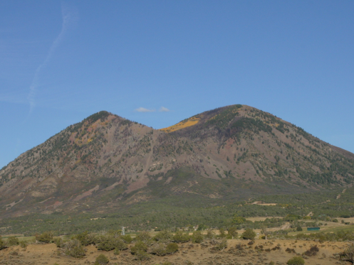
Mount Lamborn
 Photo: Northforker, CC BY-SA 3.0 (via Wikimedia Commons)
- 11,403 ft
- summit
- 1
- way up
- Forest Service
- managed by
- Jun–Sep
- best months
Is Mount Lamborn open right now?
Closure in the area
There's a closure order in Grand Mesa, Uncompahgre and Gunnison National Forests. It doesn't name Mount Lamborn, so check the source for the area it covers (2 listed).
Gold Mountain Wildfire Roads and Trails Closure Order v 4.0
Agency closure covering Grand Mesa, Uncompahgre and Gunnison National Forests · USFS · Grand Mesa, Uncompahgre and Gunnison National Forests
Ophir Pass Road Closure
Agency closure covering Grand Mesa, Uncompahgre and Gunnison National Forests · USFS · Grand Mesa, Uncompahgre and Gunnison National Forests
Potter Basin Road Closure Order
Agency alert covering Grand Mesa, Uncompahgre and Gunnison National Forests · USFS · Grand Mesa, Uncompahgre and Gunnison National Forests
Beaver Park Road Closure Order
Agency alert covering Grand Mesa, Uncompahgre and Gunnison National Forests · USFS · Grand Mesa, Uncompahgre and Gunnison National Forests
TERMINATION OF ORDER - FIRE RESTRICTIONS
Agency alert covering Grand Mesa, Uncompahgre and Gunnison National Forests · USFS · Grand Mesa, Uncompahgre and Gunnison National Forests
As of · Source: USFS · Grand Mesa, Uncompahgre and Gunnison National Forests. Agencies don't list every closure — check before you go.
Mount Lamborn is a summit in Colorado, 11,403 feet elevation. It is reached by the Mt. Lamborn Summit Trail, a public trail 18.68 miles long with 4,769 feet of elevation gain.
Conditions and forecast
Daily highs and lows, wind and the chance of precipitation at the summit and route start for the next 7 days, from the Open-Meteo model.
- Summit elevation
- 11,403 ft
- Land manager
- Forest Service
Elevation from USGS 3D Elevation Program terrain data (about 10 m resolution).
Map © Mapbox © OpenStreetMap contributors Questions about Mount Lamborn
How tall is Mount Lamborn?
11,403 ft (3,476 m).
How many routes go to the summit of Mount Lamborn?
One: Mt. Lamborn Summit Trail.
 Youngs Peak7,426 ft · Colorado1 route7.8 mi awayPhoto: Jeffrey Beall, CC BY 3.0 (via Wikimedia Commons)
- Raven Mesa8,292 ft · Colorado1 route11 mi away
- Bonfisk Peak11,619 ft · Colorado1 route17 mi away
- Green Mountain8,566 ft · Colorado1 route18 mi away
 West Elk Peak13,039 ft · Colorado1 route18 mi awayPhoto: John Sowell, CC BY-SA 4.0 (via Wikimedia Commons)
- High Point8,284 ft · Colorado1 route20 mi away
- Mt. Lamborn Summit TrailHiking1.3 mi
- LambornHiking2.4 mi
- Lone Cabin TrailHiking3.3 mi
- Lands End TrailHiking3.5 mi
- Little Elk BasinHiking3.7 mi
- Clear Fork CampgroundCamping9.4 mi
 Smith ForkCanoeingPhoto: Jeffrey Beall, CC BY 3.0 (via Wikimedia Commons)9.4 mi
- Iron Creek CampgroundCamping9.8 mi
Source: Roamze catalog (indexable pages within 10 miles, PostGIS distance)
 Landsend PeakSummit · ~5 min drivePhoto: GregJoeson, CC BY-SA 4.0 (via Wikimedia Commons)
 Saddle MountainSummit · ~12 min drivePhoto: GregJoeson, CC BY-SA 4.0 (via Wikimedia Commons)
- Youngs PeakSummit · ~13 min drivePhoto: Jeffrey Beall, CC BY 3.0 (via Wikimedia Commons)
 Mount GueroSummit · ~16 min drivePhoto: formulanone, CC BY-SA 2.0 (via Wikimedia Commons)
 West Beckwith MountainSummit · ~24 min drivePhoto: John Sowell, CC BY-SA 4.0 (via Wikimedia Commons)
 East Beckwith MountainSummit · ~28 min drivePhoto: GregJoeson, CC BY-SA 4.0 (via Wikimedia Commons)
 Marcellina MountainSummit · ~30 min drivePhoto: John Sowell, CC BY-SA 4.0 (via Wikimedia Commons)
 Chair MountainSummit · ~37 min drivePhoto: Hogs555, CC BY-SA 3.0 (via Wikimedia Commons)
 Mount OwenSummit · ~39 min drivePhoto: John Sowell, CC BY-SA 4.0 (via Wikimedia Commons)
 Purple PeakSummit · ~39 min drivePhoto: Scott Krankkala, CC BY 2.0 (via Wikimedia Commons)
Best time to visit Mount Lamborn
Best months: June–September. Best months have typical highs of 55–85 °F, lows of 30 °F or warmer (32 °F where the station doesn't record snow), at most one snowy day and no more than 12 wet days.
Jan
26° / 6°
Feb
27° / 4°
Mar
34° / 12°
Apr
40° / 17°
May
49° / 27°
Jun
62° / 37°
Jul
68° / 42°
Aug
64° / 40°
Sep
57° / 34°
Oct
45° / 24°
Nov
34° / 14°
Dec
26° / 5°
Typical high / low (°F) and days with rain or snow, 1991–2020. Measured at Bonham Rsvr, CO, 28.9 mi away at 9,852 ft. The station sits about 1,600 ft lower than this place, so expect it a little cooler here. This station doesn't record snowfall. Source: NOAA NCEI U.S. Climate Normals 1991–2020.

