East River
- 2.2 mi
- distance
- 176 ft
- climb
- Jun–Aug
- best months
Caution at last check
Agency alerts are in effect for this area; weather is marginal · USFS, OpenWeather · checked 23 h ago
Is East River open right now?
Closure in the area
There's a closure order in Grand Mesa, Uncompahgre and Gunnison National Forests. It doesn't name East River, so check the source for the area it covers (2 listed).
Gold Mountain Wildfire Roads and Trails Closure Order v 4.0
Agency closure covering Grand Mesa, Uncompahgre and Gunnison National Forests · USFS · Grand Mesa, Uncompahgre and Gunnison National Forests
Ophir Pass Road Closure
Agency closure covering Grand Mesa, Uncompahgre and Gunnison National Forests · USFS · Grand Mesa, Uncompahgre and Gunnison National Forests
Potter Basin Road Closure Order
Agency alert covering Grand Mesa, Uncompahgre and Gunnison National Forests · USFS · Grand Mesa, Uncompahgre and Gunnison National Forests
Beaver Park Road Closure Order
Agency alert covering Grand Mesa, Uncompahgre and Gunnison National Forests · USFS · Grand Mesa, Uncompahgre and Gunnison National Forests
TERMINATION OF ORDER - FIRE RESTRICTIONS
Agency alert covering Grand Mesa, Uncompahgre and Gunnison National Forests · USFS · Grand Mesa, Uncompahgre and Gunnison National Forests
As of · Source: USFS · Grand Mesa, Uncompahgre and Gunnison National Forests. Agencies don't list every closure — check before you go.
East River is a mountain biking route in Colorado's Gunnison Ranger District, part of the Grand Mesa, Uncompahgre and Gunnison National Forests. The Forest Service manages the land, and the route lies about 2.2 miles long, with a total elevation gain of 176 feet from a starting point near 8,935 feet to a high point of about 9,096 feet. The climb is short and gentle, with the steepest stretch at about 1.2 miles in, where the grade reaches 12 percent. Summer is the most comfortable time to ride. Typical averages from the nearby Crested Butte weather station show July highs around 76°F with lows near 40°F, while winter highs stay in the mid-20s. Several other outings sit close by. The Canal hike is about 0.6 miles away, and Brush Creek Road and Brush Creek Camping Area are each about 0.7 miles off. Farris Creek Camping Area is roughly 1.6 miles away.
Local outfitters
- Valley Mobile RV Park41 mi away
- Monarch Spur RV Park44 mi away
Not on Roamze yet. Their page has how to reach them.
- CanalHiking0.6 mi
 Brush Creek RoadCross-country skiingPhoto: jpaxton, CC BY-SA 3.0 (via Wikimedia Commons)0.7 mi
- Brush Creek Camping AreaCamping0.7 mi
- Farris Creek Camping AreaCamping1.6 mi
- Brush CreekCanoeing2 mi
- Battleship BoulderRock climbing2.4 mi
- The Joint BoulderRock climbing2.4 mi
 Slate RiverCanoeingPhoto: Jeffrey Beall, CC BY 3.0 (via Wikimedia Commons)4.7 mi
Source: Roamze catalog (indexable pages within 10 miles, PostGIS distance)
 West Brush Creek Snowmo/skiMountain biking · ~6 min drivePhoto: James St. John, CC BY 2.0 (via Wikimedia Commons)
- Deer CreekMountain biking · ~7 min drivePhoto: James St. John, CC BY 2.0 (via Wikimedia Commons)
- Strand BonusMountain biking · ~2 min drive
- Strand HillMountain biking · ~2 min drive
- upper upper trail 435.1Mountain biking · ~3 min drive
- upper upper trail #435.1Mountain biking · ~3 min drive
- Upper Upper LoopMountain biking · ~3 min drive
- upper upper trail 435.1Mountain biking · ~3 min drive
- SideshowMountain biking · ~3 min drive
- BridgesMountain biking · ~4 min drive
Also worth it near here
- Brush Creek RoadCross-country skiing · ~1 min drivePhoto: jpaxton, CC BY-SA 3.0 (via Wikimedia Commons)
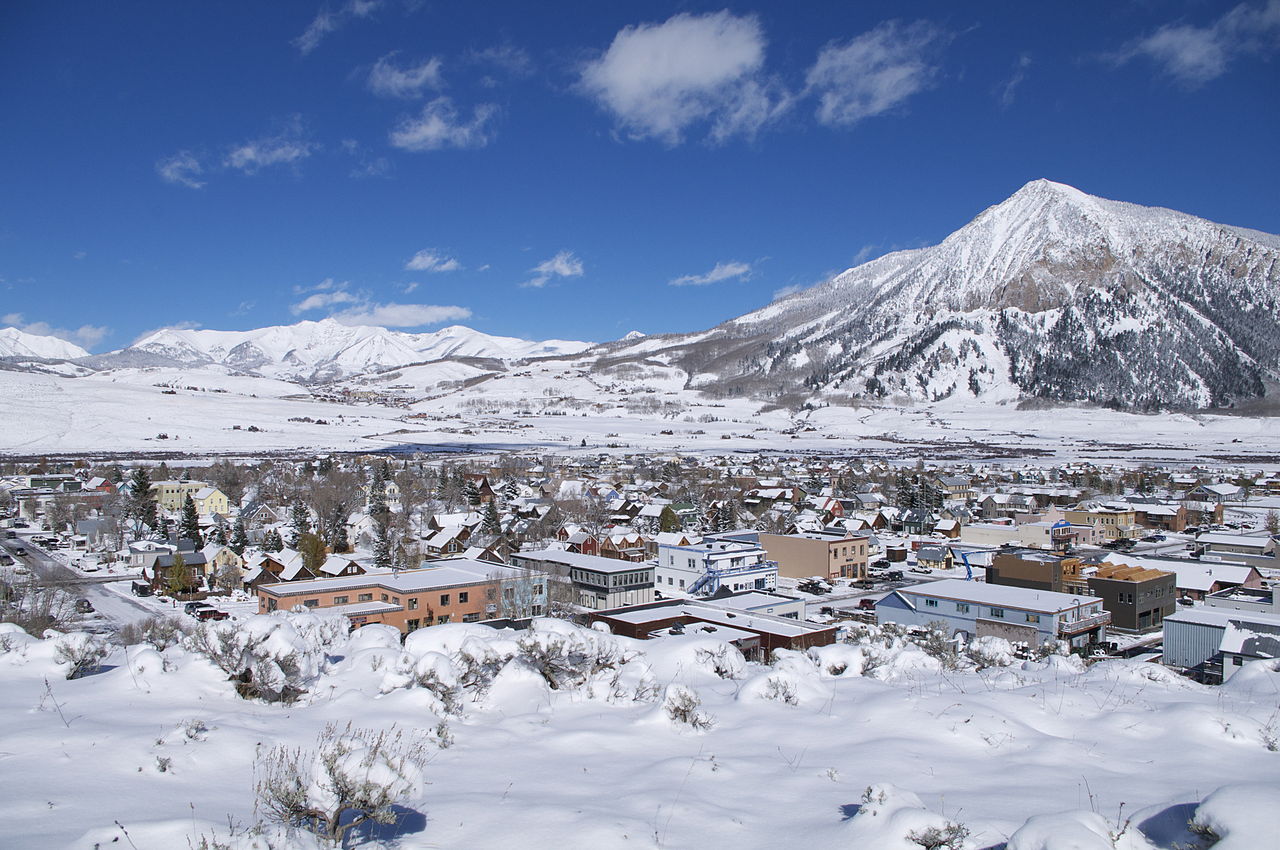 Crested ButteSummit · ~3 min drivePhoto: Chris Segal, CC0 (via Wikimedia Commons)
 Crested Butte Mountain SummitHiking · ~3 min drivePhoto: Larry D. Moore, CC BY 4.0 (via Wikimedia Commons)
- Lake GrantLake fishing · ~4 min drive
Best time to visit East River
Best months: June–August. Best months have typical highs of 55–85 °F, lows of 30 °F or warmer (32 °F where the station doesn't record snow), at most one snowy day and no more than 12 wet days.
Jan
26° / -7°
12 wet
Feb
29° / -2°
11 wet
Mar
38° / 7°
10 wet
Apr
47° / 19°
9 wet
May
58° / 28°
8 wet
Jun
70° / 34°
7 wet
Jul
76° / 40°
10 wet
Aug
74° / 38°
12 wet
Sep
66° / 31°
9 wet
Oct
54° / 22°
8 wet
Nov
39° / 9°
9 wet
Dec
27° / -4°
11 wet
Typical high / low (°F) and days with rain or snow, 1991–2020. Measured at Crested Butte, CO, 3.6 mi away at 8,867 ft. This station doesn't record snowfall. Source: NOAA NCEI U.S. Climate Normals 1991–2020.
Map and trail data © OpenStreetMap contributors
