Rocky Ridge
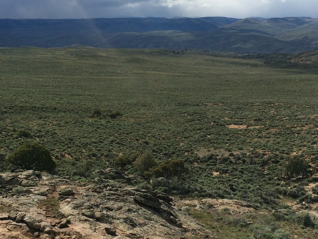 Photo: Matt Lavin, CC BY-SA 2.0 (via Flickr)
- 1.2 mi
- round trip
- 342 ft
- climb
- 8,269 ft
- high point
- Out and back
- route
- Jun–Sep
- best months
Rocky Ridge is a short, easy hike in western Colorado, on land managed by the Bureau of Land Management's Gunnison Field Office. The trip is an out-and-back of about 2.4 miles with a total elevation gain of 342 feet, starting and ending at about 8,100 feet. The climb is front-loaded, with the steepest stretch of about 8% at just over 0.14 miles from the start, and the high point reaches about 8,269 feet. Summer and early fall are the mildest times to go. Typical averages from a nearby weather station in Gunnison show July highs around 80°F with lows near 44°F, and September highs near 70°F with lows around 34°F. Winter there is cold, with January highs in the mid-20s and lows below zero. The trail sits close to several other outdoor spots. McCabe To Cottonwood Grove Road and Hartman Rocks Drive, both cross-country ski routes, start about 0.1 miles away. The Broken Shovel mountain biking area is about 0.4 miles off, and the Hartman Rocks climbing area is about 0.7 miles away.
Local outfitters
- Taylor Park Trading Post32 mi away
- Monarch Spur RV Park40 mi away
Not on Roamze yet. Their page has how to reach them.
 Mccabe To Cottonwood Grove RoadCross-country skiingPhoto: Earth Science and Remote Sensing Unit, NASA Johnson Space Center, Public domain (via Wikimedia Commons)0.1 mi
- Hartman Rocks DriveCross-country skiingPhoto: Earth Science and Remote Sensing Unit, NASA Johnson Space Center, Public domain (via Wikimedia Commons)0.1 mi
- Broken ShovelMountain biking0.4 mi
 Hartman RocksRock climbingPhoto: Matt Lavin, CC BY-SA 2.0 (via Flickr)0.7 mi
- Bouldering AreasRock climbingPhoto: Matt Lavin, CC BY-SA 2.0 (via Flickr)1 mi
- The SlotRock climbing1 mi
- Mesa RV ResortCamping2.7 mi
- Gunnison KOACamping2.9 mi
Source: Roamze catalog (indexable pages within 10 miles, PostGIS distance)
 The RidgeHiking · ~3 min drivePhoto: Matt Lavin, CC BY-SA 2.0 (via Flickr)
 RidgelineHiking · ~9 min drivePhoto: Ken Lund from Reno, Nevada, USA, CC BY-SA 2.0 (via Wikimedia Commons)
 South Rim TrailHiking · ~14 min drivePhoto: Ken Lund from Reno, Nevada, USA, CC BY-SA 2.0 (via Wikimedia Commons)
- Fossil Ridge TrailHiking · ~32 min drive
 Beaver Creek TrailHiking · ~7 min drivePhoto: flamouroux, CC BY-SA 2.0 (via Flickr)
 Dillon Pinnacles TrailHiking · ~27 min drivePhoto: AndreyZharkikh, CC BY 2.0 (via Flickr)
- April GulchHiking · ~19 min drive
- Sun Park TrailHiking · ~22 min drive
- Van Tuyl TrailHiking · ~8 min drivePhoto: Ken Lund from Reno, Nevada, USA, CC BY-SA 2.0 (via Wikimedia Commons)
- SUN CREEKHiking · ~18 min drive
Also worth it near here
- Mccabe To Cottonwood Grove RoadCross-country skiing · Next doorPhoto: Earth Science and Remote Sensing Unit, NASA Johnson Space Center, Public domain (via Wikimedia Commons)
- Broken ShovelMountain biking · Next door
- Hartman RocksRock climbing · ~1 min drivePhoto: Matt Lavin, CC BY-SA 2.0 (via Flickr)
- Paddle Boat PondLake fishing · ~4 min drive
Best time to visit Rocky Ridge
Best months: June–September. Best months have typical highs of 55–85 °F, lows of 30 °F or warmer (32 °F where the station doesn't record snow), at most one snowy day and no more than 12 wet days.
Jan
26° / -6°
7 wet
Feb
30° / 1°
6 wet
Mar
44° / 14°
5 wet
Apr
56° / 23°
5 wet
May
66° / 30°
6 wet
Jun
76° / 36°
6 wet
Jul
80° / 44°
10 wet
Aug
77° / 43°
11 wet
Sep
70° / 34°
9 wet
Oct
60° / 22°
6 wet
Nov
44° / 11°
5 wet
Dec
28° / -3°
7 wet
Typical high / low (°F) and days with rain or snow, 1991–2020. Measured at Gunnison 3sw, CO, 2.5 mi away at 7,622 ft. The station sits about 600 ft lower than this place, so expect it a little cooler here. This station doesn't record snowfall. Source: NOAA NCEI U.S. Climate Normals 1991–2020.
Map and trail data © OpenStreetMap contributors
