Little Cimarron East
- 3.0 mi
- round trip
- 305 ft
- climb
- 10,012 ft
- high point
- Out and back
- route
- Jun–Sep
- best months
Caution at last check
Agency alerts are in effect for this area; weather is marginal · USFS, OpenWeather · checked 18 h ago
Is Little Cimarron East open right now?
Closure in the area
There's a closure order in Grand Mesa, Uncompahgre and Gunnison National Forests. It doesn't name Little Cimarron East, so check the source for the area it covers (2 listed).
Gold Mountain Wildfire Roads and Trails Closure Order v 4.0
Agency closure covering Grand Mesa, Uncompahgre and Gunnison National Forests · USFS · Grand Mesa, Uncompahgre and Gunnison National Forests
Ophir Pass Road Closure
Agency closure covering Grand Mesa, Uncompahgre and Gunnison National Forests · USFS · Grand Mesa, Uncompahgre and Gunnison National Forests
Potter Basin Road Closure Order
Agency alert covering Grand Mesa, Uncompahgre and Gunnison National Forests · USFS · Grand Mesa, Uncompahgre and Gunnison National Forests
Beaver Park Road Closure Order
Agency alert covering Grand Mesa, Uncompahgre and Gunnison National Forests · USFS · Grand Mesa, Uncompahgre and Gunnison National Forests
TERMINATION OF ORDER - FIRE RESTRICTIONS
Agency alert covering Grand Mesa, Uncompahgre and Gunnison National Forests · USFS · Grand Mesa, Uncompahgre and Gunnison National Forests
As of · Source: USFS · Grand Mesa, Uncompahgre and Gunnison National Forests. Agencies don't list every closure — check before you go.
Little Cimarron East is a 3-mile out-and-back hike in the Ouray Ranger District of the Grand Mesa, Uncompahgre and Gunnison National Forests in Colorado, managed by the Forest Service. The trail rises about 305 feet from a low of roughly 9,700 feet to a high of about 10,000 feet, and it is rated moderate. The trail is on natural surface and is accessible to horses, so it works well for riders. Bikes are not allowed, and the route is not an accessible trail. Summer is the most comfortable time to go. Typical averages from a nearby weather station at Lake City run to highs around 77°F in July and 75°F in August. That station sits nearly 1,300 feet lower than the trail's high point, so temperatures on the trail run cooler. The trip starts at the Alpine / Little Cimarron Trailhead and is open year-round. The closest neighbors are the Firebox and the Little Cimarron Spur B Trail 674B, both about half a mile away. For an overnight stay, East Fork Dispersed campground is about 2.5 miles off, and Cimarron Forks Camping Area is about 2.9 miles away.
Local outfitters
- Peak Mountain Guides17 mi away
- Grizzly RT RV Park22 mi away
Not on Roamze yet. Their page has how to reach them.
- FireboxHiking0.5 mi
- Little Cimarron Spur B Trail 674BHiking0.5 mi
- East Fork DispersedCamping2.5 mi
- Cimarron Forks Camping AreaCamping2.9 mi
- Big Blue CreekCanoeing3.3 mi
- Uncompahgre/Big Blue WildernessRock climbing7.9 mi
- Coxcomb PeakMountaineering8.5 mi
- Cimarron RiverCanoeing9.8 mi
Source: Roamze catalog (indexable pages within 10 miles, PostGIS distance)
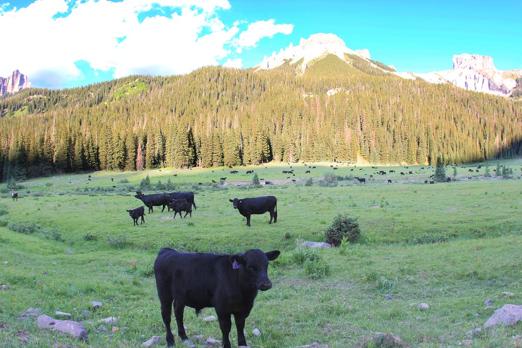 OWL CREEK PASS SNOHiking · ~11 min drivePhoto: daveynin, CC BY 2.0 (via Flickr)
- OLD OWL CREEK SPUR BHiking · ~12 min drivePhoto: daveynin, CC BY 2.0 (via Flickr)
 Old Owl Creek TrailHiking · ~13 min drivePhoto: daveynin, CC BY 2.0 (via Flickr)
- STEALEY MOUNTAIN SPURHiking · ~14 min drivePhoto: daveynin, CC BY 2.0 (via Flickr)
- NATE CREEKHiking · ~13 min drivePhoto: daveynin, CC BY 2.0 (via Flickr)
- Little Cimarron Spur B Trail 674BHiking · Next door
- FireboxHiking · Next door
- SHEEP MOUNTAINHiking · ~7 min drive
- Failes CreekHiking · ~5 min drive
- Salt HouseHiking · ~4 min drive
Best time to visit Little Cimarron East
Best months: June–September. Best months have typical highs of 55–85 °F, lows of 30 °F or warmer (32 °F where the station doesn't record snow), at most one snowy day and no more than 12 wet days.
Jan
31° / -1°
Feb
36° / 4°
Mar
43° / 15°
Apr
51° / 23°
May
62° / 30°
Jun
74° / 38°
Jul
77° / 44°
Aug
75° / 43°
Sep
68° / 36°
Oct
57° / 25°
Nov
43° / 13°
Dec
31° / 1°
Typical high / low (°F) and days with rain or snow, 1991–2020. Measured at Lake City 1nne, CO, 14.2 mi away at 8,714 ft. The station sits about 1,300 ft lower than this place, so expect it a little cooler here. This station doesn't record snowfall. Source: NOAA NCEI U.S. Climate Normals 1991–2020.
