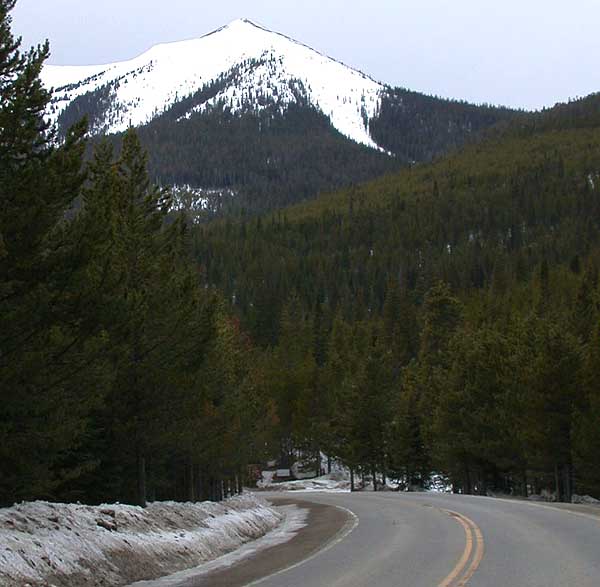
Arapaho Creek
- 4.1 mi
- round trip
- 1,248 ft
- climb
- 11,152 ft
- high point
- Out and back
- route
Is Arapaho Creek open right now?
Alert in the area
The Forest Service lists 3 alerts for Medicine Bow-Routt National Forest.
Access Impact: Big Creek Lakes Dam Project
Agency alert covering Medicine Bow-Routt National Forest · USFS · Medicine Bow-Routt National Forest
Trail & Access Impact: Stillwater Reservoir Project
Agency alert covering Medicine Bow-Routt National Forest · USFS · Medicine Bow-Routt National Forest
Snowy Range - 2026 Active Vegetation Operations
Agency alert covering Medicine Bow-Routt National Forest · USFS · Medicine Bow-Routt National Forest
As of · Source: USFS · Medicine Bow-Routt National Forest. Agencies don't list every closure — check before you go.
Arapaho Creek is a 4.1-mile out-and-back hike in Colorado's Medicine Bow-Routt National Forest, within the Parks Ranger District. It is a moderate trail with a total elevation gain of 1,248 feet, rising from a low of about 9,850 feet to a high of about 11,150 feet. The route is an out-and-back, and the Forest Service manages the surrounding land. The trail is a natural-surface route, and both horses and bikes are allowed. The Longs Lake Trailhead is the starting point, and it's open year-round, so the hike can be done any time the weather is good enough. Nearby options include the Snyder Creek Loop, about 1.7 miles away, and Arapaho Ridge, about 2.6 miles off. For paddlers, Willow Creek is about 6 miles away. Haystack Creek, roughly 6.4 miles from the trailhead, is another hike to consider.
Local outfitters
- Rancho Del Rio37 mi away
- Alpine Lodge at Red Feather Lakes45 mi away
Not on Roamze yet. Their page has how to reach them.
- SNYDER CREEK LOOPHiking1.7 mi
- Arapaho RidgeHiking2.6 mi
- Willow CreekCanoeing6 mi
 TroublesomeMountain bikingPhoto: cogdogblog, CC BY 2.0 (via Wikimedia Commons)6.3 mi
- Haystack CreekHiking6.4 mi
- Siebert CreekHiking6.6 mi
 ParkviewHikingPhoto: cogdogblog, CC BY 2.0 (via Wikimedia Commons)7.2 mi
- East Fork Troublesome CreekCanoeing8.4 mi
Source: Roamze catalog (indexable pages within 10 miles, PostGIS distance)
- ParkviewHiking · ~12 min drivePhoto: cogdogblog, CC BY 2.0 (via Wikimedia Commons)
- PARKVIEW CREEKHiking · ~13 min drivePhoto: cogdogblog, CC BY 2.0 (via Wikimedia Commons)
- SNYDER CREEK LOOPHiking · ~3 min drive
- Elk MountainHiking · ~13 min drive
- Willow Pass TrailHiking · ~14 min drivePhoto: cogdogblog, CC BY 2.0 (via Wikimedia Commons)
- Elk MountainHiking · ~20 min drive
- KAUFFMAN CREEKHiking · ~18 min drive
- Paradise CreekHiking · ~13 min drive
- Siebert CreekHiking · ~11 min drive
- Arapaho RidgeHiking · ~4 min drive