South Fork Campground
- from $27
- fee
- 6/3
- season
- Jun–Jul
- best months
Is South Fork Campground open right now?
Alert in the area
The Forest Service lists 3 alerts for Arapaho and Roosevelt National Forests.
Fire Restrictions
Agency alert covering Arapaho and Roosevelt National Forests · USFS · Arapaho and Roosevelt National Forests
Fire Restrictions
Agency alert covering Sulphur Ranger District · USFS · Sulphur Ranger District
Permanent Recreational Shooting Order
Agency alert covering Sulphur Ranger District · Order 02-10-00-25-02 · USFS · Sulphur Ranger District
As of · Source: USFS · Arapaho and Roosevelt National Forests. Agencies don't list every closure — check before you go.
- At 8,940 ftHigh camp: expect cold nights, even in summer
- Sulphur Ranger DistrictArapaho and Roosevelt National Forests
South Fork Campground is a Forest Service campground in the Sulphur Ranger District of the Arapaho and Roosevelt National Forests in Colorado. It sits among a cluster of trails and other campgrounds, with the Williams Fork Boardwalk and the South Fork Group Site - Arapaho NF (CO) both about 0.1 mile away. The site has vault toilets, and a fee is charged for stays. Summer is the most comfortable time to visit. Typical averages from a nearby weather station at Dillon show July highs around 75°F with lows near 38°F, while winter highs stay in the low 30s. Several other spots are close by. The Darling Creek hike is about 0.2 mile away, and Sugarloaf Campground is about 0.4 mile away. Paddlers can reach the Williams Fork about 6 miles off, and the Equinox Gardens climbing area is about 7.5 miles away.
Local outfitters
- Camp Always Choose Adventures24 mi away
- Lostfork Basecamp30 mi away
Not on Roamze yet. Their page has how to reach them.
 Williams Fork BoardwalkHikingPhoto: jtsmmm, CC BY 3.0 (via Wikimedia Commons)0.1 mi
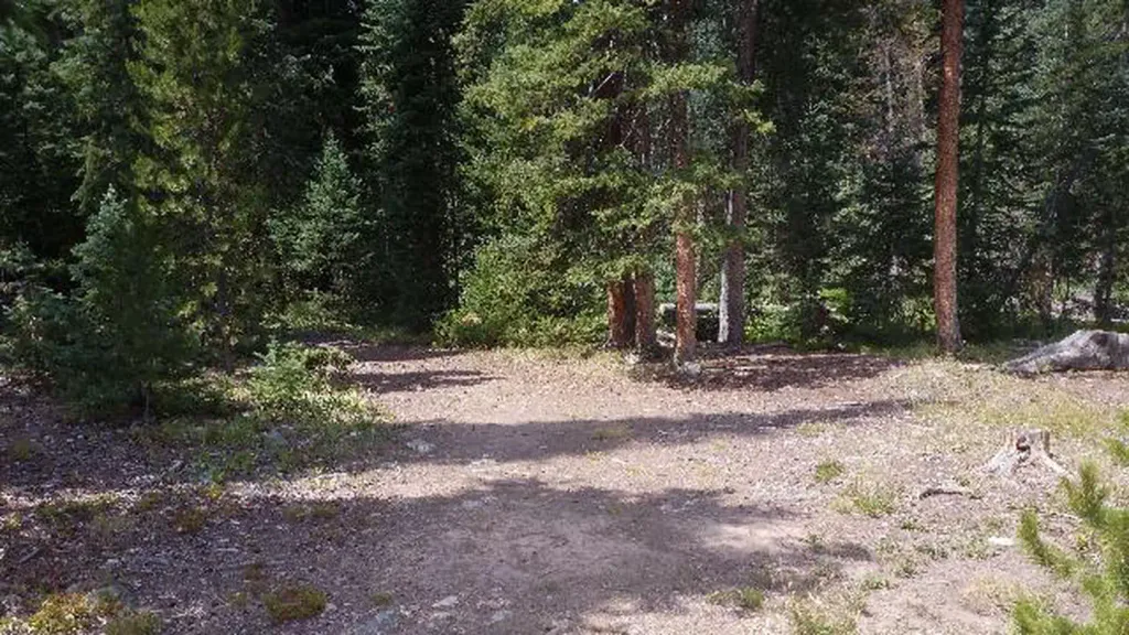 South Fork Group Site - Arapaho NF (CO)CampingPhoto: Recreation.gov (RIDB) / public domain0.1 mi
- Darling CreekHikingPhoto: jtsmmm, CC BY 3.0 (via Wikimedia Commons)0.2 mi
- South ForkHiking0.4 mi
- Sugarloaf CampgroundCamping0.4 mi
 Williams ForkCanoeingPhoto: US Geological Survey, Public domain (via Wikimedia Commons)6 mi
- Equinox GardensRock climbing7.5 mi
- Lower/Upper Slate Lakes #65Lake fishing9.1 mi
Source: Roamze catalog (indexable pages within 10 miles, PostGIS distance)
- South Fork Group Site - Arapaho NF (CO)Camping · Next door
- Rock House CabinHut camping · ~19 min drive
 Heaton Bay Picnic SiteCamping · ~23 min drivePhoto: KimonBerlin, CC BY-SA 2.0 (via Wikimedia Commons)
- Broome HutHut camping · ~23 min drive
 Gore Creek CampgroundCamping · ~30 min drivePhoto: KimonBerlin — CC BY-SA 2.0 (via Flickr)
- Sugarloaf CampgroundCamping · Next door
- Blue River CampgroundCamping · ~12 min drive
- Horseshoe CampgroundCamping · ~14 min drive
- Byers Creek CampgroundCamping · ~15 min drive
- Prairie Point CampgroundCamping · ~19 min drive
Also worth it near here
Best time to visit South Fork Campground
Best months: June–July. Best months have typical highs of 55–85 °F, lows of 30 °F or warmer (32 °F where the station doesn't record snow), at most one snowy day and no more than 12 wet days.
Jan
31° / 1°
12 wet
Feb
33° / 4°
11 wet
Mar
41° / 10°
11 wet
Apr
47° / 18°
11 wet
May
58° / 26°
10 wet
Jun
69° / 33°
9 wet
Jul
75° / 38°
12 wet
Aug
73° / 37°
13 wet
Sep
66° / 30°
10 wet
Oct
54° / 21°
8 wet
Nov
41° / 11°
9 wet
Dec
32° / 3°
11 wet
Typical high / low (°F) and days with rain or snow, 1991–2020. Measured at Dillon 1 E, CO, 11.7 mi away at 9,065 ft. This station doesn't record snowfall. Source: NOAA NCEI U.S. Climate Normals 1991–2020.
South Fork Campground
Book on Recreation.gov
