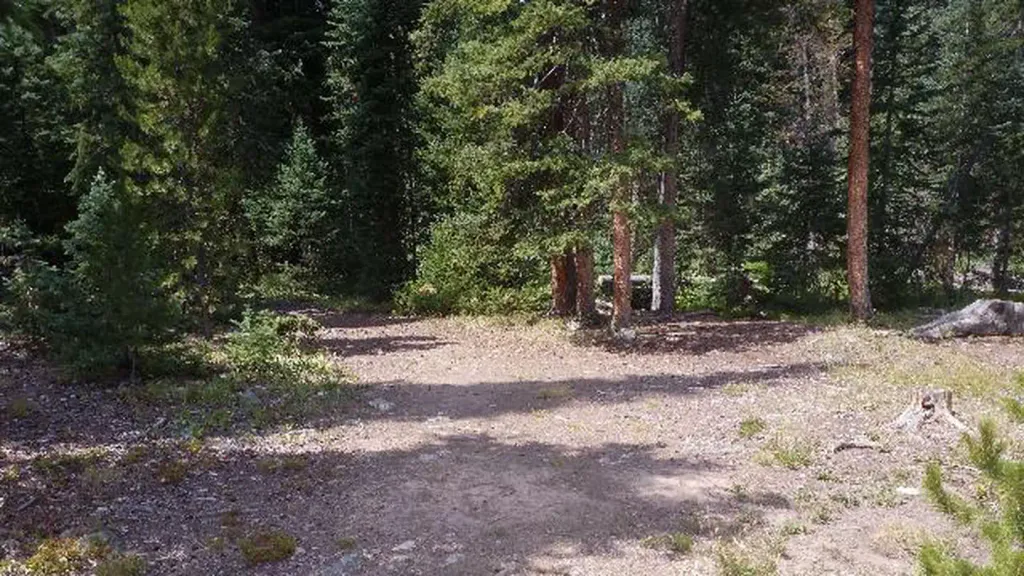
Williams Fork Boardwalk
 Photo: jtsmmm, CC BY 3.0 (via Wikimedia Commons)
- 1.2 mi
- round trip
- 18 ft
- climb
- 8,977 ft
- high point
- Out and back
- route
- Jun–Jul
- best months
Caution at last check
Agency alerts are in effect for this area; weather is good · USFS, OpenWeather · checked 15 h ago
Is Williams Fork Boardwalk open right now?
Alert in the area
The Forest Service lists 3 alerts for Arapaho and Roosevelt National Forests.
Fire Restrictions
Agency alert covering Arapaho and Roosevelt National Forests · USFS · Arapaho and Roosevelt National Forests
Fire Restrictions
Agency alert covering Sulphur Ranger District · USFS · Sulphur Ranger District
Permanent Recreational Shooting Order
Agency alert covering Sulphur Ranger District · Order 02-10-00-25-02 · USFS · Sulphur Ranger District
As of · Source: USFS · Arapaho and Roosevelt National Forests. Agencies don't list every closure — check before you go.
Williams Fork Boardwalk is an easy 1.2-mile out-and-back walk on the gravel trail of the same name, set at about 9,000 feet in the Sulphur Ranger District of the Arapaho and Roosevelt National Forests in Colorado. The route rises just 18 feet from its low point of 8,959 feet to a high of 8,977 feet, making it a flat, low-elevation outing rather than a climb. Bikes are allowed on this trail, and the Forest Service has it listed as a non-accessible route. The boardwalk's trailhead is marked as Williams Fork Boardwalk TH, and the trail stays open year-round. Summer is the most comfortable season. Typical averages from a nearby weather station at Dillon show July highs around 75°F with lows near 38°F, while winter highs hover around freezing. The station sits about 90 feet lower than the boardwalk's route. South Fork Campground and the South Fork Group Site are both about 0.1 mile away. The Darling Creek and South Fork hikes lie within half a mile.
Go with a guide
- Mineral Belt Trail Guided WalkNexPM AI · $25 per person · 40 mi away
- Camp Always Choose Adventures25 mi away
 South Fork Group Site - Arapaho NF (CO)CampingPhoto: Recreation.gov (RIDB) / public domain0.1 mi
- South Fork CampgroundCamping0.1 mi
- Darling CreekHikingPhoto: jtsmmm, CC BY 3.0 (via Wikimedia Commons)0.3 mi
- South ForkHiking0.4 mi
- Sugarloaf CampgroundCamping0.4 mi
 Williams ForkCanoeingPhoto: US Geological Survey, Public domain (via Wikimedia Commons)6 mi
- Equinox GardensRock climbing7.5 mi
- Lower/Upper Slate Lakes #65Lake fishing9 mi
Source: Roamze catalog (indexable pages within 10 miles, PostGIS distance)
- Darling CreekHiking · Next doorPhoto: jtsmmm, CC BY 3.0 (via Wikimedia Commons)
 KINNEY CREEKHiking · ~5 min drivePhoto: jtsmmm, CC BY 3.0 (via Wikimedia Commons)
- Acorn Creek TrailHiking · ~5 min drive
- Ute PeakHiking · ~12 min drive
 Bushee CreekHiking · ~12 min drivePhoto: devriesm, CC BY-SA 2.0 (via Flickr)
- KINNEY CREEKHiking · ~7 min drive
- South ForkHiking · Next door
- Pioneer CreekHiking · ~13 min drivePhoto: devriesm, CC BY-SA 2.0 (via Flickr)
- Ute PassHiking · ~8 min drive
- Ute PeakHiking · ~3 min drive
Best time to visit Williams Fork Boardwalk
Best months: June–July. Best months have typical highs of 55–85 °F, lows of 30 °F or warmer (32 °F where the station doesn't record snow), at most one snowy day and no more than 12 wet days.
Jan
31° / 1°
12 wet
Feb
33° / 4°
11 wet
Mar
41° / 10°
11 wet
Apr
47° / 18°
11 wet
May
58° / 26°
10 wet
Jun
69° / 33°
9 wet
Jul
75° / 38°
12 wet
Aug
73° / 37°
13 wet
Sep
66° / 30°
10 wet
Oct
54° / 21°
8 wet
Nov
41° / 11°
9 wet
Dec
32° / 3°
11 wet
Typical high / low (°F) and days with rain or snow, 1991–2020. Measured at Dillon 1 E, CO, 11.6 mi away at 9,065 ft. This station doesn't record snowfall. Source: NOAA NCEI U.S. Climate Normals 1991–2020.
