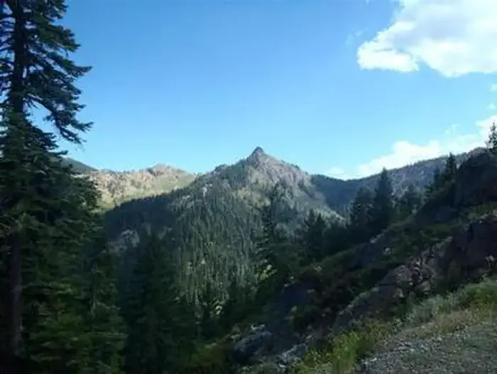
Russian Peak
 Photo: Mkauffmann, CC BY 3.0 (via Wikimedia Commons)
- 8,175 ft
- summit
- Forest Service
- managed by
Is Russian Peak open right now?
Alert in the area
The Forest Service lists 2 alerts for Klamath National Forest.
Temporarily closure of approximately 3.5 miles of National Forest System Roads 47N01
Agency alert covering Klamath National Forest · Order 05-05-00-26-08 · USFS · Klamath National Forest
Grayback Road Repairs
Agency alert covering Klamath National Forest · USFS · Klamath National Forest
As of · Source: USFS · Klamath National Forest. Agencies don't list every closure — check before you go.
Russian Peak is a summit of about 8,175 feet in the Russian Wilderness of Siskiyou County, California. It lies within the Salmon River Ranger District of Klamath National Forest, which the Forest Service manages, and the nearest town is Etna, about 12.5 miles away. Another notes that the contact phone number for activity levels is out of service and asks visitors to use 530-643-0279 instead. Sugar Lake and Bingham Lake are the closest neighbors, each within about a mile and a half, and Little Duck Lake is about 2.1 miles off. Trail Creek campground, about 3.8 miles away, is the nearest place to camp.
Conditions and forecast
Daily highs and lows, wind and the chance of precipitation at the summit for the next 7 days, from the Open-Meteo model.
- Summit elevation
- 8,175 ft
- Land manager
- Forest Service
Elevation from USGS 3D Elevation Program terrain data (about 10 m resolution).
We don't know of a mapped trail or route to the summit of Russian Peak. Plan the approach with local maps, a guidebook or a local guide, and check conditions before you go.
Questions about Russian Peak
How tall is Russian Peak?
8,175 ft (2,492 m).
Is there a trail to the top of Russian Peak?
We don't know of a mapped trail or route to the summit. Plan the approach with local maps, a guidebook or a local guide.
- Coyote Peak7,765 ft · California2 routes13 mi away
- Packers Peak7,824 ft · California2 routes13 mi away
- English Peak7,319 ft · California1 route16 mi away
- Tom Payne Peak5,096 ft · California1 route22 mi away
- Marble Mountain6,980 ft · California2 routes24 mi away
- Medicine Mountain6,831 ft · California1 route24 mi away
- Sugar LakeHiking1.3 mi
- Bingham LakeHiking1.4 mi
 Little Duck LakeHikingPhoto: theforestprimeval, CC BY-SA 2.0 (via Flickr)2.1 mi
- Trail CreekCamping3.8 mi
 Carter Meadows Horse GroupCampingPhoto: Recreation.gov (RIDB) / public domain4.7 mi
- East Fork South Fork Salmon RiverCanoeing6.5 mi
- IdlewildCamping6.5 mi
- North Russian CreekCanoeing6.6 mi
Source: Roamze catalog (indexable pages within 10 miles, PostGIS distance)
 Mount EddySummit · ~42 min drivePhoto: Little Mountain 5, CC BY-SA 3.0 (via Wikimedia Commons)
 Salmon MountainSummit · ~43 min drivePhoto: Mkauffmann, CC BY 3.0 (via Wikimedia Commons)
 Black ButteSummit · ~55 min drivePhoto: KyleAndMelissa22 (talk) (Uploads), Public domain (via Wikimedia Commons)
 ShastinaSummit · ~1h 7m drivePhoto: KyleAndMelissa22 at English Wikipedia, Public domain (via Wikimedia Commons)
 Mount ShastaSummit · ~1h 9m drivePhoto: Frank Schulenburg, CC BY-SA 4.0 (via Wikimedia Commons)
 Hayfork BallySummit · ~1h 18m drivePhoto: Region 5 Photography, CC BY 2.0 (via Wikimedia Commons)
- Coyote PeakSummit · ~22 min drive
- Packers PeakSummit · ~23 min drive
- English PeakSummit · ~27 min drive
- Portuguese PeakSummit · ~35 min drive

