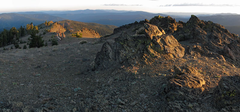
Hayfork Bally
 Photo: Region 5 Photography, CC BY 2.0 (via Wikimedia Commons)
- 6,268 ft
- summit
- Forest Service
- managed by
Is Hayfork Bally open right now?
Closure in the area
There's a closure order in Shasta-Trinity National Forest. It doesn't name Hayfork Bally, so check the source for the area it covers (2 listed).
Mud and Ash Creek Area and Road Closure
Agency closure covering Shasta-Trinity National Forest · Order 14-26-13 · USFS · Shasta-Trinity National Forest
Road Closure on Wild Mad Road
Agency closure covering Shasta-Trinity National Forest · Order 14-25-09 · USFS · Shasta-Trinity National Forest
Trout Creek Bridge Closure Order
Agency alert covering Shasta-Trinity National Forest · Order 14-26-02 · USFS · Shasta-Trinity National Forest
South Fork Suspension Bridge Closure
Agency alert covering Shasta-Trinity National Forest · Order 14-25-30 · USFS · Shasta-Trinity National Forest
Ah-Di-Na Area Closure
Agency alert covering Shasta-Trinity National Forest · Order 14-25-10 · USFS · Shasta-Trinity National Forest
As of · Source: USFS · Shasta-Trinity National Forest. Agencies don't list every closure — check before you go.
Hayfork Bally is a summit of about 6,268 feet in Trinity County, California, within the Hayfork Ranger District of Shasta-Trinity National Forest. The Forest Service manages the land, and the nearest town is Hayfork, about 7.6 miles away. Several other destinations sit within a few miles. Pasture Gulch and Bear Creek are both about 3 miles away, Miners Creek is about 3.3 miles off, and Skunk Point Group Campground is about 5.4 miles away.
Conditions and forecast
Daily highs and lows, wind and the chance of precipitation at the summit for the next 7 days, from the Open-Meteo model.
- Summit elevation
- 6,268 ft
- Land manager
- Forest Service
Elevation from USGS 3D Elevation Program terrain data (about 10 m resolution).
We don't know of a mapped trail or route to the summit of Hayfork Bally. Plan the approach with local maps, a guidebook or a local guide, and check conditions before you go.
Questions about Hayfork Bally
How tall is Hayfork Bally?
6,268 ft (1,910 m).
Is there a trail to the top of Hayfork Bally?
We don't know of a mapped trail or route to the summit. Plan the approach with local maps, a guidebook or a local guide.
- Pattison Peak5,157 ft · California1 route6.7 mi away
- Chanchelulla Peak6,398 ft · California1 route18 mi away
- Blake Mountain5,889 ft · California2 routes18 mi away
- Granite Peak8,081 ft · California1 route25 mi away
- Board Camp Butte5,051 ft · California1 route26 mi away
- Chinquapin Butte5,869 ft · California1 route27 mi away
- Pasture GulchHiking3 mi
- Bear CreekHiking3 mi
- Miners CreekCanoeing3.3 mi
- East ButtressRock climbing3.9 mi
- The CavernsRock climbing4 mi
- Big CreekCanoeing4.2 mi
- Skunk Point Group CampgroundCamping5.4 mi
- Skunk Point PaCamping5.4 mi
Source: Roamze catalog (indexable pages within 10 miles, PostGIS distance)
 Salmon MountainSummit · ~1h 4m drivePhoto: Mkauffmann, CC BY 3.0 (via Wikimedia Commons)
 Mount LinnSummit · ~1h 21m drivePhoto: Mkauffmann, CC BY 3.0 (via Wikimedia Commons)
 Russian PeakSummit · ~1h 18m drivePhoto: Mkauffmann, CC BY 3.0 (via Wikimedia Commons)
- Pattison PeakSummit · ~11 min drive
- Chanchelulla PeakSummit · ~30 min drive
- Blake MountainSummit · ~31 min drive
- Granite PeakSummit · ~43 min drive
- Board Camp ButteSummit · ~44 min drive
- Chinquapin ButteSummit · ~46 min drive
- Green MountainSummit · ~47 min drive
Also worth it near here


