Swamp Meadow
Campground
Campground · 2.0 mi from the trail
Closure in the area
There's a closure order in Sierra National Forest. It doesn't name Dinkey Lakes, so check the source for the area it covers (3 listed).
Safety Tips for Burned Areas: Garnet Fire Area
Agency closure covering Sierra National Forest · USFS · Sierra National Forest
Wilderness Food and Refuse Storage
Agency closure covering Sierra National Forest · Order 05-15-00-26-03 · USFS · Sierra National Forest
Food and Refuse Storage
Agency closure covering Sierra National Forest · Order 05-15-00-26-02 · USFS · Sierra National Forest
Forest Order removes Fish Camp, Soda Springs, and Little Jackass from closure list
Agency alert covering Sierra National Forest · Order 05-15-00-26-11 · USFS · Sierra National Forest
Ansel Adams and John Muir Wilderness Campfire Restrictions
Agency alert covering Sierra National Forest · Order 05-15-00-26-09 · USFS · Sierra National Forest
As of · Source: USFS · Sierra National Forest. Agencies don't list every closure — check before you go.
Dinkey Lakes is a mountain biking route in California's Dinkey Lakes Wilderness, part of the High Sierra Ranger District of Sierra National Forest. The Forest Service manages the land, and the route lies within designated wilderness. The climb rises about 1,700 feet over a distance of roughly 8 miles, from a low point of about 8,190 feet to a high point of about 9,889 feet. That makes it a significant ride for mountain bikers heading into the high country. Mystery Lake sits about half a mile away, and the Rainbow hike is close by at under a mile. Climbers can head to the Western Sierra area, about 2.5 miles off, and paddlers will find Helms Creek about 5.7 miles away.
Swamp Meadow
Campground
Places © OpenStreetMap contributors, Places © Overture Maps Foundation
More in Shaver Lake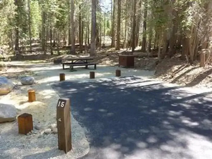 RancheriaCampingPhoto: Recreation.gov (RIDB) / public domain7.4 mi
Source: Roamze catalog (indexable pages within 10 miles, PostGIS distance)
 Red FirMountain biking · ~14 min drivePhoto: jeepwaters, CC BY 3.0 (via Wikimedia Commons)MeadowMountain biking · ~15 min drivePhoto: jeepwaters, CC BY 3.0 (via Wikimedia Commons)
 ChipmunkMountain biking · ~15 min drivePhoto: kallahar, CC BY 3.0 (via Wikimedia Commons)
 GnarlyMountain biking · ~16 min drivePhoto: kallahar, CC BY 3.0 (via Wikimedia Commons)Easy Does ItMountain biking · ~16 min drivePhoto: kallahar, CC BY 3.0 (via Wikimedia Commons)Rancheria Falls National Recreation TrailMountain biking · ~16 min drivePhoto: kallahar, CC BY 3.0 (via Wikimedia Commons)RavenMountain biking · ~16 min drivePhoto: jeepwaters, CC BY 3.0 (via Wikimedia Commons)
 Bear ButteMountain biking · ~16 min drivePhoto: kallahar, CC BY 3.0 (via Wikimedia Commons)
 Midge CreekMountain biking · ~17 min drivePhoto: kallahar, CC BY 3.0 (via Wikimedia Commons)
 RancheriaMountain biking · ~17 min drivePhoto: kallahar, CC BY 3.0 (via Wikimedia Commons)
Also worth it near here
Map and trail data © OpenStreetMap contributors

