Woodchuck Cutoff
- 2.3 mi
- round trip
- 2,458 ft
- climb
- 9,479 ft
- high point
- Out and back
- route
Is Woodchuck Cutoff open right now?
Closure in the area
There's a closure order in Sierra National Forest. It doesn't name Woodchuck Cutoff, so check the source for the area it covers (3 listed).
Safety Tips for Burned Areas: Garnet Fire Area
Agency closure covering Sierra National Forest · USFS · Sierra National Forest
Wilderness Food and Refuse Storage
Agency closure covering Sierra National Forest · Order 05-15-00-26-03 · USFS · Sierra National Forest
Food and Refuse Storage
Agency closure covering Sierra National Forest · Order 05-15-00-26-02 · USFS · Sierra National Forest
Forest Order removes Fish Camp, Soda Springs, and Little Jackass from closure list
Agency alert covering Sierra National Forest · Order 05-15-00-26-11 · USFS · Sierra National Forest
Ansel Adams and John Muir Wilderness Campfire Restrictions
Agency alert covering Sierra National Forest · Order 05-15-00-26-09 · USFS · Sierra National Forest
As of · Source: USFS · Sierra National Forest. Agencies don't list every closure — check before you go.
Woodchuck Cutoff is a 4.5-mile out-and-back hike in California's John Muir Wilderness, within the High Sierra Ranger District of Sierra National Forest. The Forest Service manages the land, and the route starts at about 8,500 feet, rising to a high point of 9,479 feet. The climb is front-loaded, with the steepest stretch at about 1 mile in, where the grade reaches 22 percent. The total elevation gain is 2,458 feet, and the trip takes about 2.5 hours. The route is rated moderate, and the climb is the main challenge. The trail is a single, straightforward line through the wilderness, with the most significant ascent in the first half of the hike. Several other routes sit close by. Bench Valley is under a mile away, and Woodchuck Trail and Halfmoon Cutoff are each about 1.1 miles off. For paddling, the North Fork Kings River is roughly 6 miles away.
Local outfitters
- Bishop Pack Outfitters17 mi away
- Rainbow Pack Outfitters18 mi away
Not on Roamze yet. Their page has how to reach them.
- Bench ValleyHiking0.8 mi
- Woodchuck TrailHiking1.1 mi
- HALFMOON CUTOFFHiking1.1 mi
 North Fork Kings RiverCanoeingPhoto: Gene Daniels, Public domain (via Wikimedia Commons)6.3 mi
- Post Corral CreekCanoeing6.4 mi
- Dusy DomeRock climbing6.5 mi
- Penstemon DomeRock climbing6.6 mi
- Penstemon Dome (West Face)Rock climbing6.7 mi
Source: Roamze catalog (indexable pages within 10 miles, PostGIS distance)
 Crown BasinHiking · ~7 min drivePhoto: jason.c.hansen, CC BY 2.0 (via Flickr)
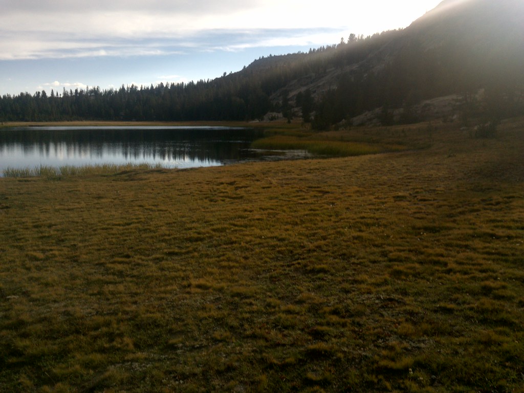 Mosquito PassHiking · ~10 min drivePhoto: jason.c.hansen, CC BY 2.0 (via Flickr)
 Blackcap TrailHiking · ~12 min drivePhoto: Kurt Minard, CC BY-SA 3.0 (via Wikimedia Commons)
 Cliff CampHiking · ~15 min drivePhoto: Marcin Chady, CC BY 2.0 (via Flickr)
- Dale LakeHiking · ~9 min drivePhoto: jason.c.hansen, CC BY 2.0 (via Flickr)
 Hell for Sure PassHiking · ~10 min drivePhoto: jason.c.hansen, CC BY 2.0 (via Flickr)
- Crown Valley TrailHiking · ~14 min drive
- WoodchuckHiking · ~13 min drivePhoto: Marcin Chady, CC BY 2.0 (via Flickr)
- Hell for SureHiking · ~10 min drivePhoto: jason.c.hansen, CC BY 2.0 (via Flickr)
 Goddard CanyonHiking · ~10 min drivePhoto: jason.c.hansen, CC BY 2.0 (via Flickr)
Also worth it near here
- McGuire LakesLake fishing · ~3 min drive
- Moore Boys CampCamping · ~8 min drive
- North Fork Kings RiverCanoeing · ~11 min drivePhoto: Gene Daniels, Public domain (via Wikimedia Commons)
 Mount GoddardSummit · ~12 min drivePhoto: Gilbert, G.K., Public domain (via Wikimedia Commons)
- Voyager RockRock climbing · ~13 min drivePhoto: Kurt Minard, CC BY-SA 3.0 (via Wikimedia Commons)
Map and trail data © OpenStreetMap contributors
