Jackson Flats
Campground
The next 7 weekends are full on Recreation.gov
 Photo: mjhbower, CC BY-SA 2.0 (via Flickr)
Alert in the area
The Forest Service lists 7 alerts for Angeles National Forest.
Rincon-Redbox Road (2N24) Closure
Agency alert covering Angeles National Forest · Order 05-01-26-13 · USFS · Angeles National Forest
Fire Danger Level Elevated to "Very High"
Agency alert covering Angeles National Forest · USFS · Angeles National Forest
San Gabriel Canyon OHV Area Prohibitions
Agency alert covering Angeles National Forest · Order 05-01-26-09 · USFS · Angeles National Forest
San Dimas Experimental Forest Closure
Agency alert covering Angeles National Forest · USFS · Angeles National Forest
Eaton Fire Area Closure
Agency alert covering Angeles National Forest · Order 05-01-26-04 · USFS · Angeles National Forest
As of · Source: USFS · Angeles National Forest. Agencies don't list every closure — check before you go.
Dawson Saddle is a moderate out-and-back hike in the San Gabriel Mountains National Monument Ranger District of Angeles National Forest, managed by the Forest Service. The trail is about 3.7 miles long, with a one-way climb of roughly 950 feet from a low point of about 7,905 feet to a high of about 8,856 feet. The route is natural-surface and allows both horses and bikes, so it works for riders and pack animals as well as hikers. The climb is steady, and the saddle itself sits at the top of the route. Hawkins Ridge Trail and Big Rock campground are both about 2 miles away, and Limber Pines Vista is a little farther at about 2.1 miles. Climbers can find Tunnel Crag about 3.3 miles off.
Jackson Flats
Campground
Warming Hut
Restaurant
 If it rainsThomas Ormston from Darmstadt, Germany, CC BY 2.0 · Wikimedia Commons
Aviation museum in Palmdale, California, United States
Places © OpenStreetMap contributors · Photos: Thomas Ormston from Darmstadt, Germany, CC BY 2.0 (commons)
More in Acton Hawkins Ridge TrailHikingPhoto: mjhbower, CC BY-SA 2.0 (via Flickr)2 mi
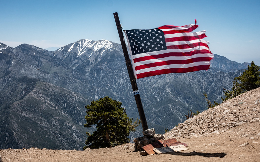 Limber Pines VistaHikingPhoto: mjhbower, CC BY-SA 2.0 (via Flickr)2.1 mi
 San Gabriel RiverCanoeingPhoto: Emarateyya, Muna Al Zaabi, CC BY-SA 3.0 (via Wikimedia Commons)9.8 mi
Source: Roamze catalog (indexable pages within 10 miles, PostGIS distance)
Hawkins Ridge TrailHiking · ~3 min drivePhoto: mjhbower, CC BY-SA 2.0 (via Flickr)Limber Pines VistaHiking · ~4 min drivePhoto: mjhbower, CC BY-SA 2.0 (via Flickr) South Fork TrailHiking · ~5 min drivePhoto: Alfa117, CC BY-SA 3.0 (via Wikimedia Commons)
 South Hawkins TrailHiking · ~5 min drivePhoto: mjhbower, CC BY-SA 2.0 (via Flickr)
 Half Knob TrailHiking · ~6 min drivePhoto: jesse?, CC BY 2.0 (via Flickr)
 Big Cienega TrailHiking · ~5 min drivePhoto: mjhbower, CC BY-SA 2.0 (via Flickr)Mt. Islip TrailHiking · ~4 min drivePhoto: mjhbower, CC BY-SA 2.0 (via Flickr)
 Bear Creek TrailHiking · ~10 min drivePhoto: Eeekster, CC BY-SA 3.0 (via Wikimedia Commons)
 Mine GulchHiking · ~5 min drivePhoto: mjhbower, CC BY-SA 2.0 (via Flickr)LOST RIDGE TRAILHiking · ~5 min drivePhoto: mjhbower, CC BY-SA 2.0 (via Flickr)
Also worth it near here
 Throop PeakSummit · ~2 min drivePhoto: Eeekster, CC BY 3.0 (via Wikimedia Commons)
 High Desert Nrt (Manzanita)Mountain biking · ~2 min drivePhoto: Crishazzard, CC BY-SA 4.0 (via Wikimedia Commons)
 Behind the ScenesRock climbing · ~7 min drivePhoto: Michael R Perry, CC BY 2.0 (via Flickr)
