Big Rock
Campground
Campground · < 0.1 mi from the trail
Alert in the area
The Forest Service lists 7 alerts for Angeles National Forest.
Rincon-Redbox Road (2N24) Closure
Agency alert covering Angeles National Forest · Order 05-01-26-13 · USFS · Angeles National Forest
Fire Danger Level Elevated to "Very High"
Agency alert covering Angeles National Forest · USFS · Angeles National Forest
San Gabriel Canyon OHV Area Prohibitions
Agency alert covering Angeles National Forest · Order 05-01-26-09 · USFS · Angeles National Forest
San Dimas Experimental Forest Closure
Agency alert covering Angeles National Forest · USFS · Angeles National Forest
Eaton Fire Area Closure
Agency alert covering Angeles National Forest · Order 05-01-26-04 · USFS · Angeles National Forest
As of · Source: USFS · Angeles National Forest. Agencies don't list every closure — check before you go.
Big Rock Campground is a Forest Service site in the San Gabriel Mountains National Monument Ranger District of Angeles National Forest in California. It sits on Forest Service Road 4N11, which is closed seasonally from May through mid-November. In winter, when the road is closed, visitors must hike 1/8 mile from the gate to reach the site. The campground has eight campsites, one of which has a picnic table and campfire ring. Vault toilets and trash receptacles are on site, and there is no piped water. Visitors are asked to bring enough water for cooking, cleaning, drinking and extinguishing campfires. The most comfortable months for a visit are typically late spring and early fall. Typical averages from a nearby weather station in Wrightwood show May highs around 69°F and September highs around 75°F, with winter highs in the upper 40s. Several trails start close by, including the Boy Scout Trail about a mile away and the Fenner Saddle Trail at about 1.5 miles. Southfork Campground and Mountain Oak are both within about 3 miles.
Big Rock
Campground
Warming Hut
Restaurant
 If it rainsThomas Ormston from Darmstadt, Germany, CC BY 2.0 · Wikimedia Commons
Aviation museum in Palmdale, California, United States
Places © OpenStreetMap contributors · Photos: Thomas Ormston from Darmstadt, Germany, CC BY 2.0 (commons)
More in Acton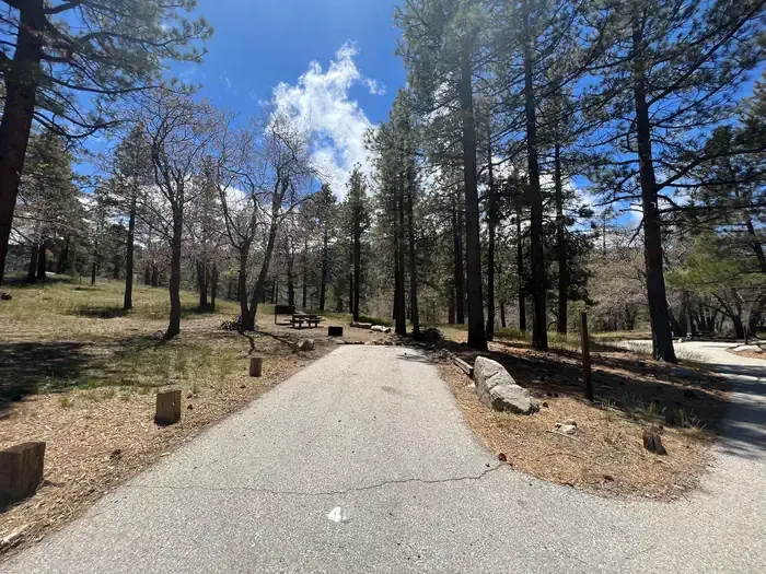 Mountain OakCampingPhoto: Recreation.gov (RIDB) / public domain2.7 mi
 Behind the ScenesRock climbingPhoto: Michael R Perry, CC BY 2.0 (via Flickr)4.7 mi
 South AreaRock climbingPhoto: RuggyBearLA, CC BY 2.0 (via Flickr)4.9 mi
Source: Roamze catalog (indexable pages within 10 miles, PostGIS distance)
Also worth it near here
 High Desert Nrt (Manzanita)Mountain biking · ~1 min drivePhoto: Crishazzard, CC BY-SA 4.0 (via Wikimedia Commons)
 Mount BurnhamSummit · ~3 min drivePhoto: Ctatkinson, Public domain (via Wikimedia Commons)
 Limber Pines VistaHiking · ~3 min drivePhoto: mjhbower, CC BY-SA 2.0 (via Flickr)Behind the ScenesRock climbing · ~8 min drivePhoto: Michael R Perry, CC BY 2.0 (via Flickr)
Best months: April–October. Best months have typical highs of 55–85 °F, lows of 30 °F or warmer (32 °F where the station doesn't record snow), at most one snowy day and no more than 12 wet days.
Jan
48° / 26°
5 wet
Feb
48° / 25°
8 wet
Mar
54° / 29°
6 wet
Apr
60° / 32°
4 wet
May
69° / 39°
2 wet
Jun
78° / 44°
1 wet
Jul
83° / 53°
2 wet
Aug
82° / 51°
2 wet
Sep
75° / 46°
2 wet
Oct
64° / 37°
3 wet
Nov
55° / 29°
4 wet
Dec
47° / 25°
5 wet
Typical high / low (°F) and days with rain or snow, 1991–2020. Measured at Wrightwood, CA, 8.1 mi away at 6,000 ft. The station sits about 600 ft higher than this place, so expect it a little warmer here. This station doesn't record snowfall. Source: NOAA NCEI U.S. Climate Normals 1991–2020.
