Santa Barbara Sunrise RV Park
Campground
Campground · 1.9 mi from the trail
Coyote Creek Trail is an easy, 0.62-mile out-and-back hike in Parma Park, managed by city land in California. It's a short walk with a front-loaded climb, starting at about 483 feet and reaching 620 feet before coming back down. The trail gains about 325 feet in total, with the steepest stretch around 0.18 miles from the start, where the grade reaches 17%. The most comfortable time to go is summer, when typical averages from the nearby Santa Barbara weather station show highs in the upper 70s with almost no wet days in July and August. That station sits well below the trail, so temperatures up high run cooler. Other outings close by include the Historic Olive Grove Loop Trail, about 0.6 miles away, and the Las Barrancas Trail, about 0.8 miles away. Climbers can head to Westmont College Boulder at 0.8 miles. Upper Oso Campground, about 8.7 miles off, is the closest place to camp.
Santa Barbara Sunrise RV Park
Campground
 If it rainsMike Boucher, CC BY 2.0 · Wikimedia Commons
Places © OpenStreetMap contributors, Places © Overture Maps Foundation · Photos: Mike Boucher, CC BY 2.0 (commons)
More in Carpinteria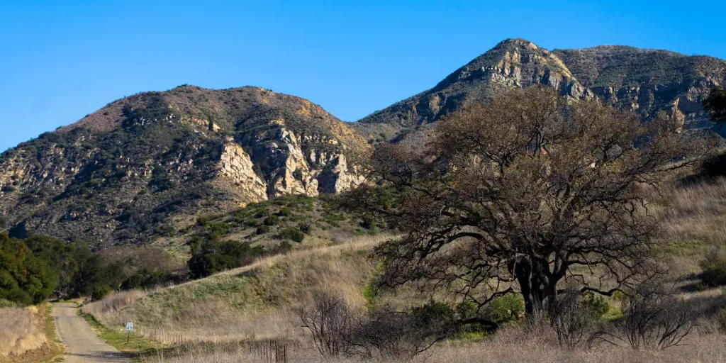 Upper Oso CampgroundCampingPhoto: Recreation.gov (RIDB) / public domain8.7 mi
 Sage HillSaltwater fishing9.2 mi
Source: Roamze catalog (indexable pages within 10 miles, PostGIS distance)
 Public Trail EasementHiking · ~1 min drivePhoto: Keithf, CC BY-SA 4.0 (via Wikimedia Commons)
 RattlesnakeHiking · ~2 min drivePhoto: bdearth, CC BY 2.0 (via Flickr)
 North Fork Cold Spring TrailHiking · ~4 min drivePhoto: breic, CC BY 2.0 (via Flickr)Rattlesnake Connector TrailHiking · ~3 min drivePhoto: bdearth, CC BY 2.0 (via Flickr)Root Cellar TrailHiking · ~3 min drivePhoto: breic, CC BY 2.0 (via Flickr)
 TunnelHiking · ~4 min drivePhoto: brewbooks, CC BY-SA 2.0 (via Flickr)
 Saddle Rock TrailHiking · ~4 min drivePhoto: lamblukas, CC BY 2.0 (via Flickr)
 Rock Garden TrailHiking · ~4 min drivePhoto: bdearth, CC BY 2.0 (via Flickr)Cathedral Peak TrailHiking · ~5 min drivePhoto: bdearth, CC BY 2.0 (via Flickr)Tunnel ConnectorHiking · ~4 min drivePhoto: bdearth, CC BY 2.0 (via Flickr)
Also worth it near here
 Parma Peak LoopMountain biking · Next doorPhoto: Mountain Mike Johans…, CC BY 3.0 (via Wikimedia Commons)
 Barbeque BoulderRock climbing · ~2 min drivePhoto: Niranjan Arminius, CC BY-SA 4.0 (via Wikimedia Commons)
Best months: Year-round. Best months have typical highs of 55–85 °F, lows of 30 °F or warmer (32 °F where the station doesn't record snow), at most one snowy day and no more than 12 wet days.
Jan
67° / 47°
7 wet
Feb
67° / 47°
7 wet
Mar
68° / 49°
7 wet
Apr
71° / 51°
3 wet
May
72° / 54°
2 wet
Jun
73° / 57°
1 wet
Jul
76° / 60°
0 wet
Aug
78° / 60°
0 wet
Sep
78° / 60°
1 wet
Oct
76° / 56°
2 wet
Nov
71° / 50°
3 wet
Dec
66° / 46°
6 wet
Typical high / low (°F) and days with rain or snow, 1991–2020. Measured at Santa Barbara, CA, 2.2 mi away at 16 ft. The station sits about 600 ft lower than this place, so expect it a little cooler here. Source: NOAA NCEI U.S. Climate Normals 1991–2020.
Map and trail data © OpenStreetMap contributors
