Santa Barbara Sunrise RV Park
Campground
Campground · 2.3 mi from the trail
Las Barrancas Trail is a short, easy hike about 0.7 miles long, with a total climb of about 500 feet and a high point of 844 feet. It is a back-loaded out-and-back route, with the steepest stretch at the beginning, about 18%, and the rest of the trail much gentler. The start and end both sit at 844 feet, so the climb and descent balance out over the course of the hike. The trail is close to Montecito, about 2 miles away, and fits easily into a day spent exploring the surrounding area. Summer is the warmest stretch for a walk here. Typical averages from a nearby weather station in Santa Barbara show July and August highs around 76 to 78°F, with almost no wet days. That station sits well below the trail, so temperatures on the higher ground run cooler. The trail makes a convenient anchor for a short outing. Westmont College Boulder, a climbing area, is about 0.3 miles away, and Lower Cold Springs Canyon and the Cold Spring hike are each about half a mile off. Upper Oso Campground lies roughly 9 miles away for an overnight stay.
Santa Barbara Sunrise RV Park
Campground
 If it rainsMike Boucher, CC BY 2.0 · Wikimedia Commons
Places © OpenStreetMap contributors, Places © Overture Maps Foundation · Photos: Mike Boucher, CC BY 2.0 (commons)
More in Carpinteria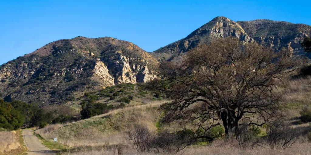 Upper Oso CampgroundCampingPhoto: Recreation.gov (RIDB) / public domain8.8 mi
 Sage HillSaltwater fishing9.4 mi
Source: Roamze catalog (indexable pages within 10 miles, PostGIS distance)
 Public Trail EasementHiking · ~2 min drivePhoto: Keithf, CC BY-SA 4.0 (via Wikimedia Commons)
 Root Cellar TrailHiking · ~2 min drivePhoto: breic, CC BY 2.0 (via Flickr)North Fork Cold Spring TrailHiking · ~3 min drivePhoto: breic, CC BY 2.0 (via Flickr)
 Saddle Rock TrailHiking · ~3 min drivePhoto: lamblukas, CC BY 2.0 (via Flickr)
 RattlesnakeHiking · ~3 min drivePhoto: bdearth, CC BY 2.0 (via Flickr)
 TunnelHiking · ~5 min drivePhoto: brewbooks, CC BY-SA 2.0 (via Flickr)Rattlesnake Connector TrailHiking · ~3 min drivePhoto: bdearth, CC BY 2.0 (via Flickr)
 Rock Garden TrailHiking · ~4 min drivePhoto: bdearth, CC BY 2.0 (via Flickr)Cathedral Peak TrailHiking · ~6 min drivePhoto: bdearth, CC BY 2.0 (via Flickr)Girard TrailHiking · ~3 min drivePhoto: lamblukas, CC BY 2.0 (via Flickr)
Also worth it near here
 West Fork Cold SpringMountain biking · ~1 min drivePhoto: greglaskiewicz, CC BY 3.0 (via Wikimedia Commons)
 Cold Springs DomeRock climbing · ~3 min drivePhoto: Mountain Mike Johans…, CC BY 3.0 (via Wikimedia Commons)
Best months: Year-round. Best months have typical highs of 55–85 °F, lows of 30 °F or warmer (32 °F where the station doesn't record snow), at most one snowy day and no more than 12 wet days.
Jan
67° / 47°
7 wet
Feb
67° / 47°
7 wet
Mar
68° / 49°
7 wet
Apr
71° / 51°
3 wet
May
72° / 54°
2 wet
Jun
73° / 57°
1 wet
Jul
76° / 60°
0 wet
Aug
78° / 60°
0 wet
Sep
78° / 60°
1 wet
Oct
76° / 56°
2 wet
Nov
71° / 50°
3 wet
Dec
66° / 46°
6 wet
Typical high / low (°F) and days with rain or snow, 1991–2020. Measured at Santa Barbara, CA, 2.9 mi away at 16 ft. The station sits about 800 ft lower than this place, so expect it a little cooler here. Source: NOAA NCEI U.S. Climate Normals 1991–2020.
Map and trail data © OpenStreetMap contributors
