Forbush Flat Camp
Campground
Campground · 2.7 mi from the trail
 Photo: lamblukas, CC BY 2.0 (via Flickr)
Alert in the area
The Forest Service lists 2 alerts for Los Padres National Forest.
Los Padres Fire Use and Firearm Restrictions
Agency alert covering Los Padres National Forest · Order 05-07-00-26-05 · USFS · Los Padres National Forest
Santa Barbara Front Country Fire Use Restrictions
Agency alert covering Los Padres National Forest · Order 05-07-5406-01 · USFS · Los Padres National Forest
As of · Source: USFS · Los Padres National Forest. Agencies don't list every closure — check before you go.
Saddle Rock Trail is a short, easy hike in the Santa Barbara Ranger District of Los Padres National Forest, managed by the Forest Service. The trail is about 0.4 miles long, and the round trip is roughly 0.8 miles with a total climb of about 492 feet, making it an out-and-back route that starts and ends at nearly the same elevation. The trail is rolling, and the steepest part comes early, around 0.23 miles from the start, with a grade of about 29%. Spring and fall are the most comfortable times to go. Typical averages from the nearby Gibraltar Dam weather station show May highs around 80°F and October highs around 83°F, while July and August average in the mid-90s. Several other outings sit within a mile. Girard Trail is about half a mile away, San Ysidro offers climbing at 0.7 miles, and Hot Springs Trail is about 0.9 miles off. For an overnight stay, Upper Oso Campground is roughly 9.6 miles away.
Forbush Flat Camp
Campground
The Speakeasy
Bar
 If it rainsMike Boucher, CC BY 2.0 · Wikimedia Commons
Places © OpenStreetMap contributors, Places © Overture Maps Foundation · Photos: Mike Boucher, CC BY 2.0 (commons)
More in CarpinteriaGirard TrailHikingPhoto: lamblukas, CC BY 2.0 (via Flickr)0.5 mi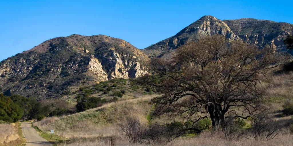 Upper Oso CampgroundCampingPhoto: Recreation.gov (RIDB) / public domain9.6 mi
Source: Roamze catalog (indexable pages within 10 miles, PostGIS distance)
Girard TrailHiking · Next doorPhoto: lamblukas, CC BY 2.0 (via Flickr) North Fork Cold Spring TrailHiking · ~3 min drivePhoto: breic, CC BY 2.0 (via Flickr)Root Cellar TrailHiking · ~3 min drivePhoto: breic, CC BY 2.0 (via Flickr)
 Ortega Ridge TrailHiking · ~5 min drivePhoto: sergei.gussev, CC BY 2.0 (via Flickr)
 RattlesnakeHiking · ~6 min drivePhoto: bdearth, CC BY 2.0 (via Flickr)
 Ortega Hill TrailHiking · ~5 min drivePhoto: Damian Gadal, CC BY 2.0 (via Wikimedia Commons)
 Reservoir TrailHiking · ~6 min drivePhoto: coastalscientist, Public Domain Mark (via Flickr)QAD TrailHiking · ~5 min drivePhoto: Damian Gadal, CC BY 2.0 (via Wikimedia Commons)
Also worth it near here
Best months: October–May. Best months have typical highs of 55–85 °F, lows of 30 °F or warmer (32 °F where the station doesn't record snow), at most one snowy day and no more than 12 wet days.
Jan
66° / 36°
8 wet
Feb
67° / 36°
9 wet
Mar
70° / 38°
7 wet
Apr
76° / 41°
4 wet
May
80° / 46°
2 wet
Jun
88° / 49°
0 wet
Jul
94° / 55°
0 wet
Aug
96° / 54°
0 wet
Sep
91° / 51°
1 wet
Oct
83° / 45°
2 wet
Nov
73° / 40°
3 wet
Dec
64° / 34°
6 wet
Typical high / low (°F) and days with rain or snow, 1991–2020. Measured at Gibraltar Dam #2, CA, 5.2 mi away at 1,558 ft. This station doesn't record snowfall. Source: NOAA NCEI U.S. Climate Normals 1991–2020.
Map and trail data © OpenStreetMap contributors


