Cherry Valley Lakes RV Resort
Campground
Campground · 4.2 mi from the trail
 Photo: inkknife_2000 (7.5 million views +), CC BY-SA 2.0 (via Wikimedia Commons)
Bogart Trail is a short, easy out-and-back hike in California, set on Regional Agency Land and covering about 0.7 miles. The trail's low point sits at 3,229 feet, and it climbs to 3,271 feet before returning, with a total gain and loss of about 82 feet each way. The steepest stretch comes within the first few steps, with a grade of about 6%. Spring and fall are the most comfortable times to go. Typical averages from a nearby weather station in Hemet show May highs around 81°F and October highs around 82°F, while July and August average in the mid-90s. The trip takes about half an hour. Ridge Trail lies about 0.4 miles away and East Canyon Trail about 0.6 miles. Farther out, Stetson Trail and Oak Tree Loop are each about 3.3 miles away.
Cherry Valley Lakes RV Resort
Campground
Ears to You- Grill Roasted Corn and More
Restaurant
Places © OpenStreetMap contributors, Places © Overture Maps Foundation
More in Desert Hot SpringsRidge TrailHikingPhoto: inkknife_2000 (7.5 million views +), CC BY-SA 2.0 (via Wikimedia Commons)0.4 mi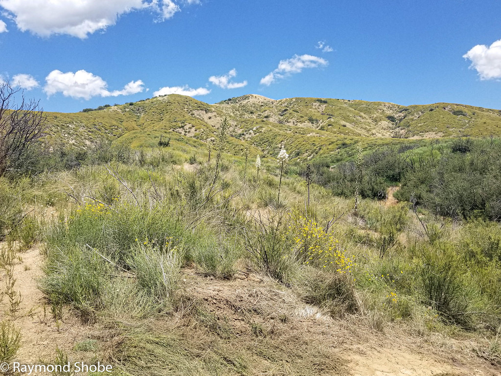 East Canyon TrailHikingPhoto: bossco, CC BY-SA 2.0 (via Flickr)0.6 mi
 Stetson TrailHikingPhoto: inkknife_2000 (7.5 million views +), CC BY-SA 2.0 (via Wikimedia Commons)3.3 mi
 Oak Tree LoopHikingPhoto: Brück & Sohn Kunstverlag Meißen, CC0 (via Wikimedia Commons)3.3 mi
Source: Roamze catalog (indexable pages within 10 miles, PostGIS distance)
Ridge TrailHiking · Next doorPhoto: inkknife_2000 (7.5 million views +), CC BY-SA 2.0 (via Wikimedia Commons)Cottonwood TrailHiking · ~7 min drivePhoto: inkknife_2000 (7.5 million views +), CC BY-SA 2.0 (via Wikimedia Commons) Wilshire Peak (No SurveyHiking · ~8 min drivePhoto: inkknife_2000 (7.5 million views +), CC BY-SA 2.0 (via Wikimedia Commons)
 Yucaipa Ridge Truck TrailHiking · ~9 min drivePhoto: inkknife_2000 (7.5 million views +), CC BY-SA 2.0 (via Wikimedia Commons)Bogart TrailHiking · Next doorPhoto: inkknife_2000 (7.5 million views +), CC BY-SA 2.0 (via Wikimedia Commons)
 Regional Park TrailHiking · ~12 min drivePhoto: inkknife_2000 (7.5 million views +), CC BY-SA 2.0 (via Wikimedia Commons)
 Pack TrailHiking · ~8 min drivePhoto: bossco, CC BY-SA 2.0 (via Flickr)East Canyon TrailHiking · ~1 min drivePhoto: bossco, CC BY-SA 2.0 (via Flickr)
 City TrailHiking · ~12 min drivePhoto: inkknife_2000 (7.5 million views +), CC BY-SA 2.0 (via Wikimedia Commons)
 Wilson CreekHiking · ~9 min drivePhoto: inkknife_2000 (7.5 million views +), CC BY-SA 2.0 (via Wikimedia Commons)
Best months: October–May. Best months have typical highs of 55–85 °F, lows of 30 °F or warmer (32 °F where the station doesn't record snow), at most one snowy day and no more than 12 wet days.
Jan
66° / 44°
6 wet
Feb
67° / 46°
6 wet
Mar
71° / 47°
5 wet
Apr
75° / 49°
3 wet
May
81° / 54°
2 wet
Jun
89° / 56°
1 wet
Jul
96° / 65°
1 wet
Aug
97° / 66°
1 wet
Sep
92° / 62°
1 wet
Oct
82° / 55°
2 wet
Nov
73° / 49°
3 wet
Dec
65° / 43°
5 wet
Typical high / low (°F) and days with rain or snow, 1991–2020. Measured at Hemet, CA, 17.7 mi away at 1,811 ft. The station sits about 1,500 ft lower than this place, so expect it a little cooler here. Source: NOAA NCEI U.S. Climate Normals 1991–2020.
Map and trail data © OpenStreetMap contributors

