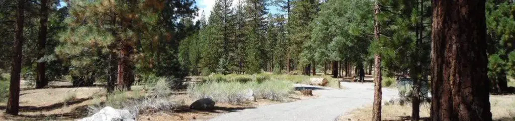
Limber Pine Bench
Campground
Campground · 2.3 mi from the trail
Alert in the area
The Forest Service lists 4 alerts for San Bernardino National Forest.
Safety Alert - Falling Rocks at Bonita Falls
Agency alert covering San Bernardino National Forest · USFS · San Bernardino National Forest
Upper Big Falls Area Closure
Agency alert covering Front Country Ranger District · Order 05-12-53-26-03 · USFS · Front Country Ranger District
Fire Restrictions
Agency alert covering San Bernardino National Forest · Order 05-12-00-26-05 · USFS · San Bernardino National Forest
Applewhite Picnic Area Closure
Agency alert covering Front Country Ranger District · Order 05-12-53-26-01 · USFS · Front Country Ranger District
As of · Source: USFS · San Bernardino National Forest. Agencies don't list every closure — check before you go.
Monkeyface Falls is a waterfall in the Front Country Ranger District of San Bernardino National Forest in California, about 4 miles from the town of Oak Glen. It sits at roughly 5,100 feet, and the surrounding area draws climbers and hikers, with several climbing areas and trails within a few miles. Summer is the most comfortable time to visit. Typical averages from the Lake Arrowhead weather station, about 17 miles away at a similar elevation, show July and August highs in the low 80s with lows in the upper 50s and only about one wet day a month. Winter brings highs in the mid-40s and a few snow days a month. Climbers will find the Lower Tier (Right Side) and Middle Tier (Right Side) climbing areas about half a mile away. The Oak Glen Divide hike is about 1.6 miles off, and the Thomas Hunting Grounds Yellow Post Sites campground is about 3.8 miles away.
Limber Pine Bench
Campground
El Mexicano
Restaurant
 If it rainsBeyond My Ken, CC BY-SA 4.0 · Wikimedia Commons
Deep Creek Hot Springs
Hot spring
Natural hot springs located in San Bernardino National Forest, California, United States
Places © OpenStreetMap contributors · Photos: Beyond My Ken, CC BY-SA 4.0 (commons)
More in Lucerne ValleyElevation from USGS 3D Elevation Program terrain data (about 10 m resolution).
 Oak Glen DivideHikingPhoto: inkknife_2000 (7.5 million views +), CC BY-SA 2.0 (via Wikimedia Commons)1.6 mi
 Yucaipa Ridge Truck TrailHikingPhoto: inkknife_2000 (7.5 million views +), CC BY-SA 2.0 (via Wikimedia Commons)2 mi
 Barton FlatsCampingPhoto: Recreation.gov (RIDB) / public domain6.8 mi
 San GorgonioSaltwater fishing7.2 mi
Source: Roamze catalog (indexable pages within 10 miles, PostGIS distance)
 Tahquitz FallsWaterfall · ~52 min drivePhoto: Agentz92505, CC BY-SA 3.0 (via Wikimedia Commons)
 Bonita FallsWaterfall · ~56 min drivePhoto: San Bernardino Nat'l Forest, Public domain (via Wikimedia Commons)
Also worth it near here
Oak Glen DivideHiking · ~3 min drivePhoto: inkknife_2000 (7.5 million views +), CC BY-SA 2.0 (via Wikimedia Commons) Momyer Creek Non WildernessMountain biking · ~4 min drivePhoto: inkknife_2000 (7.5 million views +), CC BY-SA 2.0 (via Wikimedia Commons)
 (b) Thurman Flat (Sport Boulder)Rock climbing · ~6 min drivePhoto: inkknife_2000 (7.5 million views +), CC BY-SA 2.0 (via Wikimedia Commons)
Best months: April–October. Best months have typical highs of 55–85 °F, lows of 30 °F or warmer (32 °F where the station doesn't record snow), at most one snowy day and no more than 12 wet days.
Jan
44° / 29°
6 wet · 1 snow
Feb
45° / 30°
6 wet · 1 snow
Mar
52° / 32°
6 wet · 1 snow
Apr
60° / 36°
4 wet · 1 snow
May
67° / 41°
2 wet
Jun
76° / 49°
1 wet
Jul
81° / 57°
1 wet
Aug
82° / 57°
1 wet
Sep
74° / 52°
1 wet
Oct
63° / 43°
2 wet
Nov
52° / 34°
3 wet
Dec
43° / 29°
5 wet · 1 snow
Typical high / low (°F) and days with rain or snow, 1991–2020. Measured at Lake Arrowhead, CA, 16.8 mi away at 5,205 ft. Source: NOAA NCEI U.S. Climate Normals 1991–2020.
