Highland Lakes Upper Campground
Campground
Campground · 4.0 mi from the trail
Closure in the area
There's a closure order in Carson Ranger District. It doesn't name Asa Lake, so check the source for the area it covers (2 listed).
Hawk Fire Closure (Carson Ranger District)
Agency closure covering Carson Ranger District · Order 04-17-26-01-08 · USFS · Carson Ranger District
Elephant Fire Closure
Agency closure covering Humboldt-Toiyabe National Forest · Order 04-17-26-01-04 · USFS · Humboldt-Toiyabe National Forest
Floriston Fire Closure
Agency alert covering Carson Ranger District · Order 17-26-24 · USFS · Carson Ranger District
Power line construction along SR 88, Alpine County, California (Carson Ranger District)
Agency alert covering Carson Ranger District · USFS · Carson Ranger District
Over-Snow Vehicle Closure (Carson Ranger District)
Agency alert covering Carson Ranger District · Order 04-17-25-12 · USFS · Carson Ranger District
As of · Source: USFS · Carson Ranger District. Agencies don't list every closure — check before you go.
Asa Lake is a 4.8-mile out-and-back hike in the Carson-Iceberg Wilderness, part of the Carson Ranger District of the Humboldt-Toiyabe National Forest in California. The trail climbs from a low point of 7,697 feet to a high of 8,410 feet, a gain of 754 feet, and is rated moderate. The Forest Service manages the land. The route is natural-surfaced and allows horses, and bikes are not permitted. It is open year-round. Summer is the most comfortable time to go. Typical averages from a nearby weather station at Dagget Pass, Nevada, show July highs around 75°F with lows near 49°F, and the station sits about 1,000 feet below the trail's high point, so temperatures on the ridge run cooler. Wolf Creek lies just 0.1 mile away, and Bull Canyon is about 1.3 miles off. Highland Lakes campground is 4.1 miles away, and the East Fork Carson River offers canoeing about 3.7 miles from the trail.
Highland Lakes Upper Campground
Campground
Lake Alpine Resort
Restaurant
Alpine County Museum
Museum
Places © OpenStreetMap contributors
More in Bear ValleyBest months: May–October. Best months have typical highs of 55–85 °F, lows of 30 °F or warmer (32 °F where the station doesn't record snow), at most one snowy day and no more than 12 wet days.
Jan
36° / 23°
9 wet
Feb
37° / 23°
8 wet
Mar
42° / 26°
7 wet
Apr
48° / 29°
5 wet
May
56° / 35°
4 wet
Jun
66° / 42°
2 wet
Jul
75° / 49°
2 wet
Aug
74° / 49°
1 wet
Sep
67° / 44°
2 wet
Oct
55° / 36°
3 wet
Nov
43° / 28°
5 wet
Dec
35° / 23°
7 wet
Typical high / low (°F) and days with rain or snow, 1991–2020. Measured at Dagget Pass, NV, 33.8 mi away at 7,334 ft. The station sits about 1,100 ft lower than this place, so expect it a little cooler here. This station doesn't record snowfall. Source: NOAA NCEI U.S. Climate Normals 1991–2020.
 Photo: Chris Dolanc (talk · contribs), Public domain (via Wikimedia Commons)
8N01 SNOW TRAIL
~11 min drive
10.2-mile out-and-back snow trail in California with 2,419 ft elevation gain and loss.
 Photo: jfdervin, CC BY-SA 2.0 (via Flickr)
Corral Valley
~12 min drive
Scenic 4-mile valley loop with steady climbing through grassland and oak woodland.
 Photo: GSEC, CC BY 2.0 (via Flickr)
Deer Creek
~16 min drive
1.61-mile out-and-back trail in California with 263 ft gain.
HIKE
Pacific Crest National Scenic Trail #2000
~13 min drive
46.78-mile out-and-back on the Pacific Crest Trail in California with 8,414 ft gain/loss
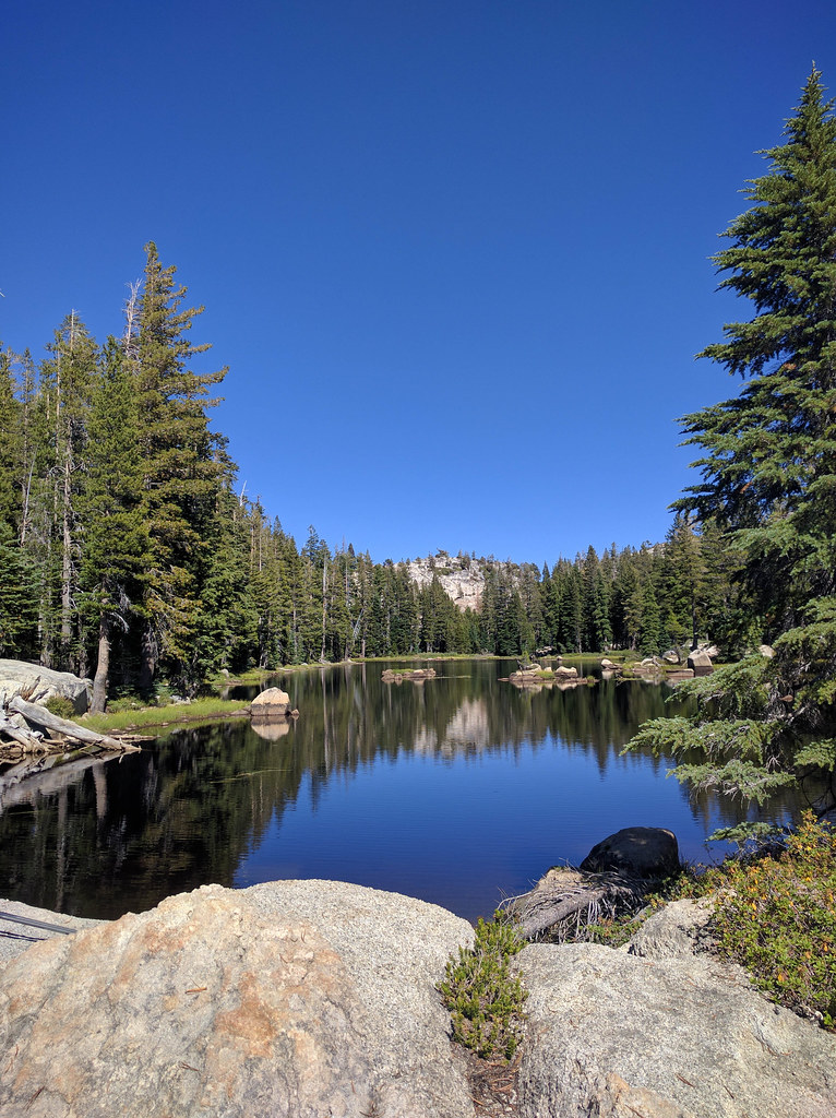 Photo: npdoty, CC BY 2.0 (via Flickr)
Pacific Creek
~15 min drive
10.82-mile out-and-back trail in California with 1,522 ft elevation gain.
Photo: GSEC, CC BY 2.0 (via Flickr)Willow Mdw
~15 min drive
4.96-mile out-and-back trail in California with 1,207 ft gain.
HIKE
Halfmoon Lake Trail
~5 min drive
1.24-mile out-and-back trail to Halfmoon Lake in California.
Photo: npdoty, CC BY 2.0 (via Flickr)Milk Ranch Mdw.
~15 min drive
14.22-mile out-and-back trail in California with 1,930 ft elevation gain.
 Photo: jfdervin, CC BY-SA 2.0 (via Flickr)
Driveway
~15 min drive
4.34-mile out-and-back trail in California with 80 ft of elevation gain.
HIKE
East Carson River Trail
~5 min drive
2.02-mile out-and-back hike on East Carson River Trail in California

