Alabama Hills Trail
- 1.1 mi
- round trip
- 854 ft
- climb
- 4,124 ft
- high point
- Out and back
- route
- Feb–May, Oct–Nov
- best months
Alabama Hills Trail is a short, easy hike on Bureau of Land Management land in California's Bishop Field Office, about 1.1 miles long with a one-way elevation gain of 570 feet. The route is an out-and-back that reaches a high point of about 4,124 feet, with the steepest stretch starting just 0.14 miles from the trailhead at a 21% grade. Spring and fall are the most comfortable times to go. Typical averages from a nearby weather station in Independence put October highs around 81°F and April highs around 76°F, while July averages climb to about 102°F. The trail sits close to several climbing areas, including Eastern Choss Proving Grounds about 1.8 miles away and Oz Rock's East and North faces at about 1.9 miles. For an overnight stay, Tuttle Creek Campground is about 3.8 miles off.
Local outfitters
- Big Willi Mountaineering Companyunder a mile away
- Glacier Lodge41 mi away
Not on Roamze yet. Their page has how to reach them.
 Eastern Choss Proving GroundsRock climbingPhoto: cogdogblog, CC BY 2.0 (via Wikimedia Commons)1.8 mi
 Oz Rock - East FaceRock climbingPhoto: RuggyBearLA, CC BY 2.0 (via Flickr)1.9 mi
- Oz Rock - North FaceRock climbingPhoto: RuggyBearLA, CC BY 2.0 (via Flickr)1.9 mi
 Arch Loop TrailHikingPhoto: hakkun, CC BY-SA 3.0 (via Wikimedia Commons)2.7 mi
- Tuttle Creek CampgroundCamping3.8 mi
- Lone PineCamping6 mi
- Tuttle Creek TrailHiking6.9 mi
- TUTTLE CREEK ASHRAMHiking7 mi
Source: Roamze catalog (indexable pages within 10 miles, PostGIS distance)
 Alabama Hills TrailHiking · ~2 min drivePhoto: lamblukas, CC BY 2.0 (via Flickr)
 Mount IrvineHiking · ~15 min drivePhoto: inkknife_2000 (7.5 million views +), CC BY-SA 2.0 (via Wikimedia Commons)
 North Fork Lone Pine CreekHiking · ~17 min drivePhoto: Ken Lund — CC BY-SA 2.0 (via Flickr)
 Cottonwood LakesHiking · ~17 min drivePhoto: kalestews, CC BY 2.0 (via Flickr)
 Alabama Hills TrailHiking · ~3 min drivePhoto: kalestews, CC BY 2.0 (via Flickr)
 Mount WhitneyHiking · ~16 min drivePhoto: daveynin — CC BY 2.0 (via Flickr)
- Little Cottonwood CreekHiking · ~17 min drivePhoto: kalestews, CC BY 2.0 (via Flickr)
- Alabama Hills TrailHiking · ~9 min drive
- Arch Loop TrailHiking · ~5 min drivePhoto: hakkun, CC BY-SA 3.0 (via Wikimedia Commons)
 Mount Russell: Approach to 13,000 ftHiking · ~16 min drivePhoto: docentjoyce, CC BY 2.0 (via Flickr)
Also worth it near here
- Eastern Choss Proving GroundsRock climbing · ~3 min drivePhoto: cogdogblog, CC BY 2.0 (via Wikimedia Commons)
 Mobius ArchNatural arch · ~5 min drivePhoto: Clyde Charles Brown, CC BY-SA 4.0 (via Wikimedia Commons)
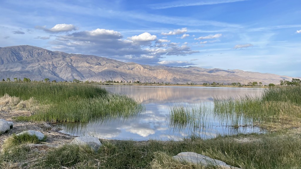 Diaz Lake CampgroundCamping · ~5 min drivePhoto: jfdervin — CC BY-SA 2.0 (via Flickr)
 Lone Pine PeakSummit · ~15 min drivePhoto: UFGS Region 5, CC BY 2.0 (via Wikimedia Commons)
Best time to visit Alabama Hills Trail
Best months: February–May and October–November. Best months have typical highs of 55–85 °F, lows of 30 °F or warmer (32 °F where the station doesn't record snow), at most one snowy day and no more than 12 wet days.
Jan
58° / 30°
4 wet
Feb
61° / 33°
4 wet
Mar
69° / 39°
3 wet
Apr
76° / 44°
1 wet
May
85° / 53°
1 wet
Jun
96° / 62°
1 wet
Jul
102° / 67°
1 wet
Aug
101° / 65°
1 wet
Sep
93° / 58°
1 wet
Oct
81° / 48°
1 wet
Nov
67° / 36°
2 wet
Dec
57° / 29°
4 wet
Typical high / low (°F) and days with rain or snow, 1991–2020. Measured at Independence, CA, 15.2 mi away at 3,950 ft. This station doesn't record snowfall. Source: NOAA NCEI U.S. Climate Normals 1991–2020.
Map and trail data © OpenStreetMap contributors
