Alabama Hills Trail
 Photo: lamblukas, CC BY 2.0 (via Flickr)
- 0.4 mi
- round trip
- 171 ft
- climb
- 4,421 ft
- high point
- Out and back
- route
- Feb–May, Oct–Nov
- best months
The Alabama Hills Trail is a short, easy out-and-back hike in California's Alabama Hills, about 2 miles from the town of Lone Pine. The route is 0.7 miles long, with a total elevation gain of 171 feet, and it reaches a high point of 4,421 feet. The climb is front-loaded, with the steepest stretch at about 0.09 miles from the start, where the grade reaches 10 percent. Spring and fall are the most comfortable times to go. Typical averages from a nearby weather station in Independence show April highs around 76°F and October highs around 81°F, while July and August average in the low 100s. The trail makes an easy pairing with the climbing areas around it. Eastern Choss Proving Grounds is 0.6 miles away, Kearsarge Dome is 0.8 miles away, and South Pile is 0.9 miles away. For an overnight stay, Tuttle Creek Campground is about 2.7 miles off.
Local outfitters
- Big Willi Mountaineering Company2 mi away
- Glacier Lodge41 mi away
Not on Roamze yet. Their page has how to reach them.
 Eastern Choss Proving GroundsRock climbingPhoto: cogdogblog, CC BY 2.0 (via Wikimedia Commons)0.6 mi
 Kearsarge Dome aka The Battle ShipRock climbingPhoto: RuggyBearLA, CC BY 2.0 (via Flickr)0.8 mi
 South PileRock climbingPhoto: RuggyBearLA, CC BY 2.0 (via Flickr)0.9 mi
 Arch Loop TrailHikingPhoto: hakkun, CC BY-SA 3.0 (via Wikimedia Commons)1.7 mi
- Tuttle Creek CampgroundCamping2.7 mi
- Lone PineCamping4.7 mi
- Tuttle Creek TrailHiking5.6 mi
- TUTTLE CREEK ASHRAMHiking5.8 mi
Source: Roamze catalog (indexable pages within 10 miles, PostGIS distance)
 Alabama Hills TrailHiking · Next doorPhoto: kalestews, CC BY 2.0 (via Flickr)
 Mount WhitneyHiking · ~13 min drivePhoto: daveynin — CC BY 2.0 (via Flickr)
 North Fork Lone Pine CreekHiking · ~14 min drivePhoto: Ken Lund — CC BY-SA 2.0 (via Flickr)
 Cottonwood LakesHiking · ~15 min drivePhoto: kalestews, CC BY 2.0 (via Flickr)
- Arch Loop TrailHiking · ~3 min drivePhoto: hakkun, CC BY-SA 3.0 (via Wikimedia Commons)
 Mount MuirHiking · ~14 min drivePhoto: Seth Tisue, CC BY-SA 2.0 (via Flickr)
- Little Cottonwood CreekHiking · ~15 min drivePhoto: kalestews, CC BY 2.0 (via Flickr)
 South Fork Cottonwood CreekHiking · ~18 min drivePhoto: Jesse Wagstaff, CC BY 2.0 (via Flickr)
 Meysan LakesHiking · ~12 min drivePhoto: inkknife_2000 (7.5 million views +), CC BY-SA 2.0 (via Wikimedia Commons)
- Discovery PinnacleHiking · ~14 min drivePhoto: Seth Tisue, CC BY-SA 2.0 (via Flickr)
Also worth it near here
- Eastern Choss Proving GroundsRock climbing · ~1 min drivePhoto: cogdogblog, CC BY 2.0 (via Wikimedia Commons)
 Mobius ArchNatural arch · ~3 min drivePhoto: Clyde Charles Brown, CC BY-SA 4.0 (via Wikimedia Commons)
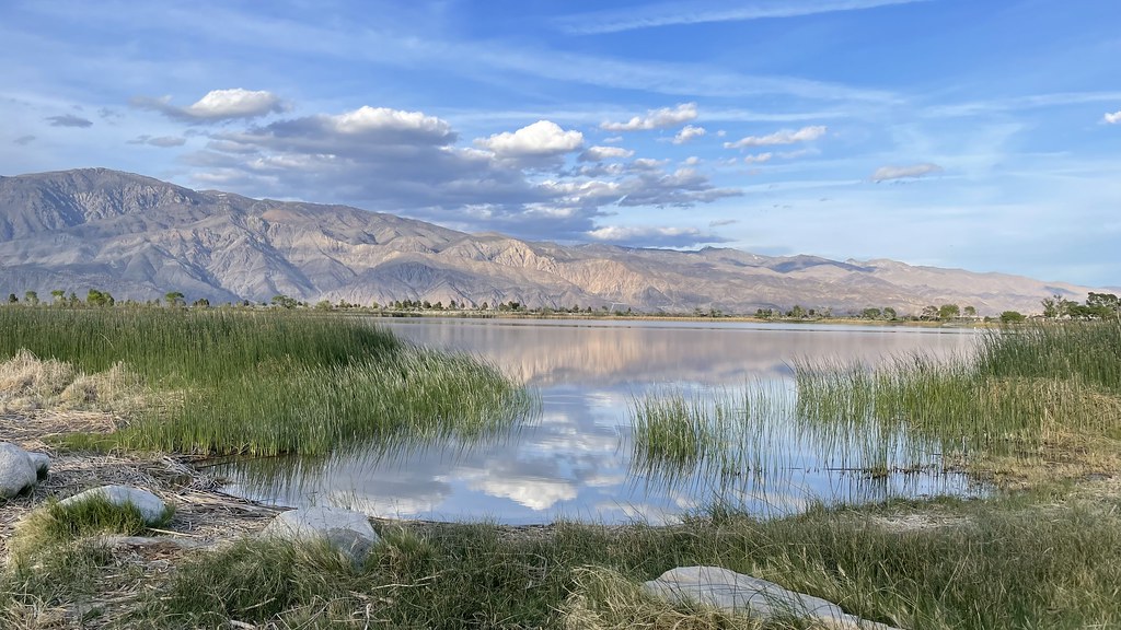 Diaz Lake CampgroundCamping · ~6 min drivePhoto: jfdervin — CC BY-SA 2.0 (via Flickr)
 Lone Pine PeakSummit · ~13 min drivePhoto: UFGS Region 5, CC BY 2.0 (via Wikimedia Commons)
Best time to visit Alabama Hills Trail
Best months: February–May and October–November. Best months have typical highs of 55–85 °F, lows of 30 °F or warmer (32 °F where the station doesn't record snow), at most one snowy day and no more than 12 wet days.
Jan
58° / 30°
4 wet
Feb
61° / 33°
4 wet
Mar
69° / 39°
3 wet
Apr
76° / 44°
1 wet
May
85° / 53°
1 wet
Jun
96° / 62°
1 wet
Jul
102° / 67°
1 wet
Aug
101° / 65°
1 wet
Sep
93° / 58°
1 wet
Oct
81° / 48°
1 wet
Nov
67° / 36°
2 wet
Dec
57° / 29°
4 wet
Typical high / low (°F) and days with rain or snow, 1991–2020. Measured at Independence, CA, 15 mi away at 3,950 ft. This station doesn't record snowfall. Source: NOAA NCEI U.S. Climate Normals 1991–2020.
Map and trail data © OpenStreetMap contributors
