Manzanita.
Campground
Sites open the weekend of Dec 4 on Recreation.gov
 Photo: inkknife_2000 (7.5 million views +), CC BY-SA 2.0 (via Wikimedia Commons)
Alert in the area
The Forest Service lists 5 alerts for Coconino National Forest.
West Fork Temporary Area Closure - Extension to 2/27/27
Agency alert covering Coconino National Forest · Order 03-04-00-26-09 · USFS · Coconino National Forest
Temporary Closure for West Wing Pile Burn
Agency alert covering Flagstaff Ranger District · Order 03-04-08-26-08 · USFS · Flagstaff Ranger District
Newman Park Pile Burn
Agency alert covering Flagstaff Ranger District · USFS · Flagstaff Ranger District
Kachina Village and Pumphouse Wash Camping and Campfire Restrictions
Agency alert covering Flagstaff Ranger District · Order 03-04-08-25-02 · USFS · Flagstaff Ranger District
Flagstaff-area camping and campfire restrictions in effect year-round
Agency alert covering Flagstaff Ranger District · Order 03-04-08-25-01 · USFS · Flagstaff Ranger District
As of · Source: USFS · Coconino National Forest. Agencies don't list every closure — check before you go.
Thompson Ladder is a 4.5-mile out-and-back hike in the Flagstaff Ranger District of Coconino National Forest in northern Arizona. The trail rises from about 6,241 feet to 6,247 feet at the high point before returning, with a total elevation gain of 3,815 feet over the course of the trip. The steepest stretch comes at about 1.3 miles in, where the grade reaches 50 percent. The Forest Service manages the land, and the trail's natural surface makes for a straightforward, if challenging, route. For comfortable weather, late spring and early fall are the best bets. Typical averages from a nearby weather station at Mund's Park show highs around 69°F in May and 76°F in September, with July and August bringing the most wet days. That station sits about 220 feet higher than the trail's high point, so temperatures on the route run slightly warmer. The hike pairs well with other outings in the area. The Waterfall climbing area lies about a mile away, and North Wilson #123 is a hiking option at roughly 1.4 miles. Manzanita campground is about 1.9 miles off, and Oak Creek offers canoeing about 2.5 miles away.
Manzanita.
Campground
Places © OpenStreetMap contributors
More in Kachina VillageNot on Roamze yet. Their page has how to reach them.
Best months: May–July and September. Best months have typical highs of 55–85 °F, lows of 30 °F or warmer (32 °F where the station doesn't record snow), at most one snowy day and no more than 12 wet days.
Jan
46° / 17°
7 wet
Feb
47° / 19°
7 wet
Mar
53° / 23°
7 wet
Apr
60° / 27°
4 wet
May
69° / 34°
3 wet
Jun
79° / 40°
3 wet
Jul
83° / 49°
9 wet
Aug
81° / 50°
13 wet
Sep
76° / 41°
8 wet
Oct
66° / 31°
5 wet
Nov
54° / 22°
5 wet
Dec
46° / 16°
7 wet
Typical high / low (°F) and days with rain or snow, 1991–2020. Measured at Mund'S Park, AZ, 4.2 mi away at 6,470 ft. This station doesn't record snowfall. Source: NOAA NCEI U.S. Climate Normals 1991–2020.
 Photo: inkknife_2000 (7.5 million views +), CC BY-SA 2.0 (via Wikimedia Commons)
North Wilson #123
~2 min drive
4.14-mile out-and-back trail in Arizona with 1,563 ft of elevation gain.
 Photo: deborah.soltesz, Public Domain Dedication (CC0) (via Flickr)
Wilson Mountain
~4 min drive
0.82-mile out-and-back trail to Wilson Mountain in Arizona with 269 ft gain.
 Photo: InSapphoWeTrust from Los Angeles, California, USA, CC BY-SA 2.0 (via Wikimedia Commons)
Wilson Mountain #10
~5 min drive
10.84-mile out-and-back trail in Arizona with 2,198 ft elevation gain.
 Photo: inkknife_2000 (14 million views), CC BY-SA 2.0 (via Flickr)
Huckaby #161
~6 min drive
6.07-mile out-and-back trail in Arizona with 387 ft of elevation gain.
 Photo: inkknife_2000 (7.5 million views +), CC BY-SA 2.0 (via Wikimedia Commons)
Casner Canyon
~4 min drive
Casner Canyon is a 2.61-mile out-and-back trail in Arizona with 534 feet of elevation gain.
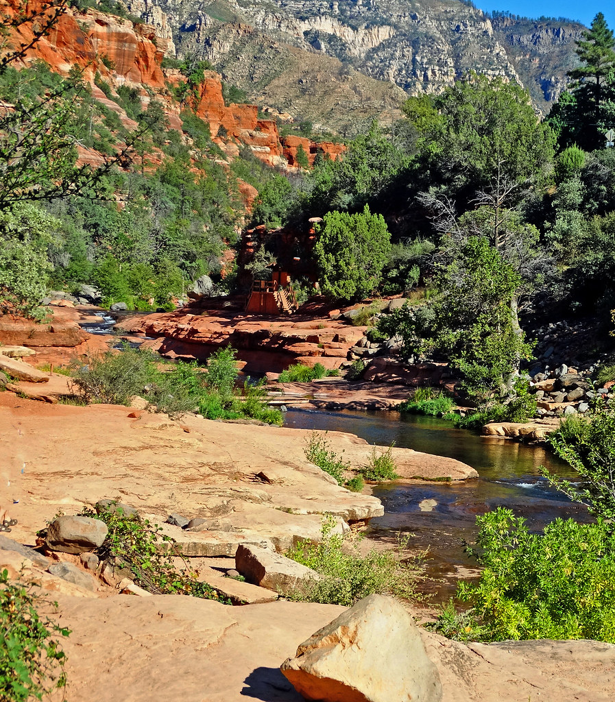 Photo: inkknife_2000 (14 million views), CC BY-SA 2.0 (via Flickr)
Slide Rock Trail
~4 min drive
0.62-mile out-and-back hike in Arizona with 173 ft of elevation gain
 Photo: deborah.soltesz, Public Domain Dedication (CC0) (via Flickr)
Hangover #78C
~6 min drive
6.86-mile out-and-back trail in Arizona with 143 ft elevation gain.
HIKE
Willard
~6 min drive
9.67-mile out-and-back trail in Arizona with 353 ft gain
Photo: inkknife_2000 (14 million views), CC BY-SA 2.0 (via Flickr)Clifftop Trail
~4 min drive
0.38-mile loop with 61 ft gain and loss in Arizona
 Photo: Coconino NF Photography, Public Domain Mark (via Flickr)
Oak Creek Spur C
~8 min drive
2.3-mile out-and-back trail in Arizona with 1,358 ft elevation gain


