Sugarloaf Lookout
 Photo: w_lemay, CC BY-SA 2.0 (via Flickr)
- 0.9 mi
- round trip
- 891 ft
- climb
- 7,309 ft
- high point
- Out and back
- route
Is Sugarloaf Lookout open right now?
No closures listed
The National Park Service lists no closures for Chiricahua National Monument.
As of · Source: NPS · Chiricahua National Monument. Agencies don't list every closure — check before you go.
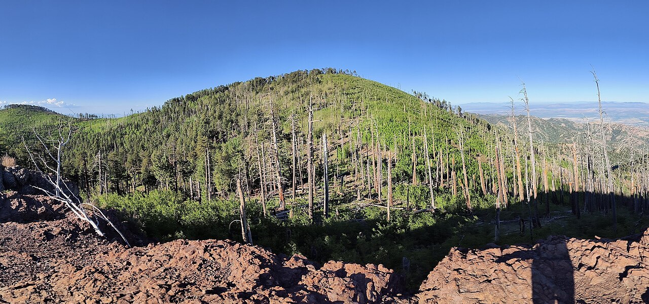
Sugarloaf Lookout is an easy out-and-back hike in Chiricahua National Monument in southeastern Arizona, managed by the National Park Service. The trail is about 1.8 miles long, with a total climb of 891 feet, and the one-way gain is 467 feet. The steepest stretch comes at about 0.64 miles in, with a grade of 19 percent. The route starts at a low point of about 6,830 feet and reaches a high of about 7,309 feet. There is no fee to hike it. Several other trails sit close by. Echo Canyon is about 0.4 miles away, the Massai Point Exhibit Trail is about 0.8 miles away, and Hailstone and Ed Riggs are each about a mile away. For an overnight stay, Rustler Park campground is about 8 miles off.
Conditions and forecast on Sugarloaf Mountain
Daily highs and lows, wind and the chance of precipitation at the summit and route start for the next 7 days, from the Open-Meteo model.
 Echo CanyonHikingPhoto: w_lemay, CC BY-SA 2.0 (via Flickr)0.4 mi
 Massai Point Exhibit TrailHikingPhoto: w_lemay, CC BY-SA 2.0 (via Flickr)0.8 mi
 HailstoneHikingPhoto: w_lemay, CC BY-SA 2.0 (via Flickr)0.9 mi
 Ed RiggsHikingPhoto: Caddymob at English Wikipedia, CC BY 3.0 (via Wikimedia Commons)1 mi
 Whitetail TrailHikingPhoto: Neepster on Flickr, CC BY-SA 2.0 (via Wikimedia Commons)1 mi
- Lower RhyoliteHikingPhoto: w_lemay, CC BY-SA 2.0 (via Flickr)1.3 mi
- Upper RhyoliteHikingPhoto: w_lemay, CC BY-SA 2.0 (via Flickr)1.3 mi
- Rustler ParkCamping8 mi
Source: Roamze catalog (indexable pages within 10 miles, PostGIS distance)
- Echo CanyonHiking · Next doorPhoto: w_lemay, CC BY-SA 2.0 (via Flickr)
- Massai Point Exhibit TrailHiking · ~1 min drivePhoto: w_lemay, CC BY-SA 2.0 (via Flickr)
- Hoovey CanyonHiking · ~8 min drive
- Lower RhyoliteHiking · ~2 min drivePhoto: w_lemay, CC BY-SA 2.0 (via Flickr)
- HailstoneHiking · ~2 min drivePhoto: w_lemay, CC BY-SA 2.0 (via Flickr)
- Fife CanyonHiking · ~10 min drive
 Sara Deming TrailHiking · ~3 min drivePhoto: w_lemay, CC BY-SA 2.0 (via Flickr)
- Ed RiggsHiking · ~2 min drivePhoto: Caddymob at English Wikipedia, CC BY 3.0 (via Wikimedia Commons)
- Bootlegger Trail #257Hiking · ~14 min drive
- Mushroom RockHiking · ~3 min drivePhoto: Caddymob at English Wikipedia, CC BY 3.0 (via Wikimedia Commons)

Route details
- Distance
- 0.9 mi round trip
- Climbing
- About 891 ft
- Summit
- 7,309 ft
- Difficulty
- Moderate
- Time
- About 0.5 hours
Questions about this route
How long is the Sugarloaf Lookout on Sugarloaf Mountain?
About 0.9 mi round trip.
How much elevation gain is on the Sugarloaf Lookout?
About 891 ft of climbing round trip.
How hard is the Sugarloaf Lookout?
It is rated moderate.
How long does the Sugarloaf Lookout take?
About 0.5 hours round trip.
