Price Shake
- 6.9 mi
- round trip
- 1,233 ft
- climb
- 7,354 ft
- high point
- Out and back
- route
Caution today
Agency alerts are in effect for this area; weather is good · USFS, OpenWeather · checked 11 h ago
Is Price Shake open right now?
Alert in the area
The Forest Service lists 3 alerts for Coronado National Forest.
Border Barrier Construction Closure
Agency alert covering Coronado National Forest · Order 03-05-00-26-011 · USFS · Coronado National Forest
No Fire Restrictions
Agency alert covering Coronado National Forest · USFS · Coronado National Forest
Barfoot Snake Closure Order 03-05-01-24-004
Agency alert covering Coronado National Forest · USFS · Coronado National Forest
As of · Source: USFS · Coronado National Forest. Agencies don't list every closure — check before you go.
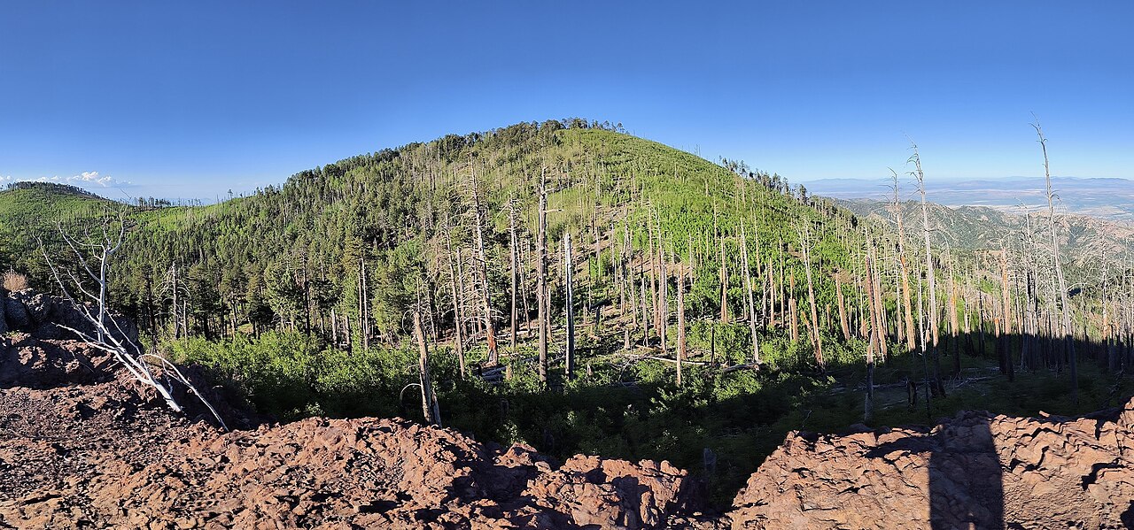
Price Shake is a hard hike in the Douglas Ranger District of Coronado National Forest in Arizona, about 6.9 miles long with a one-way elevation gain of 1,233 feet. The trail is on natural surface and is not accessible. Bikes are allowed. The route is an out-and-back that starts at about 6,000 feet and climbs to about 7,350 feet. It's a long, steep day, so plan for a full commitment. Several other trails sit within a few miles, including Upper Rucker Canyon Trail #223A, Rucker Trail #222 and Red Rock Canyon Trail #223. For an overnight base, Camp Rucker Group Site is about 5.7 miles away.
Keep exploring — more trails worth the drive
 Photo: Jon Roanhaus, CC BY-SA 4.0 (via Wikimedia Commons)
Crest Trail #270D
~9 min drive
2.26-mile out-and-back trail in Arizona with 1,176 ft elevation gain
 Photo: cogdogblog, CC BY 2.0 (via Flickr)
Pothole Canyon Trail
~12 min drive
3.34-mile out-and-back hike in Arizona with 727 ft elevation gain.
 Photo: Clay Gilliland, CC BY-SA 2.0 (via Flickr)
Rasberry Ridge Trail #228
~5 min drive
8.85-mile out-and-back trail in Arizona with 3,122 ft of elevation gain.
HIKE
Upper Rucker Canyon Trail #223A
~3 min drive
4.1-mile out-and-back hike in Arizona with 3,211 ft elevation gain and loss.
HIKE
Rucker Trail #222
~4 min drive
9.36-mile out-and-back trail in Arizona with 923 ft elevation gain.
HIKE
Jones Ridge Trail #365
~6 min drive
2.78-mile out-and-back trail in Arizona with 330 ft elevation gain.
HIKE
Price Canyon Trail #224
~5 min drive
10.77-mile out-and-back hike in Arizona with 2,424 ft gain.
HIKE
Baker Canyon Trail #225
~6 min drive
5.37-mile out-and-back trail in Arizona with 1,758 ft elevation gain.
HIKE
Red Rock Canyon Trail #223
~4 min drive
10.08-mile out-and-back trail in Arizona with 1,740 ft elevation gain.
HIKE
Sentinel Peak Trail
~6 min drive
Sentinel Peak Trail is a 0.08-mile lollipop trail in Arizona with 7 feet of elevation gain.