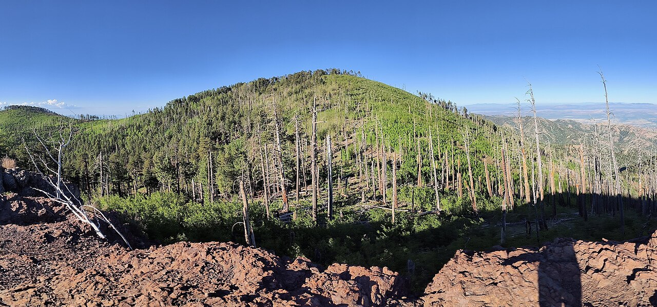
Rucker Lake
- Mar–May, Sep–Nov
- best months
Is Rucker Lake open right now?
Alert in the area
The Forest Service lists 3 alerts for Coronado National Forest.
Border Barrier Construction Closure
Agency alert covering Coronado National Forest · Order 03-05-00-26-011 · USFS · Coronado National Forest
No Fire Restrictions
Agency alert covering Coronado National Forest · USFS · Coronado National Forest
Barfoot Snake Closure Order 03-05-01-24-004
Agency alert covering Coronado National Forest · USFS · Coronado National Forest
As of · Source: USFS · Coronado National Forest. Agencies don't list every closure — check before you go.
Rucker Lake is a 6-acre lake near Pearce, Arizona, at about 6,069 feet. It is managed by the U.S. Forest Service.
Best time to go · Mar–May, Sep–Nov
Best time to visit Rucker Lake
Best months: March–May and September–November. Best months have typical highs of 55–85 °F, lows of 30 °F or warmer (32 °F where the station doesn't record snow), at most one snowy day and no more than 12 wet days.
Jan
56° / 25°
5 wet · 1 snow
Feb
60° / 28°
4 wet
Mar
66° / 32°
4 wet
Apr
73° / 37°
2 wet
May
81° / 43°
2 wet
Jun
89° / 52°
5 wet
Jul
88° / 58°
12 wet
Aug
85° / 57°
13 wet
Sep
81° / 51°
8 wet
Oct
75° / 41°
4 wet
Nov
64° / 32°
4 wet
Dec
55° / 26°
5 wet · 1 snow
Typical high / low (°F) and days with rain or snow, 1991–2020. Measured at Portal 4 Sw, AZ, 9.3 mi away at 5,390 ft. The station sits about 700 ft lower than this place, so expect it a little cooler here. Source: NOAA NCEI U.S. Climate Normals 1991–2020.
Keep exploring — more waters worth the drive
SEE
Malpais Tank
~28 min drive
Malpais Tank is a lake near San Simon, Arizona, at about 4,514 feet.
SEE
Cattail Pond
~49 min drive
Cattail Pond is a 204-acre pond near McNeal, Arizona, at about 4,062 feet. It is managed by the state fish and wildlife agency.
SEE
Braidfoot Tank
~1h 10m drive
Braidfoot Tank is a 11-acre lake near Lordsburg, New Mexico, at about 4,184 feet.
SEE
South Alkali Flats Duckpond
~1h 12m drive
South Alkali Flats Duckpond is a 6-acre lake near Animas, New Mexico, at about 4,148 feet. It is managed by the Bureau of Land Management.