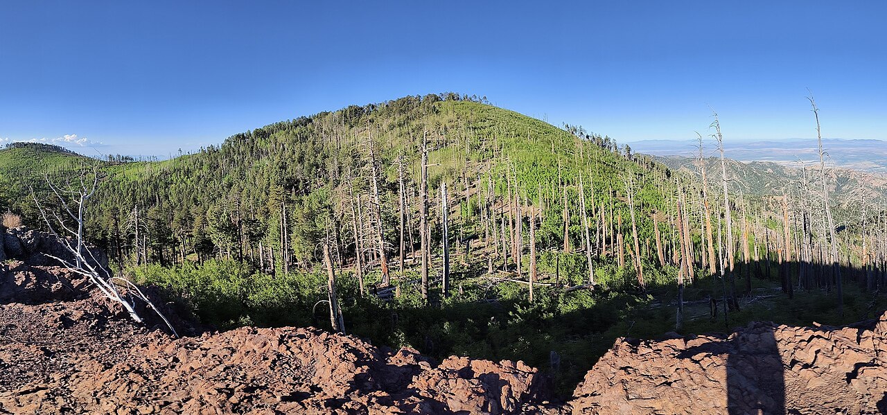
Brushy Canyon
- 5.0 mi
- round trip
- 193 ft
- climb
- 6,805 ft
- high point
- Out and back
- route
- Mar–May, Sep–Nov
- best months
Is Brushy Canyon open right now?
Alert in the area
The Forest Service lists 3 alerts for Coronado National Forest.
Border Barrier Construction Closure
Agency alert covering Coronado National Forest · Order 03-05-00-26-011 · USFS · Coronado National Forest
No Fire Restrictions
Agency alert covering Coronado National Forest · USFS · Coronado National Forest
Barfoot Snake Closure Order 03-05-01-24-004
Agency alert covering Coronado National Forest · USFS · Coronado National Forest
As of · Source: USFS · Coronado National Forest. Agencies don't list every closure — check before you go.
Brushy Canyon is a moderate out-and-back hike of about 5 miles on natural surface in the Douglas Ranger District of Coronado National Forest in southeastern Arizona. The trail climbs from a low point of about 6,000 feet to a high of roughly 6,800 feet, with an elevation gain of about 193 feet one way. Horses are allowed on the trail, and bikes are not. The Forest Service lists it as not accessible. The nearest town is Portal, about 8 miles away. Spring and fall are the most comfortable seasons. Typical averages from a nearby weather station run highs in the low 70s in April and October, with fewer wet days than the summer months. That station sits well below the trail, so temperatures up high run cooler. Monte Vista Trail #221 starts just 0.1 mile away, and Turtle Mountain Trail #219 is about 1.3 miles off. For camping, Camp Rucker Group Site is about 4 miles away and Sycamore is about 4.2 miles away.
Best time to go · Mar–May, Sep–Nov
Best time to visit Brushy Canyon
Best months: March–May and September–November. Best months have typical highs of 55–85 °F, lows of 30 °F or warmer (32 °F where the station doesn't record snow), at most one snowy day and no more than 12 wet days.
Jan
56° / 25°
5 wet · 1 snow
Feb
60° / 28°
4 wet
Mar
66° / 32°
4 wet
Apr
73° / 37°
2 wet
May
81° / 43°
2 wet
Jun
89° / 52°
5 wet
Jul
88° / 58°
12 wet
Aug
85° / 57°
13 wet
Sep
81° / 51°
8 wet
Oct
75° / 41°
4 wet
Nov
64° / 32°
4 wet
Dec
55° / 26°
5 wet · 1 snow
Typical high / low (°F) and days with rain or snow, 1991–2020. Measured at Portal 4 Sw, AZ, 8.8 mi away at 5,390 ft. The station sits about 1,400 ft lower than this place, so expect it a little cooler here. Source: NOAA NCEI U.S. Climate Normals 1991–2020.
Keep exploring — more trails worth the drive
 Photo: Jon Roanhaus, CC BY-SA 4.0 (via Wikimedia Commons)
Crest Trail #270D
~6 min drive
2.26-mile out-and-back trail in Arizona with 1,176 ft elevation gain
 Photo: Clay Gilliland, CC BY-SA 2.0 (via Flickr)
Rasberry Ridge Trail #228
~3 min drive
8.85-mile out-and-back trail in Arizona with 3,122 ft of elevation gain.
HIKE
Crest Trail #270B
~3 min drive
5.79-mile out-and-back hike in Arizona with 422 ft elevation gain.
HIKE
John Long
~4 min drive
7.95-mile out-and-back trail in Arizona with 1,684 ft of elevation gain.
HIKE
Turtle Mountain Trail #219
~2 min drive
2.64-mile out-and-back hike in Arizona with 1,528 ft gain and 8,508 ft max elevation.
HIKE
Monte Vista Trail #221
Next door
8.27-mile out-and-back trail in Arizona with 2,787 ft elevation gain.
HIKE
Turtle Mountain Trail #219
~4 min drive
3.51-mile out-and-back hike in Arizona with 781 ft of elevation gain.
HIKE
Upper Rucker Canyon Trail #223A
~5 min drive
4.1-mile out-and-back hike in Arizona with 3,211 ft elevation gain and loss.
HIKE
Turtle Mountain
~4 min drive
4.57-mile out-and-back trail in Arizona with 1,529 ft elevation gain.
HIKE
Price Canyon Trail #224
~7 min drive
10.77-mile out-and-back hike in Arizona with 2,424 ft gain.