Tatàypi Point
At a glance
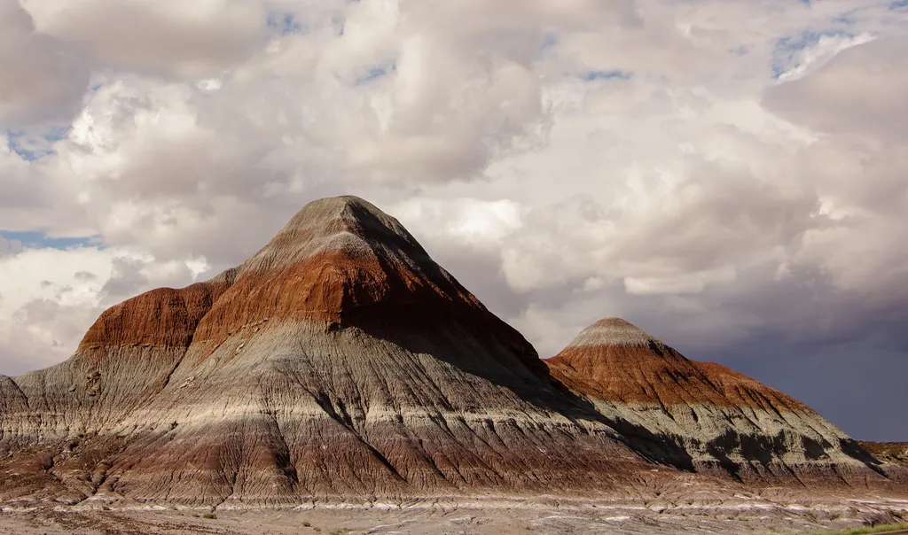
Tatàypi Point is a summit of 5,850 feet in Petrified Forest National Park in eastern Arizona, about 16 miles from the town of Sun Valley. Spring and fall are the most comfortable times to visit. Typical averages from a nearby weather station show April highs around 68°F and October highs around 70°F, while July highs reach about 92°F and winter lows drop to around 22°F. Several trails start close by. Tawa Point is about 0.3 miles away, and the Tawa Trail and the Off the Beaten Path Onyx Bridge Route Stop 1 are each within a mile. Puerco Pueblo lies about 7 miles off.
- summit
- 5,850 ft
- way up
- 1
- best months
- Mar–May, Sep–Oct
Where it is: Petrified Forest National Park
Near: Holbrook
Best time to visit Tatàypi Point
Best months: March–May and September–October. Best months have typical highs of 55–85 °F, lows of 30 °F or warmer (32 °F where the station doesn't record snow), at most one snowy day and no more than 12 wet days.
Jan
48°
22°
4 wet
Feb
52°
25°
4 wet
Mar
61°
30°
4 wet
Apr
68°
35°
3 wet
May
78°
44°
3 wet
Jun
89°
53°
3 wet
Jul
92°
60°
7 wet
Aug
88°
58°
9 wet
Sep
82°
51°
6 wet
Oct
70°
40°
5 wet
Nov
58°
28°
4 wet
Dec
46°
22°
5 wet
Typical high / low (°F) and days with rain or snow, 1991–2020. Measured at Painted Desert Np, AZ, 1 mi away at 5,760 ft. Source: NOAA NCEI U.S. Climate Normals 1991–2020.
Been here? Tell people how it was.
Map © Mapbox © OpenStreetMap contributors  Tawa PointHikingPhoto: Navin75, CC BY-SA 2.0 (via Flickr)0.3 mi
 Off the Beaten Path Onyx Bridge Route Stop 1HikingPhoto: dconvertini, CC BY-SA 2.0 (via Flickr)0.6 mi
- Tawa TrailHikingPhoto: Navin75, CC BY-SA 2.0 (via Flickr)0.7 mi
 Off the Beaten Path Onyx Bridge Route Stop 3HikingPhoto: NPS / public domain0.8 mi
 Petrified Forest National Wilderness Area: North UnitHikingPhoto: Mary P Madigan, CC BY 2.0 (via Flickr)4 mi
 Puerco PuebloHikingPhoto: dconvertini, CC BY-SA 2.0 (via Flickr)7 mi
- Deatley TrailHiking8.8 mi
 The Tepees North PulloutHikingPhoto: NPS / public domain9.1 mi
 Pilot RockSummitPhoto: National Park Service Digital Image Archives, Public domain (via Wikimedia Commons)~13 min drive
 Bidahochi ButteSummitPhoto: Steven Baltakatei Sandoval, CC BY-SA 4.0 (via Wikimedia Commons)~47 min drive
 Pyramid ButteSummitPhoto: Steven Baltakatei Sandoval, CC BY-SA 4.0 (via Wikimedia Commons)~1h 15m drive
 Saddle ButteSummitPhoto: Steven Baltakatei Sandoval, CC BY-SA 4.0 (via Wikimedia Commons)~1h 17m drive
 Hubbell HillSummitPhoto: C. C. Pierce, Public domain (via Wikimedia Commons)~1h 18m drive
 Zuñi ButtesSummitPhoto: Unknown authorUnknown author or not provided, Public domain (via Wikimedia Commons)~1h 25m drive
Conditions and forecast
Daily highs and lows, wind and the chance of precipitation at the summit and tawa trail trailhead for the next 7 days, from the Open-Meteo model.
Questions about Tatàypi Point
How tall is Tatàypi Point?
5,850 ft (1,783 m).
How many routes go to the summit of Tatàypi Point?
One: Tawa Trail.
Where do the routes up Tatàypi Point start?
Tawa Trail starts at Tawa Trail Trailhead.


Ask about this place
Questions about Tatàypi Point: conditions, access, timing. Answers say when something isn't known.
