Pat Mullen Mountain
- 7,610 ft
- summit
- 2
- ways up
- May–Jun, Sep–Oct
- best months
Is Pat Mullen Mountain open right now?
Closure in the area
There's a closure order in Apache-Sitgreaves National Forests. It doesn't name Pat Mullen Mountain, so check the source for the area it covers (3 listed).
Temporary Emergency Closure
Agency closure covering Apache-Sitgreaves National Forests · Order 03-01-26-004 · USFS · Apache-Sitgreaves National Forests
Scott Reservoir Recreation Site Closure - Lakeside RD
Agency closure covering Lakeside Ranger District · Order 03-01-07-26-001 · USFS · Lakeside Ranger District
Benny Creek Campground/Southfork Day Use Area Closure Order - Springerville Ranger District
Agency closure covering Apache-Sitgreaves National Forests · Order 03-01-25-06-004 · USFS · Apache-Sitgreaves National Forests
Forest Road Conditions Alert
Agency alert covering Apache-Sitgreaves National Forests · USFS · Apache-Sitgreaves National Forests
No Fire Restrictions
Agency alert covering Apache-Sitgreaves National Forests · USFS · Apache-Sitgreaves National Forests
As of · Source: USFS · Apache-Sitgreaves National Forests. Agencies don't list every closure — check before you go.
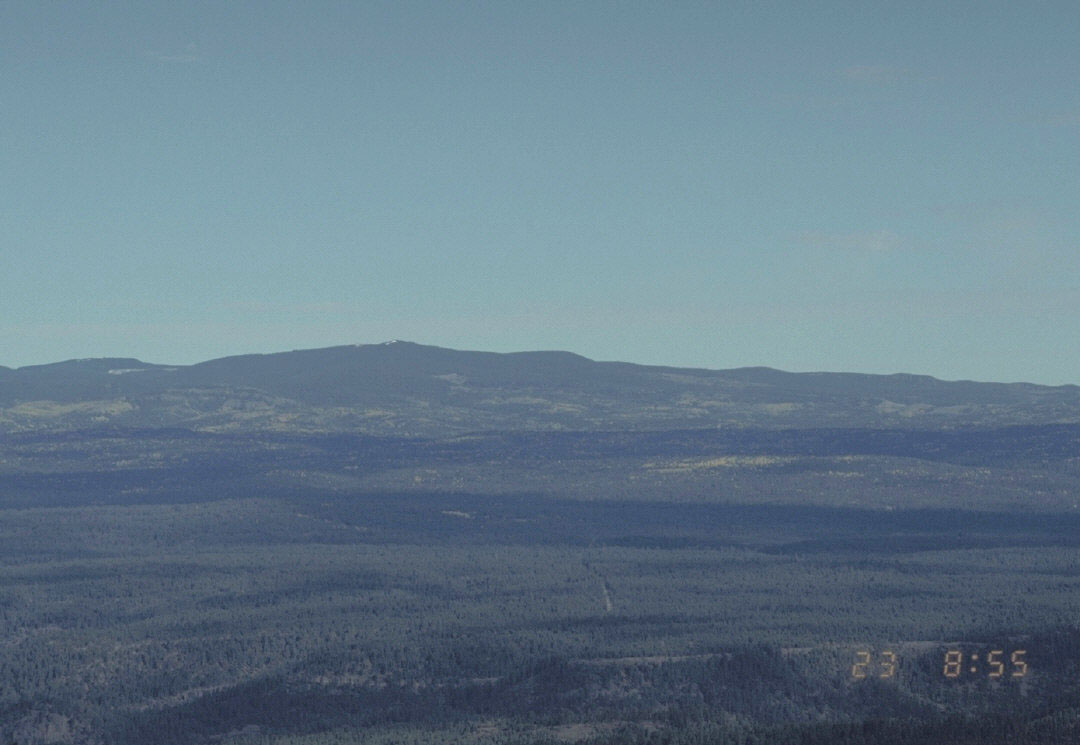
Pat Mullen Mountain is a summit of 7,610 feet in the Lakeside Ranger District of the Apache-Sitgreaves National Forests in eastern Arizona, about 2.6 miles from Pinetop Country Club. The peak sits at the center of a cluster of trails, with the Huf'n Puff Trail and the Pat Mullen Mountain Connector both starting within a tenth of a mile. Spring and fall are the most comfortable times to go. Typical averages from a nearby weather station at a similar elevation show May highs around 69°F and October highs around 64°F, while July and August bring the most wet days, about 14 to 16 a month. The surrounding area offers both hiking and mountain biking. The Country Club and Billy Creek Connector Trail 107A are mountain biking routes about half a mile away, and Scott Reservoir campground is roughly 4.6 miles off.
Conditions and forecast
Daily highs and lows, wind and the chance of precipitation at the summit and route start for the next 7 days, from the Open-Meteo model.
- Summit elevation
- 7,610 ft
Elevation from USGS 3D Elevation Program terrain data (about 10 m resolution).
- PAT MULLEN MOUNTAIN CONNECTOREasyabout 261 ft of climbing1.0 mi round trip
- Huf'n Puff TrailEasyabout 331 ft of climbing1.1 mi round trip
Compare the routes PAT MULLEN MOUNTAIN CONNECTOR Huf'n Puff Trail Climbing About 261 ft About 331 ft Round trip 1.0 mi 1.1 mi Difficulty Easy Easy Terrain Hike Hike Map © Mapbox © OpenStreetMap contributors Questions about Pat Mullen Mountain
How tall is Pat Mullen Mountain?
7,610 ft (2,320 m).
How many routes go to the summit of Pat Mullen Mountain?
2: PAT MULLEN MOUNTAIN CONNECTOR and Huf'n Puff Trail.
What is the shortest route up Pat Mullen Mountain?
PAT MULLEN MOUNTAIN CONNECTOR, about 1.0 mi round trip.
- Huf'n Puff TrailHiking0.1 mi
- PAT MULLEN MOUNTAIN CONNECTORHiking0.1 mi
- Country ClubMountain biking0.5 mi
- Billy Creek Connector Trail 107AMountain biking0.5 mi
- Country Club Trail #632Mountain biking0.7 mi
- Chipmunk Springs Connector TrailHiking0.8 mi
- Scott ReservoirCamping4.6 mi
- Los BurrosCamping6.3 mi
Source: Roamze catalog (indexable pages within 10 miles, PostGIS distance)
 Escudilla MountainSummit · ~1h 18m drivePhoto: Chris M Morris, CC BY 2.0 (via Wikimedia Commons)
 Mount BaldySummit · ~43 min drivePhoto: U.S. Forest Service, Public domain (via Wikimedia Commons)
- Blue Ridge MountainSummit · ~3 min drive
- Scrub PointSummit · ~45 min drive
- Bald PointSummit · ~46 min drive
- Big Lake KnollSummit · ~60 min drive
- Gobbler PointSummit · ~1h 14m drive
- Lake MountainSummit · ~11 min drive
Also worth it near here
Best time to visit Pat Mullen Mountain
Best months: May–June and September–October. Best months have typical highs of 55–85 °F, lows of 30 °F or warmer (32 °F where the station doesn't record snow), at most one snowy day and no more than 12 wet days.
Jan
45° / 21°
8 wet
Feb
47° / 23°
7 wet
Mar
53° / 27°
8 wet
Apr
60° / 30°
5 wet
May
69° / 38°
4 wet
Jun
80° / 47°
5 wet
Jul
80° / 52°
14 wet
Aug
77° / 52°
16 wet
Sep
73° / 46°
10 wet
Oct
64° / 36°
6 wet
Nov
54° / 28°
6 wet
Dec
45° / 21°
7 wet
Typical high / low (°F) and days with rain or snow, 1991–2020. Measured at Mc Nary 2n, AZ, 3.1 mi away at 7,340 ft. This station doesn't record snowfall. Source: NOAA NCEI U.S. Climate Normals 1991–2020.


