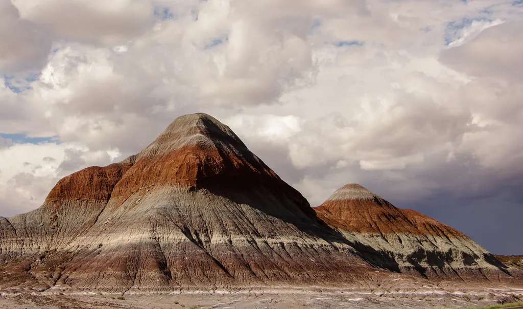
Tawa Point
 Photo: Navin75, CC BY-SA 2.0 (via Flickr)
- Mar–May, Sep–Oct
- best months
Is Tawa Point open right now?
Closure in the area
There's a closure order in Petrified Forest National Park. It doesn't name Tawa Point, so check the source for the area it covers.
Painted Desert Visitor Center Closed for Construction
Park closure covering Petrified Forest National Park · NPS · Petrified Forest National Park
As of · Source: NPS · Petrified Forest National Park. Agencies don't list every closure — check before you go.
Tawa Point is a hike in Petrified Forest National Park in northeastern Arizona, managed by the National Park Service. It sits within the park's boundaries, and a fee is charged for the visit. Spring and fall are the most comfortable times to go. Typical averages from a nearby weather station show April highs around 68°F and October highs around 70°F, while July averages about 92°F and January highs sit near 48°F. Several other routes lie close by. The Off the Beaten Path Onyx Bridge Route Stop 1 is about 0.4 miles away and Stop 3 is about 0.6 miles away. The Tawa Trail is roughly a mile off, and the Petrified Forest National Wilderness Area: North Unit is about 3.8 miles away.
Local outfitters
- OK RV Park24 mi away
Not on Roamze yet. Their page has how to reach them.
 Off the Beaten Path Onyx Bridge Route Stop 1HikingPhoto: dconvertini, CC BY-SA 2.0 (via Flickr)0.4 mi
 Off the Beaten Path Onyx Bridge Route Stop 3HikingPhoto: NPS / public domain0.6 mi
- Tawa TrailHikingPhoto: Navin75, CC BY-SA 2.0 (via Flickr)1 mi
 Petrified Forest National Wilderness Area: North UnitHikingPhoto: Mary P Madigan, CC BY 2.0 (via Flickr)3.8 mi
 Puerco PuebloHikingPhoto: dconvertini, CC BY-SA 2.0 (via Flickr)7.3 mi
- Deatley TrailHiking9 mi
 The Tepees North PulloutHikingPhoto: NPS / public domain9.4 mi
 The Tepees South PulloutHikingPhoto: Fredlyfish4, CC BY-SA 4.0 (via Wikimedia Commons)9.5 mi
Source: Roamze catalog (indexable pages within 10 miles, PostGIS distance)
- Off the Beaten Path Onyx Bridge Route Stop 3Hiking · Next door
- Tawa TrailHiking · ~2 min drivePhoto: Navin75, CC BY-SA 2.0 (via Flickr)
- Petrified Forest National Wilderness Area: North UnitHiking · ~6 min drivePhoto: Mary P Madigan, CC BY 2.0 (via Flickr)
 Historic Blue Forest TrailHiking · ~17 min drivePhoto: Navin75, CC BY-SA 2.0 (via Flickr)
- Puerco PuebloHiking · ~12 min drivePhoto: dconvertini, CC BY-SA 2.0 (via Flickr)
 Jasper Forest TrailHiking · ~23 min drivePhoto: Alexander Hatley, CC BY 2.0 (via Flickr)
- The Tepees North PulloutHiking · ~16 min drive
 Crystal Forest TrailHiking · ~26 min drivePhoto: Šarūnas Burdulis from USA, CC BY-SA 2.0 (via Wikimedia Commons)
- The Tepees South PulloutHiking · ~16 min drivePhoto: Fredlyfish4, CC BY-SA 4.0 (via Wikimedia Commons)
 Giant Logs TrailHiking · ~32 min drivePhoto: Alexander Hatley, CC BY 2.0 (via Flickr)
Also worth it near here
 Pilot RockSummit · ~12 min drivePhoto: National Park Service Digital Image Archives, Public domain (via Wikimedia Commons)
- Blue TankLake fishing · ~14 min drive
 Puerco RiverCanoeing · ~15 min drivePhoto: Finetooth, CC BY-SA 3.0 (via Wikimedia Commons)
 Agate BridgeNatural arch · ~22 min drivePhoto: hakkun, CC BY-SA 3.0 (via Wikimedia Commons)
Best time to visit Tawa Point
Best months: March–May and September–October. Best months have typical highs of 55–85 °F, lows of 30 °F or warmer (32 °F where the station doesn't record snow), at most one snowy day and no more than 12 wet days.
Jan
48° / 22°
4 wet
Feb
52° / 25°
4 wet
Mar
61° / 30°
4 wet
Apr
68° / 35°
3 wet
May
78° / 44°
3 wet
Jun
89° / 53°
3 wet
Jul
92° / 60°
7 wet
Aug
88° / 58°
9 wet
Sep
82° / 51°
6 wet
Oct
70° / 40°
5 wet
Nov
58° / 28°
4 wet
Dec
46° / 22°
5 wet
Typical high / low (°F) and days with rain or snow, 1991–2020. Measured at Painted Desert Np, AZ, 1.2 mi away at 5,760 ft. Source: NOAA NCEI U.S. Climate Normals 1991–2020.
